Directions to Valdemarin station (Madrid) with public transit
The following transit lines have routes that pass near Valdemarin
How to get to Valdemarin station by bus?
Click on the bus route to see step by step directions with maps, line arrival times and updated time schedules.
How to get to Valdemarin station by train?
Click on the train route to see step by step directions with maps, line arrival times and updated time schedules.
Bus stops near Valdemarin in Madrid
- Ana Teresa - Antonio Sanfiz, 2 min walk,
- Ana Teresa - Antares, 2 min walk,
- Camino Barrial - Ana Teresa, 5 min walk,
- Pico Ocejón - Ana Teresa, 5 min walk,
- Cementerio De Aravaca, 6 min walk,
- Blanca De Castilla - Camino De La Zarzuela, 10 min walk,
Train station near Valdemarin in Madrid
- El Barrial - Centro Comercial Pozuelo, 9 min walk,
Light Rail stations near Valdemarin in Madrid
- Berna, 45 min walk,
Bus lines to Valdemarin station in Madrid
- 656A, Palencia - Burgos,
- 656, Tenerías - Av. Huerta Grande,
- 657, Av. Monteclaro - Ctra. Majadahonda,
- N901, Princesa - Moncloa,
- 160, Aravaca,
- 815, San Juan De La Cruz - Gerardo Diego,
- 163, Estacion Aravaca,
- N28, Aravaca,
- 162, El Barrial,
- 161, Aravaca Sur,
What are the closest stations to Valdemarin?
The closest stations to Valdemarin are:
- Ana Teresa - Antonio Sanfiz is 78 meters away, 2 min walk.
- Ana Teresa - Antares is 102 meters away, 2 min walk.
- Camino Barrial - Ana Teresa is 316 meters away, 5 min walk.
- Pico Ocejón - Ana Teresa is 336 meters away, 5 min walk.
- Cementerio De Aravaca is 354 meters away, 6 min walk.
- El Barrial - Centro Comercial Pozuelo is 618 meters away, 9 min walk.
- Blanca De Castilla - Camino De La Zarzuela is 674 meters away, 10 min walk.
- Berna is 3439 meters away, 45 min walk.
Which bus lines stop near Valdemarin?
These bus lines stop near Valdemarin: 162, 815.
Which train lines stop near Valdemarin?
These train lines stop near Valdemarin: C10, C7.
What’s the nearest train station to Valdemarin in Madrid?
The nearest train station to Valdemarin in Madrid is El Barrial - Centro Comercial Pozuelo. It’s a 9 min walk away.
What’s the nearest bus stop to Valdemarin in Madrid?
The nearest bus stops to Valdemarin in Madrid are Ana Teresa - Antonio Sanfiz and Ana Teresa - Antares. The closest one is a 2 min walk away.
What time is the first light rail to Valdemarin in Madrid?
The ML-2 is the first light rail that goes to Valdemarin in Madrid. It stops nearby at 6:00 AM.
What time is the last light rail to Valdemarin in Madrid?
The ML-2 is the last light rail that goes to Valdemarin in Madrid. It stops nearby at 1:57 AM.
What time is the first train to Valdemarin in Madrid?
The C10 is the first train that goes to Valdemarin in Madrid. It stops nearby at 5:54 AM.
What time is the last train to Valdemarin in Madrid?
The C7 is the last train that goes to Valdemarin in Madrid. It stops nearby at 11:59 PM.
What time is the first bus to Valdemarin in Madrid?
The N28 is the first bus that goes to Valdemarin in Madrid. It stops nearby at 3:08 AM.
What time is the last bus to Valdemarin in Madrid?
The N28 is the last bus that goes to Valdemarin in Madrid. It stops nearby at 3:13 AM.
See Valdemarin, Madrid, on the map
Public Transit to Valdemarin in Madrid
Wondering how to get to Valdemarin in Madrid, Spain? Moovit helps you find the best way to get to Valdemarin with step-by-step directions from the nearest public transit station.
Moovit provides free maps and live directions to help you navigate through your city. View schedules, routes, timetables, and find out how long does it take to get to Valdemarin in real time.
Looking for the nearest stop or station to Valdemarin? Check out this list of stops closest to your destination: Ana Teresa - Antonio Sanfiz; Ana Teresa - Antares; Camino Barrial - Ana Teresa; Pico Ocejón - Ana Teresa; Cementerio De Aravaca; El Barrial - Centro Comercial Pozuelo; Blanca De Castilla - Camino De La Zarzuela; Berna.
Bus: 162, 815, 656A, 656, 657, N901, 160, 163, N28.Train: C10, C7.
Want to see if there’s another route that gets you there at an earlier time? Moovit helps you find alternative routes or times. Get directions from and directions to Valdemarin easily from the Moovit App or Website.
We make riding to Valdemarin easy, which is why over 1.5 million users, including users in Madrid, trust Moovit as the best app for public transit. You don’t need to download an individual bus app or train app, Moovit is your all-in-one transit app that helps you find the best bus time or train time available.
For information on prices of bus, metro and train, costs and ride fares to Valdemarin, please check the Moovit app.
Use the app to navigate to popular places including to the airport, hospital, stadium, grocery store, mall, coffee shop, school, college, and university.
Location: Madrid
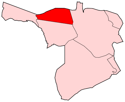
Valdemarín is a ward (barrio) of Madrid belonging to the district of Moncloa-Aravaca. Its code number is 95 and, as of 2006, its population was of 4,000.Wiki
Places Near Valdemarin (Madrid)
How to get to popular places in Madrid with public transit
Get around Madrid by public transit!
Traveling around Madrid has never been so easy. See step by step directions as you travel to any attraction, street or major public transit station. View bus and train schedules, arrival times, service alerts and detailed routes on a map, so you know exactly how to get to anywhere in Madrid.
When traveling to any destination around Madrid use Moovit's Live Directions with Get Off Notifications to know exactly where and how far to walk, how long to wait for your line, and how many stops are left. Moovit will alert you when it's time to get off — no need to constantly re-check whether yours is the next stop.
Wondering how to use public transit in Madrid or how to pay for public transit in Madrid? Moovit public transit app can help you navigate your way with public transit easily, and at minimum cost. It includes public transit fees, ticket prices, and costs. Looking for a map of Madrid public transit lines? Moovit public transit app shows all public transit maps in Madrid with all Bus, Train, Metro and Light Rail routes and stops on an interactive map.
Madrid has 4 transit type(s), including: Bus, Train, Metro and Light Rail, operated by several transit agencies, including EMT, Metro Ligero, Tranvía de Parla, Interurbanos, Metro de Madrid, Urbanos de Fuenlabrada, Urbanos de Alcalá de Henares, Urbanos de Alcobendas, Urbanos de Collado Villalba, Urbanos de Colmenar Viejo, Urbanos de Tres Cantos, Urbanos de Móstoles, Urbanos de Leganés, Urbanos de Alcorcón and Urbanos de Coslada