Vallon Des Auffes stop - Thursday schedule
| Line | Direction | Time |
|---|---|---|
| 83 | Métro Vieux Port | 06:12 |
| 83 | Métro Vieux Port | 06:32 |
| 83 | Métro Vieux Port | 06:52 |
| 83 | Métro Vieux Port | 07:14 |
| 83 | Métro Vieux Port | 07:29 |
| 83 | Métro Vieux Port | 07:44 |
| 83 | Métro Vieux Port | 08:01 |
| 83 | Métro Vieux Port | 08:18 |
| 83 | Métro Vieux Port | 08:31 |
| 83 | Métro Vieux Port | 08:43 |
| 83 | Métro Vieux Port | 08:55 |
| 83 | Métro Vieux Port | 09:07 |
| 83 | Métro Vieux Port | 09:19 |
| 83 | Métro Vieux Port | 09:29 |
| 83 | Métro Vieux Port | 09:38 |
| 83 | Métro Vieux Port | 09:48 |
| 83 | Métro Vieux Port | 09:58 |
| 83 | Métro Vieux Port | 10:08 |
| 83 | Métro Vieux Port | 10:18 |
| 83 | Métro Vieux Port | 10:28 |
| 83 | Métro Vieux Port | 10:38 |
| 83 | Métro Vieux Port | 10:46 |
| 83 | Métro Vieux Port | 10:54 |
| 83 | Métro Vieux Port | 11:02 |
| 83 | Métro Vieux Port | 11:10 |
See Vallon Des Auffes, Marseille, 7e Arrondissement, on the map
Directions to Vallon Des Auffes (Marseille, 7e Arrondissement) with public transportation
The following transit lines have routes that pass near Vallon Des Auffes
 Bus:
Bus: - Train:
- Metro:
- Ferry:
How to get to Vallon Des Auffes by bus?
Click on the bus route to see step by step directions with maps, line arrival times and updated time schedules.
How to get to Vallon Des Auffes by train?
Click on the train route to see step by step directions with maps, line arrival times and updated time schedules.
How to get to Vallon Des Auffes by metro?
Click on the metro route to see step by step directions with maps, line arrival times and updated time schedules.
Bus stations near Vallon Des Auffes in Marseille, 7e Arrondissement
- Eglise D'Endoume,3 min walk,
- Endoume,5 min walk,
- Guidicelli Fouquet,12 min walk,
Ferry stations near Vallon Des Auffes in Marseille, 7e Arrondissement
- Place Aux Huiles,30 min walk,
- Vieux Port,34 min walk,
Bus lines to Vallon Des Auffes in Marseille, 7e Arrondissement
- 80,Vieux Port Ballard,
- 83,Métro Vieux Port,
- 84,Samatan,
What are the closest stations to Vallon Des Auffes?
The closest stations to Vallon Des Auffes are:
- Eglise D'Endoume is 183 meters away, 3 min walk.
- Endoume is 373 meters away, 5 min walk.
- Guidicelli Fouquet is 919 meters away, 12 min walk.
- Place Aux Huiles is 2337 meters away, 30 min walk.
- Vieux Port is 2644 meters away, 34 min walk.
Which bus lines stop near Vallon Des Auffes?
These bus lines stop near Vallon Des Auffes: 54, 83.
Which train lines stop near Vallon Des Auffes?
These train lines stop near Vallon Des Auffes: C2, C5.
Which metro line stops near Vallon Des Auffes?
M1
What’s the nearest bus stop to Vallon Des Auffes in Marseille, 7e Arrondissement?
The nearest bus stop to Vallon Des Auffes in Marseille, 7e Arrondissement is Eglise D'Endoume. It’s a 3 min walk away.
What’s the nearest ferry station to Vallon Des Auffes in Marseille, 7e Arrondissement?
The nearest ferry station to Vallon Des Auffes in Marseille, 7e Arrondissement is Place Aux Huiles. It’s a 30 min walk away.
What time is the first bus to Vallon Des Auffes in Marseille, 7e Arrondissement?
The 80 is the first bus that goes to Vallon Des Auffes in Marseille, 7e Arrondissement. It stops nearby at 5:07 AM.
What time is the last bus to Vallon Des Auffes in Marseille, 7e Arrondissement?
The 83 is the last bus that goes to Vallon Des Auffes in Marseille, 7e Arrondissement. It stops nearby at 1:08 AM.
What time is the first ferry to Vallon Des Auffes in Marseille, 7e Arrondissement?
The 1 is the first ferry that goes to Vallon Des Auffes in Marseille, 7e Arrondissement. It stops nearby at 6:30 AM.
What time is the last ferry to Vallon Des Auffes in Marseille, 7e Arrondissement?
The 1 is the last ferry that goes to Vallon Des Auffes in Marseille, 7e Arrondissement. It stops nearby at 12:45 AM.
See Vallon Des Auffes, Marseille, 7e Arrondissement, on the map
Public transit to Vallon Des Auffes stop (ID: RTM:PNT:00002082) in Marseille, 7e Arrondissement
Looking for directions to Vallon Des Auffes in Marseille, 7e Arrondissement, France?
Download the Moovit App to find the current schedule and step-by-step directions for Bus, Metro or Train routes that pass through Vallon Des Auffes.
Looking for the nearest stops closest to Vallon Des Auffes ? Check out this list of closest stops to your destination: Eglise D'Endoume; Endoume; Guidicelli Fouquet; Place Aux Huiles; Vieux Port.
Bus:Train:Metro:Ferry:
We make riding on public transit to Vallon Des Auffes easy, which is why over 1.5 million users, including users in Marseille, 7e Arrondissement trust Moovit as the best app for public transit.
Use the app to navigate to popular places including to the airport, hospital, stadium, grocery store, mall, coffee shop, school, college, and university.
Vallon Des Auffes stop’s code is RTM:PNT:00002082
The first line to this stop is 83, at 06:12, and the last line is 83 at 00:58.
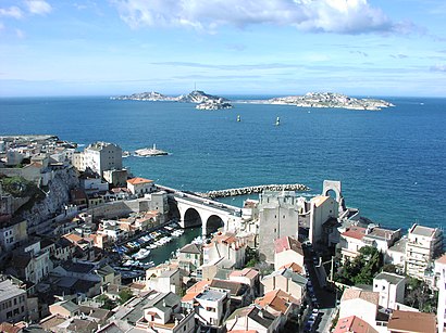
Vallon des Auffes, Marseille, France
This stop serves RTM’s lines
Popular public transit stations in Marseille, 7e Arrondissement
Métro Jules Guesde,Lycée Fourcade,Pierre Blancard,4 Chemins Des Aygalades,Cc Sormiou,Val Plan,Métro Jules Guesde,Camping Baie Des Anges,Collège Édouard Manet,Corsy,Sakakini Jeanne D'Arc,Kaddouz Aiguillette,National Loubon,Centre Commercial,Place Delibes,Vallon D'Ol Bourrély,Jean Moulin Facultés,Camas,Jean Bouin,Sadi CarnotGet around Marseille, 7e Arrondissement by public transit!
Traveling around Marseille, 7e Arrondissement has never been so easy. See step by step directions as you travel to any attraction, street or major public transit station. View bus and train schedules, arrival times, service alerts and detailed routes on a map, so you know exactly how to get to anywhere in Marseille, 7e Arrondissement.
When traveling to any destination around Marseille, 7e Arrondissement use Moovit's Live Directions with Get Off Notifications to know exactly where and how far to walk, how long to wait for your line, and how many stops are left. Moovit will alert you when it's time to get off — no need to constantly re-check whether yours is the next stop.
Wondering how to use public transit in Marseille, 7e Arrondissement or how to pay for public transit in Marseille, 7e Arrondissement? Moovit public transit app can help you navigate your way with public transit easily, and at minimum cost. It includes public transit fees, ticket prices, and costs. Looking for a map of Marseille, 7e Arrondissement public transit lines? Moovit public transit app shows all public transit maps in Marseille, 7e Arrondissement with all bus, metro or train routes and stops on an interactive map.
Marseille, 7e Arrondissement has 3 transit type(s), including: bus, metro or train, operated by several transit agencies, including RTM, RTM, RTM, RTM, Réseau Mistral, Réseau Mistral, ZOU ! Express, ZOU ! Express, ZOU ! Proximité, ZOU ! Scolaire, SNCF VOYAGEURS, Pays d Aix Mobilite, Aix en Bus, Busdel'agglo and Busdel'agglo