Directions to Vancouver with public transportation
The following transit lines have routes that pass near Vancouver
How to get to Vancouver by bus?
Click on the bus route to see step by step directions with maps, line arrival times and updated time schedules.
How to get to Vancouver by SkyTrain?
Click on the SkyTrain route to see step by step directions with maps, line arrival times and updated time schedules.
Bus stations near Vancouver
- Westbound Great Northern Way @ Thornton St, 3 min walk,
- Northbound Main St @ E 2nd Ave, 6 min walk,
Bus lines to Vancouver
- 84, UBC,
- 3, Main/Waterfront Station,
- 8, Fraser/Waterfront Station,
- 19, Metrotown Station/Stanley Park,
- N8, Downtown/Fraser NightBus,
- N19, Downtown/Surrey Central Station NightBus,
What are the closest stations to Vancouver?
The closest stations to Vancouver are:
- Westbound Great Northern Way @ Thornton St is 163 meters away, 3 min walk.
- Northbound Main St @ E 2nd Ave is 449 meters away, 6 min walk.
Which bus lines stop near Vancouver?
These bus lines stop near Vancouver: 19, 3, 84.
Which SkyTrain line stops near Vancouver?
EXPO LINE
What’s the nearest bus stop to Vancouver?
The nearest bus stop to Vancouver is Westbound Great Northern Way @ Thornton St. It’s a 3 min walk away.
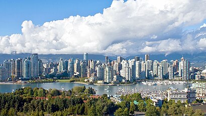
See Vancouver on the map
Public Transportation to Vancouver
Wondering how to get to Vancouver, Canada? Moovit helps you find the best way to get to Vancouver with step-by-step directions from the nearest public transit station.
Moovit provides free maps and live directions to help you navigate through your city. View schedules, routes, timetables, and find out how long does it take to get to Vancouver in real time.
Looking for the nearest stop or station to Vancouver? Check out this list of stops closest to your destination: Westbound Great Northern Way @ Thornton St; Northbound Main St @ E 2nd Ave.
Bus: 19, 3, 84, 8, N8, N19.SkyTrain: EXPO LINE.
Want to see if there’s another route that gets you there at an earlier time? Moovit helps you find alternative routes or times. Get directions from and directions to Vancouver easily from the Moovit App or Website.
We make riding to Vancouver easy, which is why over 1.5 million users, including users in Vancouver, trust Moovit as the best app for public transit. You don’t need to download an individual bus app or train app, Moovit is your all-in-one transit app that helps you find the best bus time or train time available.
For information on prices of bus, SkyTrain and ferry, costs and ride fares to Vancouver, please check the Moovit app.
Use the app to navigate to popular places including to the airport, hospital, stadium, grocery store, mall, coffee shop, school, college, and university.
Vancouver Address: BC V5T 0G5 street in Vancouver
Attractions near Vancouver
Micron Construction,Great Northern Way Bike Path,Bus Stop 59763 (84),Brandon Hart Photography,428 Great Northern Way,Industrial Brand,June B Wilde Acting Class,Artech Lofts,QLT,Tomasz Wagner Photo & Films,Dancehouse,Fresh Out,Isentient Technologies,Curve,Mainline Sound Design,Twilight Interiors,Ammill Graphics,Headlines Theatre CO,Spence Tropicals,Industrial Brand Creative IncHow to get to popular attractions in Vancouver with public transit
Concord Pacific Pop Up Park, Vancouver,Richmond Public Market, Richmond,Metrotown SkyTrain Station, Burnaby,Caulfield Village Shopping Center, West Vancouver,Arc'teryx Factory Outlet, North Vancouver,250-999 West Broadway, Vancouver,Green Lake Station, Whistler,Costco, Langford,Amazon Fulfillment Center-YVR4, Delta,H R MacMillan Space Centre, Vancouver,Victoria & 41st, Vancouver,Blue Horizon Hotel, Vancouver,Sasamat Lake, Port Moody,Douglas College, New Westminster,Granville Island Hotel, Vancouver,Main Street, Vancouver,Accent Inns Burnaby, Burnaby,Jack Poole Plaza, Vancouver,Craigdarroch Castle, Victoria,Edmonds SkyTrain Station, BurnabyGet around Southwest British Columbia by public transit!
Traveling around Southwest British Columbia has never been so easy. See step by step directions as you travel to any attraction, street or major public transit station. View bus and train schedules, arrival times, service alerts and detailed routes on a map, so you know exactly how to get to anywhere in Southwest British Columbia.
When traveling to any destination around Southwest British Columbia use Moovit's Live Directions with Get Off Notifications to know exactly where and how far to walk, how long to wait for your line, and how many stops are left. Moovit will alert you when it's time to get off — no need to constantly re-check whether yours is the next stop.
Wondering how to use public transit in Southwest British Columbia or how to pay for public transit in Southwest British Columbia? Moovit public transit app can help you navigate your way with public transit easily, and at minimum cost. It includes public transit fees, ticket prices, and costs. Looking for a map of Southwest British Columbia public transit lines? Moovit public transit app shows all public transit maps in Southwest British Columbia with all Bus, Train, SkyTrain and Ferry routes and stops on an interactive map.
Southwest British Columbia has 4 transit type(s), including: Bus, Train, SkyTrain and Ferry, operated by several transit agencies, including TransLink, False Creek Ferries, BC Ferries, Aquabus, BC Transit - Central Fraser Valley Transit System, BCTransit, BC Transit - Comox Valley Transit System, BC Transit - Aggasiz-Harrison and Hope Transit System, BC Transit - Chilliwack Transit System, BC Transit - Squamish, BC Transit - Whistler Transit System, BC Transit - Cowichan Valley Regional Transit System, BC Transit - Campbell River Transit System, BC Transit - Powell River Regional Transit System, BC Transit - Sunshine Coast Transit System