Directions to Vancouver Maritime Museum with public transportation
The following transit lines have routes that pass near Vancouver Maritime Museum
How to get to Vancouver Maritime Museum by bus?
Click on the bus route to see step by step directions with maps, line arrival times and updated time schedules.
How to get to Vancouver Maritime Museum by SkyTrain?
Click on the SkyTrain route to see step by step directions with maps, line arrival times and updated time schedules.
Bus stations near Vancouver Maritime Museum
- Westbound Beach Ave @ Bute St, 7 min walk,
- Westbound Cornwall Ave @ Cypress St, 8 min walk,
Ferry stations near Vancouver Maritime Museum
- Aquatic Centre Ferry Dock, 29 min walk,
- Granville Island, 39 min walk,
- Granville Island Ferry Dock, 39 min walk,
Bus lines to Vancouver Maritime Museum
- 23, English Bay,
- 2, Macdonald/To Dunbar Loop,
- N22, Macdonald,
What are the closest stations to Vancouver Maritime Museum?
The closest stations to Vancouver Maritime Museum are:
- Westbound Beach Ave @ Bute St is 492 meters away, 7 min walk.
- Westbound Cornwall Ave @ Cypress St is 564 meters away, 8 min walk.
- Aquatic Centre Ferry Dock is 2225 meters away, 29 min walk.
- Granville Island is 2961 meters away, 39 min walk.
- Granville Island Ferry Dock is 2984 meters away, 39 min walk.
Which bus line stops near Vancouver Maritime Museum?
2
Which SkyTrain lines stop near Vancouver Maritime Museum?
These SkyTrain lines stop near Vancouver Maritime Museum: CANADA LINE, EXPO LINE.
What’s the nearest bus stop to Vancouver Maritime Museum?
The nearest bus stop to Vancouver Maritime Museum is Westbound Beach Ave @ Bute St. It’s a 7 min walk away.
What’s the nearest ferry station to Vancouver Maritime Museum?
The nearest ferry station to Vancouver Maritime Museum is Aquatic Centre Ferry Dock. It’s a 29 min walk away.
What time is the first bus to Vancouver Maritime Museum?
The N22 is the first bus that goes to Vancouver Maritime Museum. It stops nearby at 3:18 AM.
What time is the last bus to Vancouver Maritime Museum?
The N22 is the last bus that goes to Vancouver Maritime Museum. It stops nearby at 2:57 AM.
What time is the first ferry to Vancouver Maritime Museum?
The AQUABUS is the first ferry that goes to Vancouver Maritime Museum. It stops nearby at 6:45 AM.
What time is the last ferry to Vancouver Maritime Museum?
The AQUABUS is the last ferry that goes to Vancouver Maritime Museum. It stops nearby at 10:30 PM.
See Vancouver Maritime Museum on the map
Public Transportation to Vancouver Maritime Museum
Wondering how to get to Vancouver Maritime Museum, Canada? Moovit helps you find the best way to get to Vancouver Maritime Museum with step-by-step directions from the nearest public transit station.
Moovit provides free maps and live directions to help you navigate through your city. View schedules, routes, timetables, and find out how long does it take to get to Vancouver Maritime Museum in real time.
Looking for the nearest stop or station to Vancouver Maritime Museum? Check out this list of stops closest to your destination: Westbound Beach Ave @ Bute St; Westbound Cornwall Ave @ Cypress St; Aquatic Centre Ferry Dock; Granville Island; Granville Island Ferry Dock.
Bus: 2, 23, N22.SkyTrain: CANADA LINE, EXPO LINE.Ferry: 1, 2, AQUABUS, 3.
Want to see if there’s another route that gets you there at an earlier time? Moovit helps you find alternative routes or times. Get directions from and directions to Vancouver Maritime Museum easily from the Moovit App or Website.
We make riding to Vancouver Maritime Museum easy, which is why over 1.5 million users, including users in Vancouver, trust Moovit as the best app for public transit. You don’t need to download an individual bus app or train app, Moovit is your all-in-one transit app that helps you find the best bus time or train time available.
For information on prices of bus and SkyTrain, costs and ride fares to Vancouver Maritime Museum, please check the Moovit app.
Use the app to navigate to popular places including to the airport, hospital, stadium, grocery store, mall, coffee shop, school, college, and university.
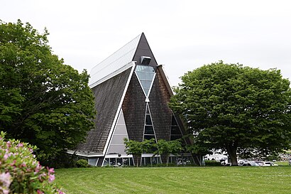
Vancouver Maritime Museum Address: Ogden Avenue street in Vancouver
Attractions near Vancouver Maritime Museum
Maritime Museum,Bard on the Beach,Vancouver Planetarium,Gate To the Northwest Passage,H R MacMillan Space Centre,Museum Of Vancouver,Liliann N Makeup,Vancouver Ocean Sports,1270 Chestnut Street,Vanier Park (Gravel) (Easypark Lot 70),Charitable Returns Marketing Services,Kits Beach Basketball Courts,Bard on the Beach (Summer Only),Vanier Park,Happy Brothers Painting,Kitsilano Beach,Amazing Painters,Vanier Bike Park,Westhome Painting,Craniosacral Therapy VancouverHow to get to popular attractions in Vancouver with public transit
Norvan Falls Trail, North Vancouver,The Rio Theatre, Vancouver,Expo Line Skytrain , Vancouver,Capital City Station, Victoria,Pay phone, Surrey,Exit 73/264 St/E, Langley District Municipality,W 16th Ave, Vancouver,Dog Mountain, North Vancouver,Shangri-La Hotel, Vancouver,Vogue Theatre, Vancouver,Medical Imaging @ Abbotsford Hospital, Abbotsford,Richmond General Hospital, Richmond,Templeton SkyTrain Station, Richmond,Kennedy Falls, North Vancouver,David Lam Park, Vancouver,Granville Station SkyTrain, Vancouver,Quarry Rock, North Vancouver,Richmond Night Market, Richmond,1200 West 73rd Avenue, Vancouver,Tsawwassen Ferry Terminal, TsawwassenGet around Southwest British Columbia by public transit!
Traveling around Southwest British Columbia has never been so easy. See step by step directions as you travel to any attraction, street or major public transit station. View bus and train schedules, arrival times, service alerts and detailed routes on a map, so you know exactly how to get to anywhere in Southwest British Columbia.
When traveling to any destination around Southwest British Columbia use Moovit's Live Directions with Get Off Notifications to know exactly where and how far to walk, how long to wait for your line, and how many stops are left. Moovit will alert you when it's time to get off — no need to constantly re-check whether yours is the next stop.
Wondering how to use public transit in Southwest British Columbia or how to pay for public transit in Southwest British Columbia? Moovit public transit app can help you navigate your way with public transit easily, and at minimum cost. It includes public transit fees, ticket prices, and costs. Looking for a map of Southwest British Columbia public transit lines? Moovit public transit app shows all public transit maps in Southwest British Columbia with all Bus, Train, SkyTrain and Ferry routes and stops on an interactive map.
Southwest British Columbia has 4 transit type(s), including: Bus, Train, SkyTrain and Ferry, operated by several transit agencies, including TransLink, False Creek Ferries, BC Ferries, Aquabus, BC Transit - Central Fraser Valley Transit System, BCTransit, BC Transit - Comox Valley Transit System, BC Transit - Aggasiz-Harrison and Hope Transit System, BC Transit - Chilliwack Transit System, BC Transit - Squamish, BC Transit - Whistler Transit System, BC Transit - Cowichan Valley Regional Transit System, BC Transit - Campbell River Transit System, BC Transit - Powell River Regional Transit System, BC Transit - Sunshine Coast Transit System