How to get to Vander Photography by bus?
Click on the bus route to see step by step directions with maps, line arrival times and updated time schedules.
How to get to Vander Photography by train?
Click on the train route to see step by step directions with maps, line arrival times and updated time schedules.
Bus stops near Vander Photography in Lawrence
Train station near Vander Photography in Lawrence
- Andover, 26 min walk,VIEW
Bus lines to Vander Photography in Lawrence
- 9, North Andover Mall,VIEW
- 5, Merrimac Plaza,VIEW
- 10, Village Plaza,VIEW
- 11, Pond Street - Cvs,VIEW
- 28, Mcgovern Transportation Center,VIEW
- 6, Holy Family Hospital,VIEW
- 12, Senior Center,VIEW
- 14, Washington Square Transit Center,VIEW
- 24, Robert B. Kennedy Transfer Center,VIEW
- HAVERHILL LINE SHUTTLE, Haverhill - Andover,VIEW
- HAVERHILL LINE SHUTTLE, Haverhill - Reading (Express),VIEW
- HAVERHILL LINE SHUTTLE, Haverhill - Reading (Local),VIEW
- HAVERHILL LINE SHUTTLE, Haverhill - Malden Center,VIEW
- HAVERHILL LINE SHUTTLE, Haverhill - North Station,VIEW
- 26, IRS/RAYTHEON,VIEW
What are the closest stations to Vander Photography?
The closest stations to Vander Photography are:
- Union & Bailey Street is 186 yards away, 3 min walk.
- Mcg H is 579 yards away, 8 min walk.
- Mcg K is 581 yards away, 8 min walk.
- Mcg F is 583 yards away, 8 min walk.
- Mcg G is 588 yards away, 8 min walk.
- Mcg B is 591 yards away, 8 min walk.
- Mcgovern Transportation Center is 607 yards away, 8 min walk.
- Andover is 2206 yards away, 26 min walk.
Which bus lines stop near Vander Photography?
These bus lines stop near Vander Photography: 14, 2, 24.
Which train line stops near Vander Photography?
HAVERHILL (#232 | North Station)
What’s the nearest train station to Vander Photography in Lawrence?
The nearest train station to Vander Photography in Lawrence is Andover. It’s a 26 min walk away.
What’s the nearest bus station to Vander Photography in Lawrence?
The nearest bus station to Vander Photography in Lawrence is Union & Bailey Street. It’s a 3 min walk away.
What time is the first train to Vander Photography in Lawrence?
The HAVERHILL is the first train that goes to Vander Photography in Lawrence. It stops nearby at 4:51 AM.
What time is the last train to Vander Photography in Lawrence?
The HAVERHILL is the last train that goes to Vander Photography in Lawrence. It stops nearby at 12:38 AM.
What time is the first bus to Vander Photography in Lawrence?
The 5 is the first bus that goes to Vander Photography in Lawrence. It stops nearby at 5:00 AM.
What time is the last bus to Vander Photography in Lawrence?
The 10 is the last bus that goes to Vander Photography in Lawrence. It stops nearby at 10:00 PM.
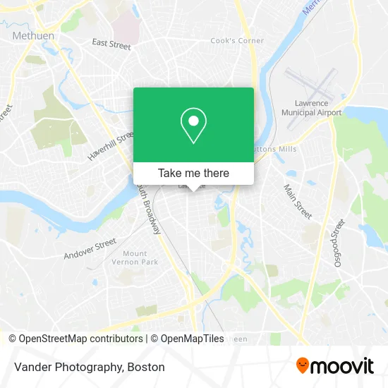
See Vander Photography, Lawrence, on the map
Public Transit to Vander Photography in Lawrence
Wondering how to get to Vander Photography in Lawrence? Moovit helps you find the best way to get to Vander Photography with step-by-step directions from the nearest public transit station.
Moovit provides free maps and live directions to help you navigate through your city. View schedules, routes, timetables, and find out how long does it take to get to Vander Photography in real time.
Looking for the nearest stop or station to Vander Photography? Check out this list of stops closest to your destination: Union & Bailey Street; Mcg H; Mcg K; Mcg F; Mcg G; Mcg B; Mcgovern Transportation Center; Andover.
Bus: 14, 2, 24, 9, 5, 10, 11, 28, 6, 12.Train: HAVERHILL.
Want to see if there’s another route that gets you there at an earlier time? Moovit helps you find alternative routes or times. Get directions from and directions to Vander Photography easily from the Moovit App or Website.
We make riding to Vander Photography easy, which is why over 1.7 million users, including users in Lawrence, trust Moovit as the best app for public transit. You don’t need to download an individual bus app or train app, Moovit is your all-in-one transit app that helps you find the best bus time or train time available.
For information on prices of bus and train, costs and ride fares to Vander Photography, please check the Moovit app.
Use the app to navigate to popular places including to the airport, hospital, stadium, grocery store, mall, coffee shop, school, college, and university.
Vander Photography Address: Salem St Lawrence, MA 01843 street in Lawrence
- Avedisian Landscaping,
- New Hope Methodist Church,
- Steak-Out,
- Abbott CR,
- Lawrence High Point Roofing,
- El Menor Barber Shop,
- Botanica San Miguel,
- La Carniceria Super Market,
- Yaport Taxes,
- Lawrence Hispanic Seventh-Day Adventist Church,
- S. Union St. and Market St., Lawrence,
- East Coast Cabinets,
- Mami's House,
- HJ Landscaping Masonry,
- Tremont Market Cafe,
- Passion Steak Tacos,
- Lawrence Locksmith Fresh Installation,
- Bullseye Auto Glass,
- St Francis & St Claire Thrift,
- Lawrence Housing Authority
Places Near Vander Photography (Lawrence)
- North End, Boston,
- Castle Island, Boston,
- Prudential Center, Boston,
- Wilbur Theatre, Boston,
- Faneuil Hall, Boston,
- Quincy Market, Boston,
- House Of Blues, Boston,
- Boston Common, Boston,
- Cheers, Boston,
- Td Garden, Boston,
- Seaport District, Boston,
- Isabella Stewart Gardner Museum, Boston,
- Boston Convention & Exhibition Center, Boston,
- Boston Medical Center, Boston,
- Leader Bank Pavilion (Leader Bank Pavillion), Boston,
- Massachusetts General Hospital, Boston,
- Boston Children's Hospital, Boston,
- Mgm Music Hall, Boston,
- Museum Of Science, Boston,
- Wang Theater, Boston
How to get to popular places in Boston with public transit
Get around Lawrence by public transit!
Traveling around Lawrence has never been so easy. See step by step directions as you travel to any attraction, street or major public transit station. View bus and train schedules, arrival times, service alerts and detailed routes on a map, so you know exactly how to get to anywhere in Lawrence.
When traveling to any destination around Lawrence use Moovit's Live Directions with Get Off Notifications to know exactly where and how far to walk, how long to wait for your line, and how many stops are left. Moovit will alert you when it's time to get off — no need to constantly re-check whether yours is the next stop.
Wondering how to use public transit in Lawrence or how to pay for public transit in Lawrence? Moovit public transit app can help you navigate your way with public transit easily, and at minimum cost. It includes public transit fees, ticket prices, and costs. Looking for a map of Lawrence public transit lines? Moovit public transit app shows all public transit maps in Lawrence with all Bus, Train, Subway and Ferry routes and stops on an interactive map.
Boston has 4 transit type(s), including: Bus, Train, Subway and Ferry, operated by several transit agencies, including MBTA, Southeastern Regional Transit Authority, MetroWest Regional Transit Authority, Rhode Island Public Transit Authority, WRTA, Lowell Regional Transit Authority, Merrimack Valley Transit, Montachusett Regional Transit Authority, Cape Cod Regional Transit Authority, Brockton Area Transit Authority, Martha's Vineyard Transit Authority, the WAVE - Nantucket Regional Transit Authority, GATRA, Cape Ann Transportation Authority and Massport