Directions to Varsity Centre (Toronto) with public transportation
The following transit lines have routes that pass near Varsity Centre
 Bus: 13A, 26, 62, 8, 94A.
- Train: BR, LW, UP.
- Subway: 1, 2.
How to get to Varsity Centre by bus?
Click on the bus route to see step by step directions with maps, line arrival times and updated time schedules.
How to get to Varsity Centre by train?
Click on the train route to see step by step directions with maps, line arrival times and updated time schedules.
How to get to Varsity Centre by subway?
Click on the subway route to see step by step directions with maps, line arrival times and updated time schedules.
Bus stops near Varsity Centre in Toronto
- Bloor St West at Bedford Rd, 3 min walk,
- Queen's Park at Charles St West - Museum Station, 4 min walk,
- Queen's Park at Charles St West North Side - Museum Station, 4 min walk,
- St George Station at Bus Bay 2, 5 min walk,
- Hoskin Ave at Tower Rd - Trinity College, 6 min walk,
- Hoskin Ave at Tower Rd - Wycliffe College, 6 min walk,
Streetcar stations near Varsity Centre in Toronto
- Spadina Station Streetcar Platform, 10 min walk,
Subway station near Varsity Centre in Toronto
- St-George, 10 min walk,
Bus lines to Varsity Centre in Toronto
- 300A, West - 300a Bloor-Danforth Towards Pearson Airport Via Kipling Stn,
- 300B, East - 300b Bloor-Danforth Towards Kennedy Station,
- 300S, West - 300s Bloor-Danforth Short Turn Towards Keele Stn,
- 882, Not In Service,
- 26, West - 26 Dupont Towards Jane Station,
- 13A, South - 13a Avenue Rd Towards Queen's Park,
- 13B, South - 13b Avenue Rd Towards Gerrard,
- 13, North - 13 Avenue Rd Towards Eglinton Station,
- 13S, North - 13s Avenue Rd Short Turn Towards Museum Station,
- 94A, West - 94a Wellesley Towards Ossington Station,
- 94, East - 94 Wellesley Towards Castle Frank Station,
What are the closest stations to Varsity Centre?
The closest stations to Varsity Centre are:
- Bloor St West at Bedford Rd stop is 162 meters away, 3 min walk.
- St George Station at Bus Bay 2 is 273 meters away, 5 min walk.
- Queen's Park at Charles St West - Museum Station is 305 meters away, 4 min walk.
- Queen's Park at Charles St West North Side - Museum Station is 305 meters away, 4 min walk.
- Hoskin Ave at Tower Rd - Trinity College stop is 368 meters away, 6 min walk.
- Hoskin Ave at Tower Rd - Wycliffe College stop is 389 meters away, 6 min walk.
- Spadina Station Streetcar Platform is 657 meters away, 10 min walk.
- St-George station is 764 meters away, 10 min walk.
Which bus lines stop near Varsity Centre?
These bus lines stop near Varsity Centre: 13A, 26, 62, 8, 94A.
Which train lines stop near Varsity Centre?
These train lines stop near Varsity Centre: BR, LW, UP.
Which subway lines stop near Varsity Centre?
These subway lines stop near Varsity Centre: 1, 2.
What’s the nearest Streetcar station to Varsity Centre in Toronto?
The nearest Streetcar station to Varsity Centre in Toronto is Spadina Station Streetcar Platform. It’s a 10 min walk away.
What’s the nearest subway station to Varsity Centre in Toronto?
The nearest subway station to Varsity Centre in Toronto is St-George. It’s a 10 min walk away.
What’s the nearest bus station to Varsity Centre in Toronto?
The nearest bus station to Varsity Centre in Toronto is Bloor St West at Bedford Rd. It’s a 3 min walk away.
What time is the first Streetcar to Varsity Centre in Toronto?
The 310 is the first Streetcar that goes to Varsity Centre in Toronto. It stops nearby at 3:08 AM.
What time is the last Streetcar to Varsity Centre in Toronto?
The 310 is the last Streetcar that goes to Varsity Centre in Toronto. It stops nearby at 3:18 AM.
What time is the first subway to Varsity Centre in Toronto?
The 2 is the first subway that goes to Varsity Centre in Toronto. It stops nearby at 5:52 AM.
What time is the last subway to Varsity Centre in Toronto?
The 1 is the last subway that goes to Varsity Centre in Toronto. It stops nearby at 1:59 AM.
What time is the first bus to Varsity Centre in Toronto?
The 300A is the first bus that goes to Varsity Centre in Toronto. It stops nearby at 3:00 AM.
What time is the last bus to Varsity Centre in Toronto?
The 300A is the last bus that goes to Varsity Centre in Toronto. It stops nearby at 3:45 AM.
What time is the first ferry to Varsity Centre in Toronto?
The 882 is the first ferry that goes to Varsity Centre in Toronto. It stops nearby at 5:06 AM.
What time is the last ferry to Varsity Centre in Toronto?
The 882 is the last ferry that goes to Varsity Centre in Toronto. It stops nearby at 2:33 AM.
See Varsity Centre, Toronto, on the map
Public Transit to Varsity Centre in Toronto
Wondering how to get to Varsity Centre in Toronto? Moovit helps you find the best way to get to Varsity Centre with step-by-step directions from the nearest public transit station.
Moovit provides free maps and live directions to help you navigate through your city. View schedules, routes, timetables, and find out how long does it take to get to Varsity Centre in real time.
Looking for the nearest stop or station to Varsity Centre? Check out this list of stops closest to your destination: Bloor St West at Bedford Rd; St George Station at Bus Bay 2; Queen's Park at Charles St West - Museum Station; Queen's Park at Charles St West North Side - Museum Station; Hoskin Ave at Tower Rd - Trinity College; Hoskin Ave at Tower Rd - Wycliffe College; Spadina Station Streetcar Platform; St-George.
Bus: 13A, 26, 62, 8, 94A, 300A, 300B, 300S, 882, 13, 13S, 13B.Train: BR, LW, UP.Subway: 1, 2.
Want to see if there’s another route that gets you there at an earlier time? Moovit helps you find alternative routes or times. Get directions from and directions to Varsity Centre easily from the Moovit App or Website.
We make riding to Varsity Centre easy, which is why over 1.7 billion users, including users in Toronto, trust Moovit as the best app for public transit. You don’t need to download an individual bus app or train app, Moovit is your all-in-one transit app that helps you find the best bus time or train time available.
For information on prices of bus, subway, train and Streetcar, costs and ride fares to Varsity Centre, please check the Moovit app.
Use the app to navigate to popular places including to the airport, hospital, stadium, grocery store, mall, coffee shop, school, college, and university.
Varsity Centre Address: Devonshire Place street in Toronto
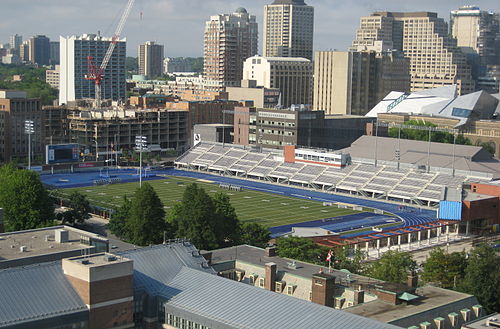
- Varsity Stadium,
- Goldring Centre,
- 100 Devonshire Place,
- Koerner Hall,
- Royal Conservatory Of Music,
- Oise Cafe,
- Woodsworth College,
- Innis College Residence,
- Rotman School Of Management And Rotman Commerce,
- Woodsworth College Residence,
- The Yorkville Royal Sonesta Hotel Toronto,
- Oise Library,
- Rotman Commerce,
- TTC Subway Line 2 - Bloor-Danforth Line,
- 515 Broadview Ave,
- St. George Station,
- Vfs.global,
- Trinity College,
- Toronto Ultrasound Imaging,
- 80 Queens Park
Places Near Varsity Centre (Toronto)
- Vaughan Mills Shopping Centre, Vaughan,
- Great Canadian Casino Resort, Toronto,
- St Michael s Hospital, Toronto,
- Sunnybrook Hospital, Toronto,
- Toronto Eaton Centre, Toronto,
- Toronto Western Hospital, Toronto,
- Toronto Courthouse, Toronto,
- Toronto General Hospital, Toronto,
- St. Michael's Hospital, Toronto,
- BMO Field, Toronto,
- Enercare Centre, Toronto,
- St Lawrence Market, Toronto,
- Medieval Times, Toronto,
- Ripley's Aquarium Of Canada, Toronto,
- Rogers Centre, Toronto,
- Exhibition Place, Toronto,
- St. Joseph's Health Centre, Toronto,
- 777 Bay Street, Toronto,
- Scarborough Town Centre, Toronto,
- Brandy Melville, Toronto
How to get to popular places in Toronto with public transit
Get around Toronto by public transit!
Traveling around Toronto has never been so easy. See step by step directions as you travel to any attraction, street or major public transit station. View bus and train schedules, arrival times, service alerts and detailed routes on a map, so you know exactly how to get to anywhere in Toronto.
When traveling to any destination around Toronto use Moovit's Live Directions with Get Off Notifications to know exactly where and how far to walk, how long to wait for your line, and how many stops are left. Moovit will alert you when it's time to get off — no need to constantly re-check whether yours is the next stop.
Wondering how to use public transit in Toronto or how to pay for public transit in Toronto? Moovit public transit app can help you navigate your way with public transit easily, and at minimum cost. It includes public transit fees, ticket prices, and costs. Looking for a map of Toronto public transit lines? Moovit public transit app shows all public transit maps in Toronto with all Bus, Train, Subway, Streetcar and Ferry routes and stops on an interactive map.
Toronto has 5 transit type(s), including: Bus, Train, Subway, Streetcar and Ferry, operated by several transit agencies, including TTC, Toronto Subway, Brampton Transit, MiWay, York Region Transit, GO Transit Bus, GO Transit, Durham Region Transit, UP Express, Grand River Transit, Guelph Transit, Hamilton Street Railway, Burlington Transit, Oakville Transit and pererborough