Directions to Viking World (Reykjanesbær) with public transportation
The following transit lines have routes that pass near Viking World
How to get to Viking World by bus?
Click on the bus route to see step by step directions with maps, line arrival times and updated time schedules.
Bus stations near Viking World in Reykjanesbær
- Stekkjarkot, 8 min walk,
- Fitjar, 14 min walk,
- Tjarnarhverfi, 15 min walk,
Bus lines to Viking World in Reykjanesbær
- 2, Miðstöð,
- 4, Miðstöð,
- 55, Fjörður,
What are the closest stations to Viking World?
The closest stations to Viking World are:
- Stekkjarkot is 554 meters away, 8 min walk.
- Fitjar is 1083 meters away, 14 min walk.
- Tjarnarhverfi is 1108 meters away, 15 min walk.
Which bus line stops near Viking World?
2
What’s the nearest bus stop to Viking World in Reykjanesbær?
The nearest bus stop to Viking World in Reykjanesbær is Stekkjarkot. It’s a 8 min walk away.
What time is the first bus to Viking World in Reykjanesbær?
The 55 is the first bus that goes to Viking World in Reykjanesbær. It stops nearby at 6:47 AM.
What time is the last bus to Viking World in Reykjanesbær?
The 55 is the last bus that goes to Viking World in Reykjanesbær. It stops nearby at 12:19 AM.
See Viking World, Reykjanesbær, on the map
Public Transit to Viking World in Reykjanesbær
Wondering how to get to Viking World in Reykjanesbær, Iceland? Moovit helps you find the best way to get to Viking World with step-by-step directions from the nearest public transit station.
Moovit provides free maps and live directions to help you navigate through your city. View schedules, routes, timetables, and find out how long does it take to get to Viking World in real time.
Looking for the nearest stop or station to Viking World? Check out this list of stops closest to your destination: Stekkjarkot; Fitjar; Tjarnarhverfi.
Bus: 2, 4, 55.
Want to see if there’s another route that gets you there at an earlier time? Moovit helps you find alternative routes or times. Get directions from and directions to Viking World easily from the Moovit App or Website.
We make riding to Viking World easy, which is why over 1.5 million users, including users in Reykjanesbær, trust Moovit as the best app for public transit. You don’t need to download an individual bus app or train app, Moovit is your all-in-one transit app that helps you find the best bus time or train time available.
For information on prices of bus, costs and ride fares to Viking World, please check the Moovit app.
Use the app to navigate to popular places including to the airport, hospital, stadium, grocery store, mall, coffee shop, school, college, and university.
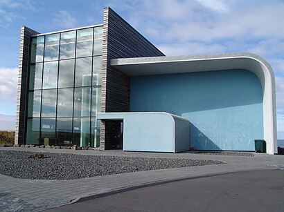
Viking World Address: Tjarnarbraut street in Reykjanesbær
Attractions near Viking World
Maron ehf,Lionsklubburinn Aesa,Keflavik Airport Car Rental,Volundarhus.Is,Mount Keilir,Netbygg Ehf.,Kaffitár Höfuðstöðvar,Orkan Fitjum Keflavik,ORKAN,Deltra Ehf.,Lepa,Isorka,Lax Ehf.,Njardvik Ehf.,Fitjabraut,Camycollections Ehf.,ON Power,Keflavík,Ravens House B N B,NjarðvíkHow to get to popular attractions in Reykjanesbær with public transit
Kailash,Bitabillinn, Reykjavík,Hotel Leifur Eiriksson, Reykjavík,Víðistaðatún, Hafnarfjörður,reykhólar, Hafnarfjörður,Hotel Reykjavik Centrum, Reykjavík,Hverfisgata 44, Reykjavík,Reykjalundur, Mosfellsbær,4th Floor Hotel Reykjavík, Reykjavík,Grótta,Dimmuborgir, Reykjavík,Reynisdrangar,Sólheimasandur, Reykjavík,Fosshotel Raudara, Reykjavík,Nirvana Iceland Head Shop, Reykjavík,Krossanes, Sveitarfélagið Skagafjörður,Goðafoss Water, Ljósavatnshreppur,Arbaejarlaug Swimming Pool, Reykjavík,Silica Hotel (Blue Lagoon Clinic Grindavik), Grindavík,Eagle Air - Flugfélagið Ernir, ReykjavíkGet around Ísland by public transit!
Traveling around Ísland has never been so easy. See step by step directions as you travel to any attraction, street or major public transit station. View bus and train schedules, arrival times, service alerts and detailed routes on a map, so you know exactly how to get to anywhere in Ísland.
When traveling to any destination around Ísland use Moovit's Live Directions with Get Off Notifications to know exactly where and how far to walk, how long to wait for your line, and how many stops are left. Moovit will alert you when it's time to get off — no need to constantly re-check whether yours is the next stop.
Wondering how to use public transit in Ísland or how to pay for public transit in Ísland? Moovit public transit app can help you navigate your way with public transit easily, and at minimum cost. It includes public transit fees, ticket prices, and costs. Looking for a map of Ísland public transit lines? Moovit public transit app shows all public transit maps in Ísland with all bus routes and stops on an interactive map.
Ísland has 1 transit type(s), including: bus, operated by several transit agencies, including Strætó bs.