Directions to Villeneuve-Le-Roi with public transportation
The following transit lines have routes that pass near Villeneuve-Le-Roi
How to get to Villeneuve-Le-Roi by bus?
Click on the bus route to see step by step directions with maps, line arrival times and updated time schedules.
Which bus line stops near Villeneuve-Le-Roi?
3
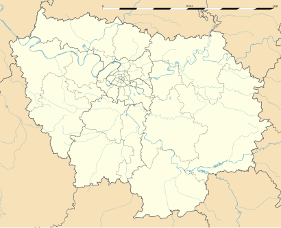
See Villeneuve-Le-Roi on the map
- Source of data:
- BD Carthage 2013 (open license) created by the IGN and available on Sandre's site;
- BD Carthage 2013 (open license) created by the IGN and available on Sandre's site;
- References for the boundaries:
Public Transportation to Villeneuve-Le-Roi
Wondering how to get to Villeneuve-Le-Roi, France? Moovit helps you find the best way to get to Villeneuve-Le-Roi with step-by-step directions from the nearest public transit station.
Moovit provides free maps and live directions to help you navigate through your city. View schedules, routes, timetables, and find out how long does it take to get to Villeneuve-Le-Roi in real time.
Bus: 3.
Want to see if there’s another route that gets you there at an earlier time? Moovit helps you find alternative routes or times. Get directions from and directions to Villeneuve-Le-Roi easily from the Moovit App or Website.
We make riding to Villeneuve-Le-Roi easy, which is why over 1.5 million users, including users in Villeneuve-Le-Roi, trust Moovit as the best app for public transit. You don’t need to download an individual bus app or train app, Moovit is your all-in-one transit app that helps you find the best bus time or train time available.
For information on prices of bus, RER, light rail and funicular, costs and ride fares to Villeneuve-Le-Roi, please check the Moovit app.
Use the app to navigate to popular places including to the airport, hospital, stadium, grocery store, mall, coffee shop, school, college, and university.
Villeneuve-Le-Roi Address: Rue des Tilleuls street in Villeneuve-Le-Roi
- Source of data:
- BD Carthage 2013 (open license) created by the IGN and available on Sandre's site;
- BD Carthage 2013 (open license) created by the IGN and available on Sandre's site;
- References for the boundaries:
Attractions near Villeneuve-Le-Roi
Conservatoire De Musique Jean Viener,Place De L'Abbé Bonnin,Monument Aux Morts,Église Saint-Charles,54 Avenue Poincaré,41 Rue des Tilleuls,Le Petit Diable,Cordonnerie Du Kiosque,Audition Conseil,Lcl,Caisse D'Épargne,Tsad Qualité,Duchêne Coiffure,Immobilière Des Trois Communes,17 Ter Avenue Poincaré,78 Rue du Général de Gaulle,1 Rue Marcel Risser,Retoucherie,Select Pressing,L'arbre à pâtesHow to get to popular attractions in Villeneuve-Le-Roi with public transit
Université Paris Ouest - Nanterre la Défense, Nanterre,Aéroville, Tremblay-En-France,Cergy, Cergy,Oracle France, Colombes,Bures-sur-Yvette, Bures-Sur-Yvette,Tour Maine - Montparnasse, Paris,Théâtre du Rond-Point, Paris,Court Philippe Chatrier, Paris,Talend S.A., Suresnes,Fnac, Boulogne-Billancourt,Parc Monceau, Paris,Gonesse, Gonesse,Place Coluche, Paris,McCann Paris, Clichy,MRM Paris, Clichy,Novedia, Boulogne-Billancourt,Stade de France K To Z, Saint-Denis,Musée D'Orsay, Paris,Tour CGI, Courbevoie,Monoprix HQ, ClichyGet around Paris by public transit!
Traveling around Paris has never been so easy. See step by step directions as you travel to any attraction, street or major public transit station. View bus and train schedules, arrival times, service alerts and detailed routes on a map, so you know exactly how to get to anywhere in Paris.
When traveling to any destination around Paris use Moovit's Live Directions with Get Off Notifications to know exactly where and how far to walk, how long to wait for your line, and how many stops are left. Moovit will alert you when it's time to get off — no need to constantly re-check whether yours is the next stop.
Wondering how to use public transit in Paris or how to pay for public transit in Paris? Moovit public transit app can help you navigate your way with public transit easily, and at minimum cost. It includes public transit fees, ticket prices, and costs. Looking for a map of Paris public transit lines? Moovit public transit app shows all public transit maps in Paris with all Bus, Train, Metro, Light Rail, RER and Funicular routes and stops on an interactive map.
Paris has 6 transit type(s), including: Bus, Train, Metro, Light Rail, RER and Funicular, operated by several transit agencies, including RATP, RER, RER Bus de remplacement, Train, Train Bus de remplacement, Tramway Bus de remplacement, TER, Tramway, ADP, Noctilien, Magical Shuttle, Apolo 7, Argenteuil - Boucles de Seine, Autobus du Fort, Autocars Dominique