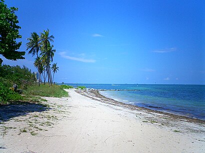
See Virginia Key, Key Biscayne, on the map
Directions to Virginia Key (Key Biscayne) with public transportation
The following transit lines have routes that pass near Virginia Key
 Bus:
Bus:
How to get to Virginia Key by bus?
Click on the bus route to see step by step directions with maps, line arrival times and updated time schedules.
Bus stations near Virginia Key in Key Biscayne
- Rickenbacker Cswy & Virginia Bch Dr,4 min walk,
Bus lines to Virginia Key in Key Biscayne
- 26,26 - Key Biscayne,
What are the closest stations to Virginia Key?
The closest stations to Virginia Key are:
- Rickenbacker Cswy & Virginia Bch Dr is 299 yards away, 4 min walk.
Which bus line stops near Virginia Key?
102
What’s the nearest bus stop to Virginia Key in Key Biscayne?
The nearest bus stop to Virginia Key in Key Biscayne is Rickenbacker Cswy & Virginia Bch Dr. It’s a 4 min walk away.
See Virginia Key, Key Biscayne, on the map
Public Transit to Virginia Key in Key Biscayne
Wondering how to get to Virginia Key in Key Biscayne, United States? Moovit helps you find the best way to get to Virginia Key with step-by-step directions from the nearest public transit station.
Moovit provides free maps and live directions to help you navigate through your city. View schedules, routes, timetables, and find out how long does it take to get to Virginia Key in real time.
Looking for the nearest stop or station to Virginia Key? Check out this list of stops closest to your destination: Rickenbacker Cswy & Virginia Bch Dr.
Bus:
Want to see if there’s another route that gets you there at an earlier time? Moovit helps you find alternative routes or times. Get directions from and directions to Virginia Key easily from the Moovit App or Website.
We make riding to Virginia Key easy, which is why over 1.5 million users, including users in Key Biscayne, trust Moovit as the best app for public transit. You don’t need to download an individual bus app or train app, Moovit is your all-in-one transit app that helps you find the best bus time or train time available.
For information on prices of bus and subway, costs and ride fares to Virginia Key, please check the Moovit app.
Use the app to navigate to popular places including to the airport, hospital, stadium, grocery store, mall, coffee shop, school, college, and university.
Location: Key Biscayne, Miami
Attractions near Virginia Key
Bear Cut Bridge,75 Virginia Beach Drive,NMFS,NOAA SEFSC,Key Colony Floranda,Wanderlust 108,Miami Reggae Festival,Virginia Key Grassroots Festival,Blue Starlite Mini Urban Drive in,4020 Virginia Beach Dr,Bear Cut Bridge,4600 Rickenbacker Causeway,Salt Waterfront Restaurant,Rickenbacker Cswy / Virginia Beach Dr,National Oceanic and Atmospheric Adminstration,The Wetlab,Rosenstiel School of Marine and Atmospheric Science,RSMAS University of Miami,University of Miami & Atmospheric Science Rosentiel School of VA Key,University of Miami Rosenstiel School - MPS ProgramHow to get to popular attractions in Key Biscayne with public transit
City of Oakland Park, Fort Lauderdale,LA Fitness, Fort Lauderdale,The Diplomat Beach Resort, Hollywood,Coconut Creek, FL, Pompano Beach,Sawgrass Mills Food Court, Plantation,City of Pompano Beach, Pompano Beach,Pollo Tropical, Miami,Regal Cinemas Sawgrass 23 & IMAX, Plantation,Outback Steakhouse, Kendall-Palmetto Bay,Costco Wholesale, Davie,Venetian Pool, Miami,Red Lobster, Kendall-Palmetto Bay,Hiatus & red road, Miramar-Pembroke Pines,SeaCoast Suites Apartment Hotel Miami, Miami Beach,IHOP, Miami,Best Western Plus Miami-Doral / Dolphin Mall, North Westside,Florida Atlantic University, Boca Raton,Boca Raton, FL, Boca Raton,The Mall at Wellington Green, Sunshine Parkway,Cinemark Boynton Beach, Boynton Beach-Delray BeachGet around Key Biscayne by public transit!
Traveling around Key Biscayne has never been so easy. See step by step directions as you travel to any attraction, street or major public transit station. View bus and train schedules, arrival times, service alerts and detailed routes on a map, so you know exactly how to get to anywhere in Key Biscayne.
When traveling to any destination around Key Biscayne use Moovit's Live Directions with Get Off Notifications to know exactly where and how far to walk, how long to wait for your line, and how many stops are left. Moovit will alert you when it's time to get off — no need to constantly re-check whether yours is the next stop.
Wondering how to use public transit in Key Biscayne or how to pay for public transit in Key Biscayne? Moovit public transit app can help you navigate your way with public transit easily, and at minimum cost. It includes public transit fees, ticket prices, and costs. Looking for a map of Key Biscayne public transit lines? Moovit public transit app shows all public transit maps in Key Biscayne with all bus or subway routes and stops on an interactive map.
Key Biscayne has 2 transit type(s), including: bus or subway, operated by several transit agencies, including Miami-Dade Transit, Miami-Dade Transit, Miami Dade Transit-Rail, Tri-Rail, Miami-Dade Transit, Broward County Transit, Palm Tran, Brightline, Brightline, MARTY, City of Homestead Trolley, Key West Transit, Treasure Coast Connector, GoLine IRT and Amtrak