Directions to Voorhees Town Center (Echelon) with public transportation
The following transit lines have routes that pass near Voorhees Town Center
How to get to Voorhees Town Center by bus?
Click on the bus route to see step by step directions with maps, line arrival times and updated time schedules.
How to get to Voorhees Town Center by train?
Click on the train route to see step by step directions with maps, line arrival times and updated time schedules.
How to get to Voorhees Town Center by subway?
Click on the subway route to see step by step directions with maps, line arrival times and updated time schedules.
Bus stops near Voorhees Town Center in Echelon
- Burnt Mill Rd at Somerdale Rd, 8 min walk,
Subway stations near Voorhees Town Center in Echelon
- Woodcrest, 34 min walk,
Bus lines to Voorhees Town Center in Echelon
- 403, Turnersville Cros Keys Com Turnersville Voorhs Tn Ctr,
- 451, Camden Wrtc,
- 459, Voorhees Ctr Winslow Plz,
What are the closest stations to Voorhees Town Center?
The closest stations to Voorhees Town Center are:
- Burnt Mill Rd at Somerdale Rd is 627 yards away, 8 min walk.
- Woodcrest is 2842 yards away, 34 min walk.
Which bus lines stop near Voorhees Town Center?
These bus lines stop near Voorhees Town Center: 403, 451.
Which train line stops near Voorhees Town Center?
ACRL
Which subway line stops near Voorhees Town Center?
PATCO
What’s the nearest bus stop to Voorhees Town Center in Echelon?
The nearest bus stop to Voorhees Town Center in Echelon is Burnt Mill Rd at Somerdale Rd. It’s a 8 min walk away.
What time is the first subway to Voorhees Town Center in Echelon?
The PATCO is the first subway that goes to Voorhees Town Center in Echelon. It stops nearby at 3:00 AM.
What time is the last subway to Voorhees Town Center in Echelon?
The PATCO is the last subway that goes to Voorhees Town Center in Echelon. It stops nearby at 3:00 AM.
What time is the first bus to Voorhees Town Center in Echelon?
The 451 is the first bus that goes to Voorhees Town Center in Echelon. It stops nearby at 5:50 AM.
What time is the last bus to Voorhees Town Center in Echelon?
The 403 is the last bus that goes to Voorhees Town Center in Echelon. It stops nearby at 12:06 AM.
See Voorhees Town Center, Echelon, on the map
Public Transit to Voorhees Town Center in Echelon
Wondering how to get to Voorhees Town Center in Echelon, United States? Moovit helps you find the best way to get to Voorhees Town Center with step-by-step directions from the nearest public transit station.
Moovit provides free maps and live directions to help you navigate through your city. View schedules, routes, timetables, and find out how long does it take to get to Voorhees Town Center in real time.
Looking for the nearest stop or station to Voorhees Town Center? Check out this list of stops closest to your destination: Burnt Mill Rd at Somerdale Rd; Woodcrest.
Bus: 403, 451, 459.Train: ACRL.Subway: PATCO.
Want to see if there’s another route that gets you there at an earlier time? Moovit helps you find alternative routes or times. Get directions from and directions to Voorhees Town Center easily from the Moovit App or Website.
We make riding to Voorhees Town Center easy, which is why over 1.5 million users, including users in Echelon, trust Moovit as the best app for public transit. You don’t need to download an individual bus app or train app, Moovit is your all-in-one transit app that helps you find the best bus time or train time available.
For information on prices of bus, subway and train, costs and ride fares to Voorhees Town Center, please check the Moovit app.
Use the app to navigate to popular places including to the airport, hospital, stadium, grocery store, mall, coffee shop, school, college, and university.
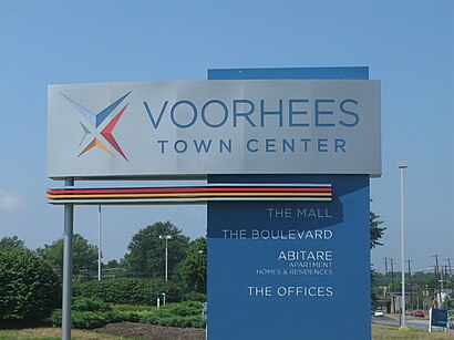
Voorhees Town Center Address: 2120 Voorhees Town Ctr street in Echelon
Attractions near Voorhees Town Center
Fusion Performing Arts Center (Fusion Shows),Oakley,Boscov's Department Store,Tom Pizzi and Off the Hook,The Mall at Voorhees Town Center,Seaton Voorhees,Amethyst Counseling,Parkops Parking Management,Wabs,Amazon Locker-Daphne,Angel Brow Bar,The Center for Enrichment by Sjha,Philadelphia Soul,Katwalk,Living Proof Recovery Centers,American Tire and Wheel,Extreme Nutrition,Amazon Locker-Stefania,Moore Engineering Services,Vipro SystemsHow to get to popular attractions in Echelon with public transit
General Motors, Falls,University Of Pennsylvania School Of Dental Medicine, Philadelphia,Trenton, NJ, Trenton,Market Frankford Line Nite Owl Bus, Philadelphia,Septa Regional Rail to Media / Elwyn, Philadelphia,Fox Chase Bank, Willow Grove,National Wholesale Liquidators, Philadelphia,Skirt, Bryn Mawr,Robbinsville,12th & Callowhill, Philadelphia,Office Of Fleet Management Shop #258, Philadelphia,NJ Transit Bus Stop #600, Princeton Junction,Ghost Bus Parking Lot, Philadelphia,SEPTA EL to 69th street terminal, Philadelphia,3700 Market Street Science Center, Philadelphia,Paul Robeson High School For Human Services, Philadelphia,Frankford High Football Field, Philadelphia,HUP Pharmacy - Ravdin, Philadelphia,Philadelphia International Airport Terminal C, Philadelphia,Dilworth Park, PhiladelphiaGet around Philadelphia by public transit!
Traveling around Philadelphia has never been so easy. See step by step directions as you travel to any attraction, street or major public transit station. View bus and train schedules, arrival times, service alerts and detailed routes on a map, so you know exactly how to get to anywhere in Philadelphia.
When traveling to any destination around Philadelphia use Moovit's Live Directions with Get Off Notifications to know exactly where and how far to walk, how long to wait for your line, and how many stops are left. Moovit will alert you when it's time to get off — no need to constantly re-check whether yours is the next stop.
Wondering how to use public transit in Philadelphia or how to pay for public transit in Philadelphia? Moovit public transit app can help you navigate your way with public transit easily, and at minimum cost. It includes public transit fees, ticket prices, and costs. Looking for a map of Philadelphia public transit lines? Moovit public transit app shows all public transit maps in Philadelphia with all Bus, Train, Subway, Light Rail and Cable Car routes and stops on an interactive map.
Philadelphia has 5 transit type(s), including: Bus, Train, Subway, Light Rail and Cable Car, operated by several transit agencies, including SEPTA Subway, SEPTA Trolley, SEPTA Rail, SEPTA, NJ TRANSIT RAIL-Rail, NJ TRANSIT RAIL-Tram, NJ TRANSIT BUS, Port Authority Transit Corporation, Navy Yard, Penn Transit, Drexel University, Pottstown Area Rapid Transit (PART), Fullington Tours, Chescobus, Amtrak