How to get to WESTERN UNION by bus?
Click on the bus route to see step by step directions with maps, line arrival times and updated time schedules.
From Hacienda San Martín, Aguascalientes
41 minFrom Paraíso, Aguascalientes
39 minFrom El Retoño, Aguascalientes
36 minFrom Ruiseñores [Fraccionamiento], Aguascalientes
66 minFrom Jesús María, Aguascalientes
42 minFrom Parque Industrial Altec, Aguascalientes
42 minFrom Mirador de las Culturas, Aguascalientes
32 minFrom Fracc Rinconada Jesús María, Aguascalientes
68 minFrom Zona Centro, Aguascalientes
42 minFrom Meridiam Park, Aguascalientes
41 min
Bus stops near WESTERN UNION in Aguascalientes
Bus lines to WESTERN UNION in Aguascalientes
- RUTA 03, La Ribera,VIEW
- RUTA 04, Mahatma Gandhi - Jesús María,VIEW
- RUTA 01, Vicente Guerrero - Margaritas,VIEW
- RUTA 05, Vicente Guerrero - La Ribera,VIEW
- RUTA 08, UTMA - Centro (Rivero y Gutiérrez),VIEW
- RUTA 10, UAA Sur - Paseos de Aguascalientes,VIEW
- RUTA 29, Lomas del Ajedrez -Centro (Jardínde Zaragoza),VIEW
- RUTA 34, Villa Montaña - UPA,VIEW
- RUTA 37, UTMA - Hacienda San Marcos,VIEW
- RUTA 38, Vicente Guerrero - Paso Blanco,VIEW
- RUTA 39, El Conejal - Centro (Jardínde Zaragoza),VIEW
- RUTA 43, San Antonio - UTMA,VIEW
- RUTA 12, Vicente Guerrero,VIEW
- RUTA 23, Villa Montaña,VIEW
- RUTA 24, Vistas De Oriente - Los Negritos,VIEW
- RUTA 25, Las Palmas,VIEW
- RUTA 41, Terminal Oriente (Penal),VIEW
- RUTA 41, Terminal Oriente (Alameda),VIEW
- RUTA 16, Bellavista,VIEW
- RUTA 19, Vistas De Oriente,VIEW
What are the closest stations to WESTERN UNION?
The closest stations to WESTERN UNION are:
- Licenciado Benito Juárez 304 is 367 meters away, 5 min walk.
- 5 De Mayo, 401 is 371 meters away, 5 min walk.
- Licenciado Adolfo López Mateos Poniente, 119 is 444 meters away, 6 min walk.
- General Guadalupe Victoria, 408 is 459 meters away, 6 min walk.
- Centro (Mercado Terán) is 467 meters away, 7 min walk.
- Oriente, 109 is 556 meters away, 8 min walk.
Which bus lines stop near WESTERN UNION?
These bus lines stop near WESTERN UNION: RUTA 04, RUTA 11, RUTA 16, RUTA 37, RUTA 38, RUTA 43, RUTA 48.
What’s the nearest bus station to WESTERN UNION in Aguascalientes?
The nearest bus stations to WESTERN UNION in Aguascalientes are Licenciado Benito Juárez 304 and 5 De Mayo, 401. The closest one is a 5 min walk away.
What time is the first bus to WESTERN UNION in Aguascalientes?
The RUTA 41 is the first bus that goes to WESTERN UNION in Aguascalientes. It stops nearby at 5:54 AM.
What time is the last bus to WESTERN UNION in Aguascalientes?
The RUTA 43 is the last bus that goes to WESTERN UNION in Aguascalientes. It stops nearby at 10:21 PM.
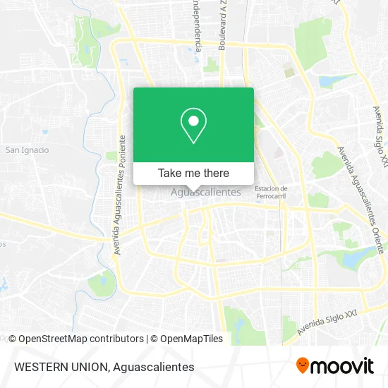
See WESTERN UNION, Aguascalientes, on the map
Public Transit to WESTERN UNION in Aguascalientes
Wondering how to get to WESTERN UNION in Aguascalientes? Moovit helps you find the best way to get to WESTERN UNION with step-by-step directions from the nearest public transit station.
Moovit provides free maps and live directions to help you navigate through your city. View schedules, routes, timetables, and find out how long does it take to get to WESTERN UNION in real time.
Looking for the nearest stop or station to WESTERN UNION? Check out this list of stops closest to your destination: Licenciado Benito Juárez 304; 5 De Mayo; Licenciado Adolfo López Mateos Poniente; General Guadalupe Victoria; Centro (Mercado Terán); Oriente.
Bus: RUTA 04, RUTA 11, RUTA 16, RUTA 37, RUTA 38, RUTA 43, RUTA 48, RUTA 01, RUTA 05, RUTA 08, RUTA 10, RUTA 29, RUTA 03, RUTA 12, RUTA 23, RUTA 24, RUTA 25, RUTA 41, RUTA 19, RUTA 36, RUTA 27, RUTA 28, RUTA 06, RUTA 07, RUTA 09, RUTA 46.
Want to see if there’s another route that gets you there at an earlier time? Moovit helps you find alternative routes or times. Get directions from and directions to WESTERN UNION easily from the Moovit App or Website.
We make riding to WESTERN UNION easy, which is why over 1.5 million users, including users in Aguascalientes, trust Moovit as the best app for public transit. You don’t need to download an individual bus app or train app, Moovit is your all-in-one transit app that helps you find the best bus time or train time available.
For information on prices of bus, costs and ride fares to WESTERN UNION, please check the Moovit app.
Use the app to navigate to popular places including to the airport, hospital, stadium, grocery store, mall, coffee shop, school, college, and university.
WESTERN UNION Address: Calle General Ignacio Allende Oriente, Aguascalientes Centro, 20000 Aguascalientes, Aguascalientes street in Aguascalientes
- Ciela Fraguas,
- Casa de Jesus A.C.,
- La Casa del Pay,
- Tienda de Abarrotes-Alarcón,
- Rancho La m,
- Rest Tufh,
- Restaurant Las Mercedes,
- Consultorio Médico Reumatologo,
- Neurotico Anonimos Grupo Libertad,
- Ámbar Cosméticos de Mayoreo,
- Copiamase,
- Desarrollo y Lotificación de Terrenos de Aguascalientes, S.A. de C.V.,
- Clinica de Ojos "GRIFER",
- Rox Studio - Roxana Muahs,
- Centro de Ensenanza Fco I Madero Ac,
- Viajes Darani-Agencia de Viajes,
- Dmm Distribuidora de Marcos y Molduras,
- Monte Providencia Suc. Aguascalientes I,
- Dycomyc Papeleria,
- Plaza Tecnomarket
Places Near WESTERN UNION (Aguascalientes)
- Hospital Imss No. 3, Aguascalientes,
- Aeropuerto de Aguascalientes S.A. de C.V., Aguascalientes,
- Agropecuario, Aguascalientes,
- Blvd. Luis Donaldo Colosio, Aguascalientes,
- ESPACIOS, Aguascalientes,
- Villas de Nuestra Señora de la Asunción, Aguascalientes,
- Central De Autobuses, Aguascalientes,
- Terminal De Combis, Aguascalientes,
- La Isla San Marcos, Aguascalientes,
- Nuevo Hospital Hidalgo, Aguascalientes,
- Parque Las Tres Centurias, Aguascalientes,
- Centro Comercial Altaria, Aguascalientes,
- Isla San Marcos, Aguascalientes,
- clinica 3 uaa, Aguascalientes,
- Jesús María, Aguascalientes,
- Universidad Autónoma de Aguascalientes, Aguascalientes,
- Ciudad industrial, Aguascalientes,
- Imss Clinica 1, Aguascalientes,
- Centro, Aguascalientes,
- Villasuncion, Aguascalientes
How to get to popular places in Aguascalientes with public transit
Get around Aguascalientes by public transit!
Traveling around Aguascalientes has never been so easy. See step by step directions as you travel to any attraction, street or major public transit station. View bus and train schedules, arrival times, service alerts and detailed routes on a map, so you know exactly how to get to anywhere in Aguascalientes.
When traveling to any destination around Aguascalientes use Moovit's Live Directions with Get Off Notifications to know exactly where and how far to walk, how long to wait for your line, and how many stops are left. Moovit will alert you when it's time to get off — no need to constantly re-check whether yours is the next stop.
Wondering how to use public transit in Aguascalientes or how to pay for public transit in Aguascalientes? Moovit public transit app can help you navigate your way with public transit easily, and at minimum cost. It includes public transit fees, ticket prices, and costs. Looking for a map of Aguascalientes public transit lines? Moovit public transit app shows all public transit maps in Aguascalientes with all bus routes and stops on an interactive map.
Aguascalientes has 1 transit type(s), including: bus, operated by several transit agencies, including Coordinación General de Movilidad