How to get to WESTERN UNION by bus?
Click on the bus route to see step by step directions with maps, line arrival times and updated time schedules.
From Liberta Coffee Lab, Edmonton
114 minFrom Amazon Locker-Overboard, Edmonton
76 minFrom 3110 Calgary Trail Northwest, Edmonton
45 minFrom Tamarack, Edmonton
67 minFrom Gateway Blvd, Edmonton
128 minFrom Snow Valley Guest Serv, Edmonton
59 minFrom 111 St NW, Edmonton
36 minFrom Lormit Professional Svc, Edmonton
114 minFrom Nisku, Leduc County
96 minFrom 3803 56 Avenue Northwest, Edmonton
75 min
Bus stops near WESTERN UNION in Edmonton
Bus lines to WESTERN UNION in Edmonton
What are the closest stations to WESTERN UNION?
The closest stations to WESTERN UNION are:
- Summerside Link & Savaryn Drive SW is 414 meters away, 6 min walk.
- 90 Street & 24 Avenue SW is 538 meters away, 8 min walk.
- 88 Street & Savaryn Drive SW is 1130 meters away, 15 min walk.
Which bus lines stop near WESTERN UNION?
These bus lines stop near WESTERN UNION: 519, 521.
What’s the nearest bus station to WESTERN UNION in Edmonton?
The nearest bus station to WESTERN UNION in Edmonton is Summerside Link & Savaryn Drive SW. It’s a 6 min walk away.
What time is the first bus to WESTERN UNION in Edmonton?
The 519 is the first bus that goes to WESTERN UNION in Edmonton. It stops nearby at 6:03 AM.
What time is the last bus to WESTERN UNION in Edmonton?
The 519 is the last bus that goes to WESTERN UNION in Edmonton. It stops nearby at 12:04 AM.
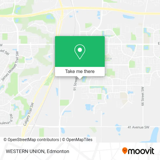
See WESTERN UNION, Edmonton, on the map
Public Transit to WESTERN UNION in Edmonton
Wondering how to get to WESTERN UNION in Edmonton? Moovit helps you find the best way to get to WESTERN UNION with step-by-step directions from the nearest public transit station.
Moovit provides free maps and live directions to help you navigate through your city. View schedules, routes, timetables, and find out how long does it take to get to WESTERN UNION in real time.
Looking for the nearest stop or station to WESTERN UNION? Check out this list of stops closest to your destination: Summerside Link & Savaryn Drive SW; 90 Street & 24 Avenue SW; 88 Street & Savaryn Drive SW.
Bus: 519, 521, 664, 638, 665.
Want to see if there’s another route that gets you there at an earlier time? Moovit helps you find alternative routes or times. Get directions from and directions to WESTERN UNION easily from the Moovit App or Website.
We make riding to WESTERN UNION easy, which is why over 1.5 million users, including users in Edmonton, trust Moovit as the best app for public transit. You don’t need to download an individual bus app or train app, Moovit is your all-in-one transit app that helps you find the best bus time or train time available.
For information on prices of bus, costs and ride fares to WESTERN UNION, please check the Moovit app.
Use the app to navigate to popular places including to the airport, hospital, stadium, grocery store, mall, coffee shop, school, college, and university.
WESTERN UNION Address: 2311 90B St SW Edmonton, AB T6X 1V8 street in Edmonton
- Alliance Insurance Associates,
- Emily Lalaan - Primerica Financial Services,
- Redbull by Ghost Kitchens,
- Ghost Kitchen's Canada by Ghost Kitchens,
- Monster Cupcakes by Ghost Kitchens,
- Shoezplug Canada,
- Regus 2335 90B Street SW,
- Mina Gayed - Mozaic Realty Group,
- 2419 90b Street Southwest,
- CMS Famous Toys LTD,
- Mitt Migration,
- Mann International Travel & Tours & Insurance and Mortgage Group,
- Terra Landscaping,
- Wayfarer Insurance Group,
- Legion Garage Doors,
- Dingus & Zazzy,
- Auf Consultants,
- Metric Media,
- Cutting Edge Digital Marketing,
- The Food Plug
Places Near WESTERN UNION (Edmonton)
- Royal Alexandra Hospital, Edmonton,
- Edmonton Valley Zoo, Edmonton,
- Borden Park, Edmonton,
- Londonderry Mall, Edmonton,
- Edmonton VIA Rail Station, Edmonton,
- Whyte Avenue, Edmonton,
- Canada Place Service Canada Centre, Edmonton,
- Grey Nuns Community Hospital, Edmonton,
- Northgate Centre, Edmonton,
- Alberta Legislature Building, Edmonton,
- Fort Edmonton Park, Edmonton,
- West Edmonton Mall, Edmonton,
- Cross Cancer Institute, Edmonton,
- MacEwan University, Edmonton,
- Rogers Place, Edmonton,
- Kingsway Mall, Edmonton,
- Kaye Edmonton Clinic, Edmonton,
- University of Alberta, Edmonton,
- Edmonton Commonwealth Stadium, Edmonton,
- Edmonton EXPO Centre, Edmonton
How to get to popular places in Edmonton with public transit
Get around Edmonton by public transit!
Traveling around Edmonton has never been so easy. See step by step directions as you travel to any attraction, street or major public transit station. View bus and train schedules, arrival times, service alerts and detailed routes on a map, so you know exactly how to get to anywhere in Edmonton.
When traveling to any destination around Edmonton use Moovit's Live Directions with Get Off Notifications to know exactly where and how far to walk, how long to wait for your line, and how many stops are left. Moovit will alert you when it's time to get off — no need to constantly re-check whether yours is the next stop.
Wondering how to use public transit in Edmonton or how to pay for public transit in Edmonton? Moovit public transit app can help you navigate your way with public transit easily, and at minimum cost. It includes public transit fees, ticket prices, and costs. Looking for a map of Edmonton public transit lines? Moovit public transit app shows all public transit maps in Edmonton with all Bus and Light Rail routes and stops on an interactive map.
Edmonton has 2 transit type(s), including: Bus and Light Rail, operated by several transit agencies, including ETS LRT, ETS, Strathcona County Transit, St. Albert Transit, Spruce Grove Transit, Fort Saskatchewan Transit, Beaumont Transit and Leduc Transit