How to get to WESTERN UNION by bus?
Click on the bus route to see step by step directions with maps, line arrival times and updated time schedules.
From Glenridding Heights, Edmonton
78 minFrom 1E4 University of Alberta Hospital, Edmonton
34 minFrom University of Alberta - Mechanical Engineering Building (MEC E), Edmonton
47 minFrom Concordia University College, Edmonton
76 minFrom River Valley Nature Walk, Edmonton
90 minFrom Holiday Inn Express (Impark Lot #352), Edmonton
47 minFrom 50th Street And Ellerslie, Edmonton
56 minFrom Constable Daniel Woodall School, Edmonton
66 minFrom Butterdome (Universiade Pavilion), Edmonton
35 minFrom Manchester Square, Edmonton
49 min
Bus stops near WESTERN UNION in Edmonton
Light Rail stations near WESTERN UNION in Edmonton
Bus lines to WESTERN UNION in Edmonton
What are the closest stations to WESTERN UNION?
The closest stations to WESTERN UNION are:
- 93 Street & 34 Avenue is 268 meters away, 4 min walk.
- 91 Street & 34 Avenue is 794 meters away, 11 min walk.
- 93 Street & 39 Avenue is 826 meters away, 11 min walk.
- Southgate Station is 1551 meters away, 20 min walk.
- Millbourne/Woodvale Stop is 3395 meters away, 44 min walk.
Which bus lines stop near WESTERN UNION?
These bus lines stop near WESTERN UNION: 056, 523, 526.
What’s the nearest light rail station to WESTERN UNION in Edmonton?
The nearest light rail station to WESTERN UNION in Edmonton is Southgate Station. It’s a 20 min walk away.
What’s the nearest bus station to WESTERN UNION in Edmonton?
The nearest bus station to WESTERN UNION in Edmonton is 93 Street & 34 Avenue. It’s a 4 min walk away.
What time is the first light rail to WESTERN UNION in Edmonton?
The VALLEY is the first light rail that goes to WESTERN UNION in Edmonton. It stops nearby at 5:10 AM.
What time is the last light rail to WESTERN UNION in Edmonton?
The VALLEY is the last light rail that goes to WESTERN UNION in Edmonton. It stops nearby at 1:02 AM.
What time is the first bus to WESTERN UNION in Edmonton?
The 523 is the first bus that goes to WESTERN UNION in Edmonton. It stops nearby at 6:46 AM.
What time is the last bus to WESTERN UNION in Edmonton?
The 523 is the last bus that goes to WESTERN UNION in Edmonton. It stops nearby at 12:35 AM.
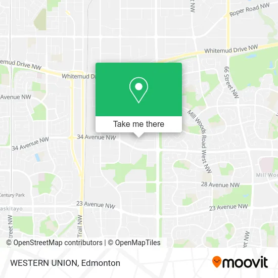
See WESTERN UNION, Edmonton, on the map
Public Transit to WESTERN UNION in Edmonton
Wondering how to get to WESTERN UNION in Edmonton? Moovit helps you find the best way to get to WESTERN UNION with step-by-step directions from the nearest public transit station.
Moovit provides free maps and live directions to help you navigate through your city. View schedules, routes, timetables, and find out how long does it take to get to WESTERN UNION in real time.
Looking for the nearest stop or station to WESTERN UNION? Check out this list of stops closest to your destination: 93 Street & 34 Avenue; 91 Street & 34 Avenue; 93 Street & 39 Avenue; Southgate Station; Millbourne/Woodvale Stop.
Bus: 056, 523, 526, 661, 503.
Want to see if there’s another route that gets you there at an earlier time? Moovit helps you find alternative routes or times. Get directions from and directions to WESTERN UNION easily from the Moovit App or Website.
We make riding to WESTERN UNION easy, which is why over 1.5 million users, including users in Edmonton, trust Moovit as the best app for public transit. You don’t need to download an individual bus app or train app, Moovit is your all-in-one transit app that helps you find the best bus time or train time available.
For information on prices of bus and light rail, costs and ride fares to WESTERN UNION, please check the Moovit app.
Use the app to navigate to popular places including to the airport, hospital, stadium, grocery store, mall, coffee shop, school, college, and university.
WESTERN UNION Address: 9258 34A Ave NW Edmonton, AB T6E 5P4 street in Edmonton
- Voyage Financial Services Inc,
- Bunchberry Immigration,
- Sky Travel & Tours,
- Shalimar Immigration,
- Sarna Production Films & Photography,
- Universalclothing,
- Organic Mechanics: Tattoo and Art Gallery,
- Multi-Immigration Services Canada,
- Taj Banquet Hall,
- Holistic Ayurveda,
- Sahib Collections,
- Kurinji Refreshment Hut,
- Millennium Bracing Sol,
- Central Institute of T,
- Parbhat Enterprises LTD,
- Unique Academy Canada,
- Uncle Brians,
- Central Material Testing,
- CS Auto Repair,
- Al Ikhwan Youth Centre
Places Near WESTERN UNION (Edmonton)
- Kingsway Mall, Edmonton,
- Edmonton VIA Rail Station, Edmonton,
- Northgate Centre, Edmonton,
- Londonderry Mall, Edmonton,
- Royal Alexandra Hospital, Edmonton,
- Cross Cancer Institute, Edmonton,
- Borden Park, Edmonton,
- University of Alberta, Edmonton,
- Fort Edmonton Park, Edmonton,
- West Edmonton Mall, Edmonton,
- Whyte Avenue, Edmonton,
- Edmonton Valley Zoo, Edmonton,
- Kaye Edmonton Clinic, Edmonton,
- Rogers Place, Edmonton,
- Grey Nuns Community Hospital, Edmonton,
- MacEwan University, Edmonton,
- Edmonton EXPO Centre, Edmonton,
- Alberta Legislature Building, Edmonton,
- Canada Place Service Canada Centre, Edmonton,
- Edmonton Commonwealth Stadium, Edmonton
How to get to popular places in Edmonton with public transit
Get around Edmonton by public transit!
Traveling around Edmonton has never been so easy. See step by step directions as you travel to any attraction, street or major public transit station. View bus and train schedules, arrival times, service alerts and detailed routes on a map, so you know exactly how to get to anywhere in Edmonton.
When traveling to any destination around Edmonton use Moovit's Live Directions with Get Off Notifications to know exactly where and how far to walk, how long to wait for your line, and how many stops are left. Moovit will alert you when it's time to get off — no need to constantly re-check whether yours is the next stop.
Wondering how to use public transit in Edmonton or how to pay for public transit in Edmonton? Moovit public transit app can help you navigate your way with public transit easily, and at minimum cost. It includes public transit fees, ticket prices, and costs. Looking for a map of Edmonton public transit lines? Moovit public transit app shows all public transit maps in Edmonton with all Bus and Light Rail routes and stops on an interactive map.
Edmonton has 2 transit type(s), including: Bus and Light Rail, operated by several transit agencies, including ETS LRT, ETS, Strathcona County Transit, St. Albert Transit, Spruce Grove Transit, Fort Saskatchewan Transit, Beaumont Transit and Leduc Transit