See Waimanalo, Hawaii, Waimanalo Beach, on the map
Directions to Waimanalo, Hawaii (Waimanalo Beach) with public transportation
The following transit lines have routes that pass near Waimanalo, Hawaii
 Bus:
Bus:
How to get to Waimanalo, Hawaii by bus?
Click on the bus route to see step by step directions with maps, line arrival times and updated time schedules.
Bus stations near Waimanalo, Hawaii in Waimanalo Beach
- Kalanianaole Hwy + Aloiloi St,1 min walk,
Bus lines to Waimanalo, Hawaii in Waimanalo Beach
- 67,Kailua - Waimanalo,
- 69,Waimanalo - Sea Life Park,
- 89,Downtown Express,
What are the closest stations to Waimanalo, Hawaii?
The closest stations to Waimanalo, Hawaii are:
- Kalanianaole Hwy + Aloiloi St is 52 yards away, 1 min walk.
Which bus lines stop near Waimanalo, Hawaii?
These bus lines stop near Waimanalo, Hawaii: 67, 69.
What’s the nearest bus stop to Waimanalo, Hawaii in Waimanalo Beach?
The nearest bus stop to Waimanalo, Hawaii in Waimanalo Beach is Kalanianaole Hwy + Aloiloi St. It’s a 1 min walk away.
What time is the first bus to Waimanalo, Hawaii in Waimanalo Beach?
The 67 is the first bus that goes to Waimanalo, Hawaii in Waimanalo Beach. It stops nearby at 4:50 AM.
What time is the last bus to Waimanalo, Hawaii in Waimanalo Beach?
The 67 is the last bus that goes to Waimanalo, Hawaii in Waimanalo Beach. It stops nearby at 11:50 PM.
See Waimanalo, Hawaii, Waimanalo Beach, on the map
Public Transit to Waimanalo, Hawaii in Waimanalo Beach
Wondering how to get to Waimanalo, Hawaii in Waimanalo Beach, United States? Moovit helps you find the best way to get to Waimanalo, Hawaii with step-by-step directions from the nearest public transit station.
Moovit provides free maps and live directions to help you navigate through your city. View schedules, routes, timetables, and find out how long does it take to get to Waimanalo, Hawaii in real time.
Looking for the nearest stop or station to Waimanalo, Hawaii? Check out this list of stops closest to your destination: Kalanianaole Hwy + Aloiloi St.
Bus:
Want to see if there’s another route that gets you there at an earlier time? Moovit helps you find alternative routes or times. Get directions from and directions to Waimanalo, Hawaii easily from the Moovit App or Website.
We make riding to Waimanalo, Hawaii easy, which is why over 1.5 million users, including users in Waimanalo Beach, trust Moovit as the best app for public transit. You don’t need to download an individual bus app or train app, Moovit is your all-in-one transit app that helps you find the best bus time or train time available.
For information on prices of bus, costs and ride fares to Waimanalo, Hawaii, please check the Moovit app.
Use the app to navigate to popular places including to the airport, hospital, stadium, grocery store, mall, coffee shop, school, college, and university.
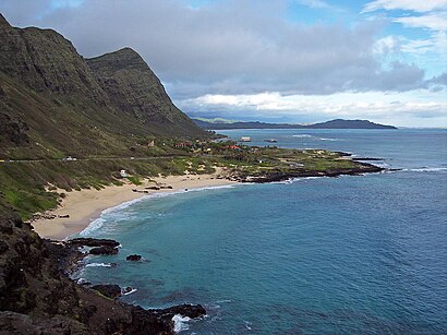
Location: Waimanalo Beach, Honolulu
Attractions near Waimanalo, Hawaii
Naturlly Hwaiian Gallery Gifts,Waimanalo Polo Field,Kwan Melvin K Rev,City and County Offices Treatment Plants,Sherwood Forest Beach,Mikey G Construction,Hau Oli Lima by Kolika,Waimanalo Bay Beach Park Campground,Waimanalo Bay Beach Park,Aloha Tub & Tile,Sherwood Beach,Cook's Ranch,Kalapawai Cafe & Deli Waimanalo,Sean Valentine Strength, Conditioning, Recovery and Performance,Post Office,Aloha Riding Lessons,Kalanianaole Hwy + Waimanalo Beach Park,Waimanalo Country Farms,Hawaii State Government,Waimanalo Beach ParkHow to get to popular attractions in Waimanalo Beach with public transit
Voyager Public Charter School, Urban Honolulu,Sunset Beach, Urban Honolulu,Shiro's Saimin Haven, Waipahu,Lanikai Beach, Kailua,Makaha Valley Towers, Makaha Valley,Ala Moana Blvd and Atkinson Drive, Urban Honolulu,Kalihi-kai Elementary School, Urban Honolulu,Amelia Earhart marker at Diamond Head Lookout, Urban Honolulu,Waipio Valley, Waipio Acres,Yummy Korean BBQ Kam Shopping Center, Urban Honolulu,Carl's Jr., Urban Honolulu,Sheraton Princess Kaiulani Hotel, Urban Honolulu,Joint Traffic Management Center Parking Garage, Urban Honolulu,Sunset Beach Park, Pupukea,Kokololio Beach Park, Hauula,Kamehameha Schools Ulupono Preschool, Urban Honolulu,Hilton Waikiki Beach, Urban Honolulu,Tripler Army Medical Center, Urban Honolulu,Ghettobuilt kustoms, Kapolei,Outback Steakhouse, Urban HonoluluGet around Waimanalo Beach by public transit!
Traveling around Waimanalo Beach has never been so easy. See step by step directions as you travel to any attraction, street or major public transit station. View bus and train schedules, arrival times, service alerts and detailed routes on a map, so you know exactly how to get to anywhere in Waimanalo Beach.
When traveling to any destination around Waimanalo Beach use Moovit's Live Directions with Get Off Notifications to know exactly where and how far to walk, how long to wait for your line, and how many stops are left. Moovit will alert you when it's time to get off — no need to constantly re-check whether yours is the next stop.
Wondering how to use public transit in Waimanalo Beach or how to pay for public transit in Waimanalo Beach? Moovit public transit app can help you navigate your way with public transit easily, and at minimum cost. It includes public transit fees, ticket prices, and costs. Looking for a map of Waimanalo Beach public transit lines? Moovit public transit app shows all public transit maps in Waimanalo Beach with all bus routes and stops on an interactive map.
Waimanalo Beach has 1 transit type(s), including: bus, operated by several transit agencies, including TheBus and DTS