See Wakefield 1st, Yonkers, NY 10704, Yonkers, Ny, on the map
Directions to Wakefield 1st, Yonkers, NY 10704 (Yonkers, Ny) with public transportation
The following transit lines have routes that pass near Wakefield 1st, Yonkers, NY 10704
 Bus:
Bus: - Train:
- Subway:
How to get to Wakefield 1st, Yonkers, NY 10704 by bus?
Click on the bus route to see step by step directions with maps, line arrival times and updated time schedules.
How to get to Wakefield 1st, Yonkers, NY 10704 by train?
Click on the train route to see step by step directions with maps, line arrival times and updated time schedules.
How to get to Wakefield 1st, Yonkers, NY 10704 by subway?
Click on the subway route to see step by step directions with maps, line arrival times and updated time schedules.
Bus stations near Wakefield 1st, Yonkers, NY 10704 in Yonkers, Ny
- Mclean Ave @ Woodlawn Ave,9 min walk,
- Katonah Av/E 242 St,14 min walk,
- Van Cortlandt Pk E/E 242 St,14 min walk,
Bus lines to Wakefield 1st, Yonkers, NY 10704 in Yonkers, Ny
- 25,Yonkers,
- BXM4,Woodlawn 242 St Via Concourse Via Katonah Av,
- BX31,Woodlawn - Westchester Sq,
- BX34,Woodlawn - Fordham Center,
What are the closest stations to Wakefield 1st, Yonkers, NY 10704?
The closest stations to Wakefield 1st, Yonkers, NY 10704 are:
- Mclean Ave @ Woodlawn Ave is 728 yards away, 9 min walk.
- Katonah Av/E 242 St is 1113 yards away, 14 min walk.
- Van Cortlandt Pk E/E 242 St is 1134 yards away, 14 min walk.
Which bus lines stop near Wakefield 1st, Yonkers, NY 10704?
These bus lines stop near Wakefield 1st, Yonkers, NY 10704: 25, 26.
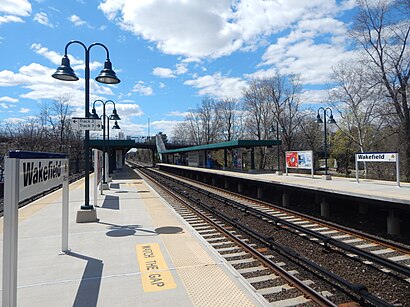
Which train line stops near Wakefield 1st, Yonkers, NY 10704?
HARLEM
Which subway line stops near Wakefield 1st, Yonkers, NY 10704?
2
What’s the nearest bus stop to Wakefield 1st, Yonkers, NY 10704 in Yonkers, Ny?
The nearest bus stop to Wakefield 1st, Yonkers, NY 10704 in Yonkers, Ny is Mclean Ave @ Woodlawn Ave. It’s a 9 min walk away.
See Wakefield 1st, Yonkers, NY 10704, Yonkers, Ny, on the map
Public Transit to Wakefield 1st, Yonkers, NY 10704 in Yonkers, Ny
Wondering how to get to Wakefield 1st, Yonkers, NY 10704 in Yonkers, Ny, United States? Moovit helps you find the best way to get to Wakefield 1st, Yonkers, NY 10704 with step-by-step directions from the nearest public transit station.
Moovit provides free maps and live directions to help you navigate through your city. View schedules, routes, timetables, and find out how long does it take to get to Wakefield 1st, Yonkers, NY 10704 in real time.
Looking for the nearest stop or station to Wakefield 1st, Yonkers, NY 10704? Check out this list of stops closest to your destination: Mclean Ave @ Woodlawn Ave; Katonah Av/E 242 St; Van Cortlandt Pk E/E 242 St.
Bus:Train:Subway:
Want to see if there’s another route that gets you there at an earlier time? Moovit helps you find alternative routes or times. Get directions from and directions to Wakefield 1st, Yonkers, NY 10704 easily from the Moovit App or Website.
We make riding to Wakefield 1st, Yonkers, NY 10704 easy, which is why over 1.5 million users, including users in Yonkers, Ny, trust Moovit as the best app for public transit. You don’t need to download an individual bus app or train app, Moovit is your all-in-one transit app that helps you find the best bus time or train time available.
For information on prices of bus, subway and train, costs and ride fares to Wakefield 1st, Yonkers, NY 10704, please check the Moovit app.
Use the app to navigate to popular places including to the airport, hospital, stadium, grocery store, mall, coffee shop, school, college, and university.
Wakefield 1st, Yonkers, NY 10704 Address: Yonkers, NY 10704 street in Yonkers, Ny
Attractions near Wakefield 1st, Yonkers, NY 10704
Wakefield Ave,Rm Heating Service Inc,Wakefield Ave (wakefield first),Gt West Contracting & Imprv,1st Street,Cover All Services,Lchair Extensions & Beauty,Wakefield Ave (hyatt wakefield),Puppets by Gwen,Healy Development Corp,10 New Pl,Montessori School 11,1,Public School 11,Little Me Daycare Center,The Stairs Of Despair,85 Bronx River Road,66 New Pl,Mark Twain Middle School,81 New PlHow to get to popular attractions in Yonkers, Ny with public transit
Virgin America Ticket Counter, Elizabeth, Nj,Time Life, Manhattan,Stamford, CT, Stamford, Ct,Culture Espresso, Manhattan,New Jersey Turnpike - Newark, Newark, Nj,Joe's Shanghai 鹿嗚春, Manhattan,Jersey Shore University Medical Center, Neptune, Nj,Newark Liberty International Airport (EWR), Newark, Nj,New Jersey, Nutley, Nj,Brass Monkey, Manhattan,The Grey Dog, Manhattan,Nassau Community College, East Garden City, Ny,MTA Subway - 42nd St / Bryant Park (B / D/F / M/7), Manhattan,I-80 (Interstate 80), Paterson, Nj,MTA Subway - Broadway (N/W), Queens,Upper West Side, Manhattan,Ace Hotel Lobby Bar, Manhattan,Stamford Transportation Center : Bus / Train (STM) Metro North & Amtrak, Stamford, Ct,The 13th Step, Manhattan,NJT - New Brunswick Station (NEC), New Brunswick, NjGet around Yonkers, Ny by public transit!
Traveling around Yonkers, Ny has never been so easy. See step by step directions as you travel to any attraction, street or major public transit station. View bus and train schedules, arrival times, service alerts and detailed routes on a map, so you know exactly how to get to anywhere in Yonkers, Ny.
When traveling to any destination around Yonkers, Ny use Moovit's Live Directions with Get Off Notifications to know exactly where and how far to walk, how long to wait for your line, and how many stops are left. Moovit will alert you when it's time to get off — no need to constantly re-check whether yours is the next stop.
Wondering how to use public transit in Yonkers, Ny or how to pay for public transit in Yonkers, Ny? Moovit public transit app can help you navigate your way with public transit easily, and at minimum cost. It includes public transit fees, ticket prices, and costs. Looking for a map of Yonkers, Ny public transit lines? Moovit public transit app shows all public transit maps in Yonkers, Ny with all bus, subway or train routes and stops on an interactive map.
Yonkers, Ny has 3 transit type(s), including: bus, subway or train, operated by several transit agencies, including MTA Subway, Metro-North Railroad, LIRR, PATH, Shore Line East, MTA Bus Company, MTA New York City Transit - Express routes, MTA Bus, NJ Transit, NYC Ferry, NICE bus, Bee-Line Bus, NJ Transit Rail, NJ Transit Rail and Norwalk Transit District