Directions to Waldwick Station (Waldwick, Nj) with public transportation
The following transit lines have routes that pass near Waldwick Station
How to get to Waldwick Station by bus?
Click on the bus route to see step by step directions with maps, line arrival times and updated time schedules.
How to get to Waldwick Station by train?
Click on the train route to see step by step directions with maps, line arrival times and updated time schedules.
Train stations near Waldwick Station in Waldwick, Nj
- Ho-Ho-Kus, 30 min walk,
What are the closest stations to Waldwick Station?
The closest stations to Waldwick Station are:
- Ho-Ho-Kus is 2461 yards away, 30 min walk.
Which bus lines stop near Waldwick Station?
These bus lines stop near Waldwick Station: 164, 175, 752.
Which train lines stop near Waldwick Station?
These train lines stop near Waldwick Station: MCL, PJL.
What’s the nearest train station to Waldwick Station in Waldwick, Nj?
The nearest train station to Waldwick Station in Waldwick, Nj is Ho-Ho-Kus. It’s a 30 min walk away.
See Waldwick Station, Waldwick, Nj, on the map
Public Transit to Waldwick Station in Waldwick, Nj
Wondering how to get to Waldwick Station in Waldwick, Nj, United States? Moovit helps you find the best way to get to Waldwick Station with step-by-step directions from the nearest public transit station.
Moovit provides free maps and live directions to help you navigate through your city. View schedules, routes, timetables, and find out how long does it take to get to Waldwick Station in real time.
Looking for the nearest stop or station to Waldwick Station? Check out this list of stops closest to your destination: Ho-Ho-Kus.
Bus: 164, 175, 752.Train: MCL, PJL.
Want to see if there’s another route that gets you there at an earlier time? Moovit helps you find alternative routes or times. Get directions from and directions to Waldwick Station easily from the Moovit App or Website.
We make riding to Waldwick Station easy, which is why over 1.5 million users, including users in Waldwick, Nj, trust Moovit as the best app for public transit. You don’t need to download an individual bus app or train app, Moovit is your all-in-one transit app that helps you find the best bus time or train time available.
For information on prices of train, bus and subway, costs and ride fares to Waldwick Station, please check the Moovit app.
Use the app to navigate to popular places including to the airport, hospital, stadium, grocery store, mall, coffee shop, school, college, and university.
Waldwick Station Address: Zazzetti Street street in Waldwick, Nj
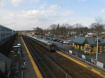
Waldwick is a commuter rail station operated by New Jersey Transit in the borough of Waldwick, Bergen County, New Jersey, United States.Wiki
Attractions near Waldwick Station
Waldwick,Lot 1 - Waldwick Station,Walwick Station House Museum,Old Waldwick Train Station,Prospect Maple Ave,Prospect St Maple,Waldwick,Waldwick,Prospect Hew Ave,Lafayette Hewson Ave,Rocket Building Supply Inc,54,W Nightengale Pl W Nightengale Pl,Waldwick, NJ,El Rodeo Store,Olegana Travel Boutique,Tekport,Mimi's Cookies,Ike's Big Mouth,Harrison Ave at Frederick St,Frederick HarrHow to get to popular attractions in Waldwick, Nj with public transit
144-06 94 ave, Queens,New York Lottery, Manhattan,Brooklyn Steel,Mitsuwa Shuttle Bus Stop, Edgewater, Nj,Sing Sing Correctional Facility, Ossining, Ny,IKEA - Brooklyn,Uptown NY, Manhattan,3,Stone St Stone St, Manhattan,The Metropolitan Museum of Art , Manhattan,22 Cortlandt Street, Manhattan,300 E 66th street, Manhattan,Tanger Outlets, Deer Park, Deer Park, Ny,225 Cadman Plaza East,Bowling Green Station, Manhattan,Rosedale, NY, Queens,Ellis Island, Manhattan,E 53rd St & 3rd Ave, Manhattan,Long Island Railroad, Manhattan,United Palace Theatre, Manhattan,Queens, NY, QueensGet around New York - New Jersey by public transit!
Traveling around New York - New Jersey has never been so easy. See step by step directions as you travel to any attraction, street or major public transit station. View bus and train schedules, arrival times, service alerts and detailed routes on a map, so you know exactly how to get to anywhere in New York - New Jersey.
When traveling to any destination around New York - New Jersey use Moovit's Live Directions with Get Off Notifications to know exactly where and how far to walk, how long to wait for your line, and how many stops are left. Moovit will alert you when it's time to get off — no need to constantly re-check whether yours is the next stop.
Wondering how to use public transit in New York - New Jersey or how to pay for public transit in New York - New Jersey? Moovit public transit app can help you navigate your way with public transit easily, and at minimum cost. It includes public transit fees, ticket prices, and costs. Looking for a map of New York - New Jersey public transit lines? Moovit public transit app shows all public transit maps in New York - New Jersey with all Bus, Train, Subway, Light Rail, Ferry and Cable Car routes and stops on an interactive map.
New York - New Jersey has 6 transit type(s), including: Bus, Train, Subway, Light Rail, Ferry and Cable Car, operated by several transit agencies, including MTA Subway, Metro-North Railroad, LIRR, PATH, Shore Line East, MTA Bus Company, MTA New York City Transit - Express routes, MTA Bus, NJ Transit, NYC Ferry, NICE bus, Bee-Line Bus, NJ Transit Rail, Norwalk Transit District, CTTransit - Waterbury-Meriden