See Walkinstown, Dublin, on the map
Directions to Walkinstown (Dublin) with public transportation
The following transit lines have routes that pass near Walkinstown
 Bus:
Bus: - Train:
How to get to Walkinstown by bus?
Click on the bus route to see step by step directions with maps, line arrival times and updated time schedules.
How to get to Walkinstown by train?
Click on the train route to see step by step directions with maps, line arrival times and updated time schedules.
Bus stations near Walkinstown in Dublin
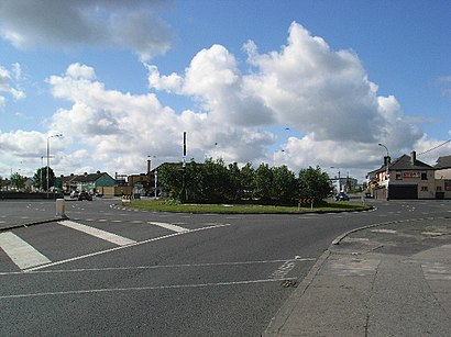
- Walkinstown, Walkinstown Road (Walkinstown Roundabout),2 min walk,
- Walkinstown, Walkinstown Avenue (Walkinstown Roundabout),5 min walk,
- Walkinstown, Kilnamanagh Court,6 min walk,
Bus lines to Walkinstown in Dublin
- 27,Clare Hall,
- 77A,Ringsend Road,
- 56A,The Square,
- 123,Kilnamanagh Rd,
What are the closest stations to Walkinstown?
The closest stations to Walkinstown are:
- Walkinstown, Walkinstown Road (Walkinstown Roundabout) is 79 meters away, 2 min walk.
- Walkinstown, Walkinstown Avenue (Walkinstown Roundabout) is 320 meters away, 5 min walk.
- Walkinstown, Kilnamanagh Court is 402 meters away, 6 min walk.
Which bus lines stop near Walkinstown?
These bus lines stop near Walkinstown: 27, 77A, 9.
Which train line stops near Walkinstown?
PHOENIX PARK TUNNEL SERVICE
What’s the nearest bus stop to Walkinstown in Dublin?
The nearest bus stop to Walkinstown in Dublin is Walkinstown, Walkinstown Road (Walkinstown Roundabout). It’s a 2 min walk away.
See Walkinstown, Dublin, on the map
Public Transit to Walkinstown in Dublin
Wondering how to get to Walkinstown in Dublin, Ireland? Moovit helps you find the best way to get to Walkinstown with step-by-step directions from the nearest public transit station.
Moovit provides free maps and live directions to help you navigate through your city. View schedules, routes, timetables, and find out how long does it take to get to Walkinstown in real time.
Looking for the nearest stop or station to Walkinstown? Check out this list of stops closest to your destination: Walkinstown; Walkinstown; Walkinstown.
Bus:Train:
Want to see if there’s another route that gets you there at an earlier time? Moovit helps you find alternative routes or times. Get directions from and directions to Walkinstown easily from the Moovit App or Website.
We make riding to Walkinstown easy, which is why over 1.5 million users, including users in Dublin, trust Moovit as the best app for public transit. You don’t need to download an individual bus app or train app, Moovit is your all-in-one transit app that helps you find the best bus time or train time available.
For information on prices of bus and train, costs and ride fares to Walkinstown, please check the Moovit app.
Use the app to navigate to popular places including to the airport, hospital, stadium, grocery store, mall, coffee shop, school, college, and university.
Walkinstown Address: Walkinstown, Dublin, Ireland street in Dublin
Attractions near Walkinstown
12 Walkinstown Drive,The Kestrel House,Walkinstown Road,Permanent Tsb,Londis,Supermacs / Papa Johns,Hardebeck Avenue,Dermot James,John'S Take Away,Hillbilly'S Fried Chicken,William Hill,1 Greenhills Rd Walkinstown Dublin 12 D12 A0P0 Greenhills Road,Church Of The Assumption Of The Blessed Virgin Mary,Tony Kealy'S,Ulster Bank,The Sisters Of Charity Assumption Secondary School,2 Saint Peter's Road,A-Z Hire,8 Beechfield Road,78 Walkinstown AvenueHow to get to popular attractions in Dublin with public transit
Galway, Galway,Avoca Handweavers, Rathcoole,The G Hotel, Galway,Tallaght Stadium, Tallaght,Liffey Valley Shopping Centre, Palmerston West,Red Cow Luas, Clondalkin,Citywest Business Campus, Tallaght,Dcu, Dublin,Shankill, Shankill,Dundalk Clarke Railway Station, Dundalk,St. Stephen's Green East, Dublin,IBM European Digital Sales Centre, Blanchardstown,Dundrum Shopping Centre, Dundrum,Clonmel / Cluain Meala, Clonmel,Limerick / Luimneach, Henry Street,Thurles Railway Station, Thurles,IKEA, Dubber,Sandymount Strand, Dublin,Galway / An Gaillimh, Galway,Trim / Baile Átha Troim, TrimGet around Dublin by public transit!
Traveling around Dublin has never been so easy. See step by step directions as you travel to any attraction, street or major public transit station. View bus and train schedules, arrival times, service alerts and detailed routes on a map, so you know exactly how to get to anywhere in Dublin.
When traveling to any destination around Dublin use Moovit's Live Directions with Get Off Notifications to know exactly where and how far to walk, how long to wait for your line, and how many stops are left. Moovit will alert you when it's time to get off — no need to constantly re-check whether yours is the next stop.
Wondering how to use public transit in Dublin or how to pay for public transit in Dublin? Moovit public transit app can help you navigate your way with public transit easily, and at minimum cost. It includes public transit fees, ticket prices, and costs. Looking for a map of Dublin public transit lines? Moovit public transit app shows all public transit maps in Dublin with all bus or train routes and stops on an interactive map.
Dublin has 2 transit type(s), including: bus or train, operated by several transit agencies, including Luas, Bus Átha Cliath – Dublin Bus, Bus Éireann, Go-Ahead Ireland, Nitelink, Dublin Bus, Citylink, Kenneally's Bus Service, Aircoach, TFI Local Link Mayo, Irish Rail, Express Bus, JJ/Bernard Kavanagh, Dublin Coach, Kearns Transport and Matthews Coach Hire