See Wareham Center, Boston, on the map
Directions to Wareham Center (Boston) with public transportation
The following transit lines have routes that pass near Wareham Center
 Bus:
Bus:
How to get to Wareham Center by bus?
Click on the bus route to see step by step directions with maps, line arrival times and updated time schedules.
Bus stations near Wareham Center in Boston
- Mill Pond,2 min walk,
- Wareham Plaza,13 min walk,
Bus lines to Wareham Center in Boston
- LINK 4,Lakeville Mbta Station,
- WAREHAM-NEW BEDFORD CONNECTION,Cranberry Plaza,
- LINK 1,Cromeset,
What are the closest stations to Wareham Center?
The closest stations to Wareham Center are:
- Mill Pond is 90 yards away, 2 min walk.
- Wareham Plaza is 1085 yards away, 13 min walk.
Which bus line stops near Wareham Center?
WAREHAM - LAKEVILLE MBTA CONNECTOR
What’s the nearest bus stop to Wareham Center in Boston?
The nearest bus stop to Wareham Center in Boston is Mill Pond. It’s a 2 min walk away.
See Wareham Center, Boston, on the map
Public Transit to Wareham Center in Boston
Wondering how to get to Wareham Center in Boston, United States? Moovit helps you find the best way to get to Wareham Center with step-by-step directions from the nearest public transit station.
Moovit provides free maps and live directions to help you navigate through your city. View schedules, routes, timetables, and find out how long does it take to get to Wareham Center in real time.
Looking for the nearest stop or station to Wareham Center? Check out this list of stops closest to your destination: Mill Pond; Wareham Plaza.
Bus:
Want to see if there’s another route that gets you there at an earlier time? Moovit helps you find alternative routes or times. Get directions from and directions to Wareham Center easily from the Moovit App or Website.
We make riding to Wareham Center easy, which is why over 1.5 million users, including users in Boston, trust Moovit as the best app for public transit. You don’t need to download an individual bus app or train app, Moovit is your all-in-one transit app that helps you find the best bus time or train time available.
For information on prices of bus and train, costs and ride fares to Wareham Center, please check the Moovit app.
Use the app to navigate to popular places including to the airport, hospital, stadium, grocery store, mall, coffee shop, school, college, and university.
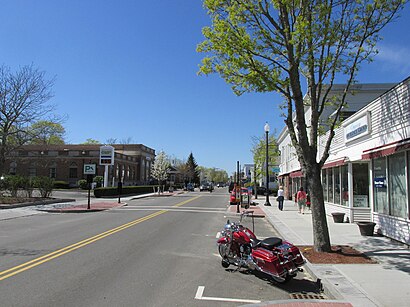
Wareham Center Address: Cranberry Highway street in Boston
Wareham Center is a census-designated place (CDP) in the town of Wareham in Plymouth County, Massachusetts, United States. The population was 2,896 at the 2010 census.Wiki
Attractions near Wareham Center
Mary Besse Park,Wesley United Methodist Church,First Congregational Church,Saint Patricks Cemetery,Boy Scout Recreation Area,Parker Mills Pond Dam,Fearing Tavern,Conant Hill,Centre Cemetery,Wing Park,Conant Hill,Kendrick House Museum,Conant Hill,Conant Hill,Wareham Free Library,Wareham,Parker Mills Pond,Conant Hill,Wareham Police Dept,Wareham Fire DepartmentHow to get to popular attractions in Boston with public transit
Clerys, Boston,Charlestown, Boston,Boston Medical Center, Boston,Charlie's Kitchen, Cambridge,Redbones Barbecue, Somerville,Stephanie's On Newbury, Boston,Kings Dining & Entertainment - Boston Back Bay, Boston,Star Market, Newton,Bell In Hand Tavern, Boston,Dillon's, Boston,Tia's, Boston,WaterFire Providence - Waterplace Park,Everett, Everett,Lincoln Tavern & Restaurant, Boston,Stella, Boston,MBTA Cleveland Circle Station, Boston,Douzo, Boston,Harry's Bar and Grill, Boston,Southbridge, MA, Southbridge Town,Union Station (WOR), WorcesterGet around Boston by public transit!
Traveling around Boston has never been so easy. See step by step directions as you travel to any attraction, street or major public transit station. View bus and train schedules, arrival times, service alerts and detailed routes on a map, so you know exactly how to get to anywhere in Boston.
When traveling to any destination around Boston use Moovit's Live Directions with Get Off Notifications to know exactly where and how far to walk, how long to wait for your line, and how many stops are left. Moovit will alert you when it's time to get off — no need to constantly re-check whether yours is the next stop.
Wondering how to use public transit in Boston or how to pay for public transit in Boston? Moovit public transit app can help you navigate your way with public transit easily, and at minimum cost. It includes public transit fees, ticket prices, and costs. Looking for a map of Boston public transit lines? Moovit public transit app shows all public transit maps in Boston with all bus or train routes and stops on an interactive map.
Boston has 2 transit type(s), including: bus or train, operated by several transit agencies, including MBTA, MBTA, MBTA, Southeastern Regional Transit Authority, MetroWest Regional Transit Authority, Rhode Island Public Transit Authority, WRTA, Lowell Regional Transit Authority, Merrimack Valley Transit, Montachusett Regional Transit Authority, Cape Cod Regional Transit Authority, Brockton Area Transit Authority, Cape Cod Regional Transit Authority, Martha's Vineyard Transit Authority and the WAVE - Nantucket Regional Transit Authority