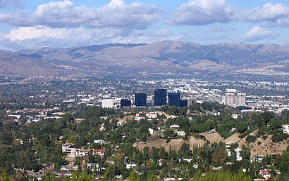
See Warner Center, Los Angeles, on the map
Directions to Warner Center (Los Angeles) with public transportation
The following transit lines have routes that pass near Warner Center
 Bus:
Bus:
How to get to Warner Center by bus?
Click on the bus route to see step by step directions with maps, line arrival times and updated time schedules.
Bus stations near Warner Center in Los Angeles
- Canoga / Trillium Driveway,1 min walk,
- Canoga Ave & Trillium Drwy,1 min walk,
Bus lines to Warner Center in Los Angeles
- 161,Canoga Station via Warner Center,
- 796,Warner Center,
What are the closest stations to Warner Center?
The closest stations to Warner Center are:
- Canoga / Trillium Driveway is 13 yards away, 1 min walk.
- Canoga Ave & Trillium Drwy is 54 yards away, 1 min walk.
Which bus lines stop near Warner Center?
These bus lines stop near Warner Center: 150/240, 164, ORG.
What’s the nearest bus stop to Warner Center in Los Angeles?
The nearest bus stops to Warner Center in Los Angeles are Canoga / Trillium Driveway and Canoga Ave & Trillium Drwy. The closest one is a 1 min walk away.
See Warner Center, Los Angeles, on the map
Public Transit to Warner Center in Los Angeles
Wondering how to get to Warner Center in Los Angeles, United States? Moovit helps you find the best way to get to Warner Center with step-by-step directions from the nearest public transit station.
Moovit provides free maps and live directions to help you navigate through your city. View schedules, routes, timetables, and find out how long does it take to get to Warner Center in real time.
Looking for the nearest stop or station to Warner Center? Check out this list of stops closest to your destination: Canoga / Trillium Driveway; Canoga Ave & Trillium Drwy.
Bus:
Want to see if there’s another route that gets you there at an earlier time? Moovit helps you find alternative routes or times. Get directions from and directions to Warner Center easily from the Moovit App or Website.
We make riding to Warner Center easy, which is why over 1.5 million users, including users in Los Angeles, trust Moovit as the best app for public transit. You don’t need to download an individual bus app or train app, Moovit is your all-in-one transit app that helps you find the best bus time or train time available.
For information on prices of bus, costs and ride fares to Warner Center, please check the Moovit app.
Use the app to navigate to popular places including to the airport, hospital, stadium, grocery store, mall, coffee shop, school, college, and university.
Warner Center Address: Warner Center, Los Angeles, CA, USA street in Los Angeles
Attractions near Warner Center
Turtle Pond Lake,21504 Victory Boulevard,# A,Woodland Hills,5960 Canoga Avenue,Canoga Park,6100 Topanga Canyon Boulevard,6600 Topanga Canyon Boulevard,Westfield Topanga,6600 Topanga Canyon Boulevard,Westfield Topanga,# 45,21281 Burbank Boulevard,Warner Center Lane,20935 Vanowen Street,6933 Remmet Avenue,5691 Collins Place,5601 De Soto Avenue,21711 Ventura Boulevard,21426 Sherman WayHow to get to popular attractions in Los Angeles with public transit
Mickey & Friends Tram, Anaheim,City of Anaheim, Anaheim,85°C Bakery Cafe, Irvine,Los Olivos Apartment Village, Irvine,City of San Bernardino, San Bernardino,LA Fitness, Santa Clarita,Katella Cast Member Parking Lot (K-Lot), Anaheim,24 Hour Fitness, Orange,City of Irvine, Irvine,The Ritz-Carlton Laguna Niguel, Dana Point,SLS Hotel, a Luxury Collection Hotel, Beverly Hills, Beverly Grove, La,The Little Mermaid ~ Ariel's Undersea Adventure, Anaheim,Hollywood, Hollywood, La,Galleria at Tyler, Riverside,Disneyland, Anaheim,24 Hour Fitness, Industry,Barney's Beanery, West Hollywood,Northridge, CA, Northridge, La,City of Los Angeles, Downtown, La,Pomona, CA, PomonaGet around Los Angeles by public transit!
Traveling around Los Angeles has never been so easy. See step by step directions as you travel to any attraction, street or major public transit station. View bus and train schedules, arrival times, service alerts and detailed routes on a map, so you know exactly how to get to anywhere in Los Angeles.
When traveling to any destination around Los Angeles use Moovit's Live Directions with Get Off Notifications to know exactly where and how far to walk, how long to wait for your line, and how many stops are left. Moovit will alert you when it's time to get off — no need to constantly re-check whether yours is the next stop.
Wondering how to use public transit in Los Angeles or how to pay for public transit in Los Angeles? Moovit public transit app can help you navigate your way with public transit easily, and at minimum cost. It includes public transit fees, ticket prices, and costs. Looking for a map of Los Angeles public transit lines? Moovit public transit app shows all public transit maps in Los Angeles with all bus routes and stops on an interactive map.
Los Angeles has 1 transit type(s), including: bus, operated by several transit agencies, including Metro - Los Angeles, Metro - Los Angeles, Metrolink Trains, METRO, Long Beach Transit, LADOT, OCTA, Foothill Transit, Big Blue Bus, Riverside Transit Agency, LAX FlyAway, Airporter Shuttle, Playa Vista Shuttle, Amtrak and OMNITRANS