Directions to Washington Rock (Green Brook, Nj) with public transportation
The following transit lines have routes that pass near Washington Rock
How to get to Washington Rock by bus?
Click on the bus route to see step by step directions with maps, line arrival times and updated time schedules.
How to get to Washington Rock by train?
Click on the train route to see step by step directions with maps, line arrival times and updated time schedules.
Bus stations near Washington Rock in Green Brook, Nj
- West Front St at Rock Ave, 41 min walk,
- Greenbrook Rd at Maple Ave, 43 min walk,
- New Market Rd at Center St, 59 min walk,
Train stations near Washington Rock in Green Brook, Nj
- Dunellen, 45 min walk,
Bus lines to Washington Rock in Green Brook, Nj
- 59, Dunellen,
- 113, 113s Dunellen Salem Road,
- 822, N Plainfield Shopping Ctr,
- 65, Express Newark Penn Station,
- 114, Mountainside New Prov Rd,
What are the closest stations to Washington Rock?
The closest stations to Washington Rock are:
- West Front St at Rock Ave is 3303 yards away, 41 min walk.
- Greenbrook Rd at Maple Ave is 3486 yards away, 43 min walk.
- Dunellen is 3679 yards away, 45 min walk.
- New Market Rd at Center St is 4921 yards away, 59 min walk.
Which bus lines stop near Washington Rock?
These bus lines stop near Washington Rock: 59, 819, 822.
Which train line stops near Washington Rock?
RVL
See Washington Rock, Green Brook, Nj, on the map
Public Transit to Washington Rock in Green Brook, Nj
Wondering how to get to Washington Rock in Green Brook, Nj, United States? Moovit helps you find the best way to get to Washington Rock with step-by-step directions from the nearest public transit station.
Moovit provides free maps and live directions to help you navigate through your city. View schedules, routes, timetables, and find out how long does it take to get to Washington Rock in real time.
Looking for the nearest stop or station to Washington Rock? Check out this list of stops closest to your destination: West Front St at Rock Ave; Greenbrook Rd at Maple Ave; Dunellen; New Market Rd at Center St.
Bus: 59, 819, 822, 113, 65, 114.Train: RVL.
Want to see if there’s another route that gets you there at an earlier time? Moovit helps you find alternative routes or times. Get directions from and directions to Washington Rock easily from the Moovit App or Website.
We make riding to Washington Rock easy, which is why over 1.5 million users, including users in Green Brook, Nj, trust Moovit as the best app for public transit. You don’t need to download an individual bus app or train app, Moovit is your all-in-one transit app that helps you find the best bus time or train time available.
For information on prices of bus and train, costs and ride fares to Washington Rock, please check the Moovit app.
Use the app to navigate to popular places including to the airport, hospital, stadium, grocery store, mall, coffee shop, school, college, and university.
Location: Green Brook, Nj, New York - New Jersey
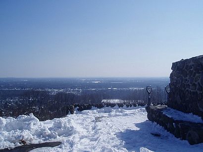
Attractions near Washington Rock
Washington Rock State Park,Longview Forest Ln,Sanabelle Water,Cella International,Pittsburgh Barbeque Company,Rock Swanson,82 US-22 (Freeway 22),Freeway 22,US- US Highw 22,US 22 Route 22 W,Route 22 W,High 22 US-22,Highway 22,Jefferson Route 22 W,Jefferson US-22,Chengdu 1 Palace (Chengdu1 Palace),Huntback Sexhouse,Joy Of Living Creative Intrs,Chengdu 1 Palace,22 MasaageHow to get to popular attractions in Green Brook, Nj with public transit
City Island, Bronx,Church Street, Manhattan,Jersery Gardens Mall, Elizabeth, Nj,Passaic, NJ, Passaic, Nj,Gun Hill Road, Bronx,Hartford Healthcare Amphitheater, Bridgeport, Ct,Museo Americano de Historia Natural, Manhattan,Jfk Terminal 4, Queens,Whitney Museum Of American Art, Manhattan,Freddy Fazbear's Pizza, Manhattan,Ubs Arena, Elmont, Ny,Springfield, NJ,Summit of New York, Manhattan,33 Beaver Street, Manhattan,Foley Square, Manhattan,Bay Plaza Shopping Center, Bronx,Bronx Zoo, Bronx,East 64th Street, Manhattan,1275 York Ave, Manhattan,Irvington, NJ, Irvington, NjGet around New York - New Jersey by public transit!
Traveling around New York - New Jersey has never been so easy. See step by step directions as you travel to any attraction, street or major public transit station. View bus and train schedules, arrival times, service alerts and detailed routes on a map, so you know exactly how to get to anywhere in New York - New Jersey.
When traveling to any destination around New York - New Jersey use Moovit's Live Directions with Get Off Notifications to know exactly where and how far to walk, how long to wait for your line, and how many stops are left. Moovit will alert you when it's time to get off — no need to constantly re-check whether yours is the next stop.
Wondering how to use public transit in New York - New Jersey or how to pay for public transit in New York - New Jersey? Moovit public transit app can help you navigate your way with public transit easily, and at minimum cost. It includes public transit fees, ticket prices, and costs. Looking for a map of New York - New Jersey public transit lines? Moovit public transit app shows all public transit maps in New York - New Jersey with all Bus, Train, Subway, Light Rail, Ferry and Cable Car routes and stops on an interactive map.
New York - New Jersey has 6 transit type(s), including: Bus, Train, Subway, Light Rail, Ferry and Cable Car, operated by several transit agencies, including MTA Subway, Metro-North Railroad, LIRR, PATH, Shore Line East, MTA Bus Company, MTA New York City Transit - Express routes, MTA Bus, NJ Transit, NYC Ferry, NICE bus, Bee-Line Bus, NJ Transit Rail, Norwalk Transit District, CTTransit - Waterbury-Meriden