See Washington Wells, Chicago, on the map
Directions to Washington Wells (Chicago) with public transportation
The following transit lines have routes that pass near Washington Wells
 Bus:
Bus: - Train:
- Chicago 'L':
How to get to Washington Wells by bus?
Click on the bus route to see step by step directions with maps, line arrival times and updated time schedules.
How to get to Washington Wells by train?
Click on the train route to see step by step directions with maps, line arrival times and updated time schedules.
How to get to Washington Wells by Chicago 'L'?
Click on the Chicago 'L' route to see step by step directions with maps, line arrival times and updated time schedules.
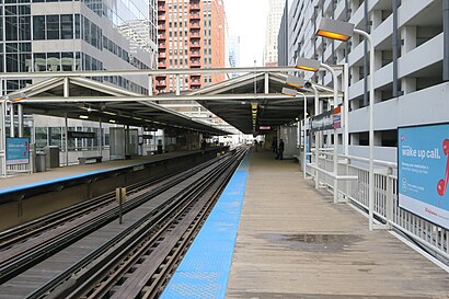
Chicago 'l' stations near Washington Wells in Chicago
- Monroe-Blue,2 min walk,
- Clark/Lake,6 min walk,
Bus stations near Washington Wells in Chicago
- Madison & Franklin (West),2 min walk,
- Franklin & Madison (North),2 min walk,
- Clark & Randolph (South),3 min walk,
- Lasalle & Randolph (North),4 min walk,
Bus lines to Washington Wells in Chicago
- J14,Jeffery & 87th Street (South),
- 20,Columbus & Randolph (South),
- 56,Washington & Wabash (East),
- 60,Racine & Roosevelt (South),
- 124,Clinton & Quincy (South),
- 157,Chestnut & Lake Shore Drive (East),
- 37,Fullerton & Sheffield (Red/Brown/Purple Line) (East),
- 22,Clark & Harrison (South),
- 24,Racine & 87th Street Terminal (West),
- 134,Stockton/LaSalle Express,
- 135,Clarendon/LaSalle Express,
- 136,Sheridan/LaSalle Express,
- 156,LaSalle,
What are the closest stations to Washington Wells?
The closest stations to Washington Wells are:
- Monroe-Blue is 129 yards away, 2 min walk.
- Madison & Franklin (West) is 135 yards away, 2 min walk.
- Franklin & Madison (North) is 155 yards away, 2 min walk.
- Clark & Randolph (South) is 202 yards away, 3 min walk.
- Lasalle & Randolph (North) is 295 yards away, 4 min walk.
- Clark/Lake is 475 yards away, 6 min walk.
Which bus lines stop near Washington Wells?
These bus lines stop near Washington Wells: 20, 24, 28, 56, 60.
Which train lines stop near Washington Wells?
These train lines stop near Washington Wells: ME, RI, UP-N, UP-NW.
Which Chicago 'L' lines stop near Washington Wells?
These Chicago 'L' lines stop near Washington Wells: BLUE LINE, BROWN LINE, GREEN LINE, RED LINE.
What’s the nearest Chicago 'L' station to Washington Wells in Chicago?
The nearest Chicago 'L' station to Washington Wells in Chicago is Monroe-Blue. It’s a 2 min walk away.
What’s the nearest bus stop to Washington Wells in Chicago?
The nearest bus stops to Washington Wells in Chicago are Madison & Franklin (West) and Franklin & Madison (North). The closest one is a 2 min walk away.
What time is the first Chicago 'L' to Washington Wells in Chicago?
The BLUE LINE is the first Chicago 'L' that goes to Washington Wells in Chicago. It stops nearby at 3:07 AM.
What time is the last Chicago 'L' to Washington Wells in Chicago?
The BLUE LINE is the last Chicago 'L' that goes to Washington Wells in Chicago. It stops nearby at 3:11 AM.
What time is the first bus to Washington Wells in Chicago?
The 60 is the first bus that goes to Washington Wells in Chicago. It stops nearby at 3:02 AM.
What time is the last bus to Washington Wells in Chicago?
The 60 is the last bus that goes to Washington Wells in Chicago. It stops nearby at 3:34 AM.
How much is the train fare to Washington Wells?
The train fare to Washington Wells costs about $4.00 - $6.75.
How much is the Chicago 'L' fare to Washington Wells?
The Chicago 'L' fare to Washington Wells costs about $2.50 - $5.00.
How much is the bus fare to Washington Wells?
The bus fare to Washington Wells costs about $2.25.
See Washington Wells, Chicago, on the map
Public Transit to Washington Wells in Chicago
Wondering how to get to Washington Wells in Chicago, United States? Moovit helps you find the best way to get to Washington Wells with step-by-step directions from the nearest public transit station.
Moovit provides free maps and live directions to help you navigate through your city. View schedules, routes, timetables, and find out how long does it take to get to Washington Wells in real time.
Looking for the nearest stop or station to Washington Wells? Check out this list of stops closest to your destination: Monroe-Blue; Madison & Franklin (West); Franklin & Madison (North); Clark & Randolph (South); Lasalle & Randolph (North); Clark/Lake.
Bus:Train:Chicago 'L':
Want to see if there’s another route that gets you there at an earlier time? Moovit helps you find alternative routes or times. Get directions from and directions to Washington Wells easily from the Moovit App or Website.
We make riding to Washington Wells easy, which is why over 1.5 million users, including users in Chicago, trust Moovit as the best app for public transit. You don’t need to download an individual bus app or train app, Moovit is your all-in-one transit app that helps you find the best bus time or train time available.
For information on prices of bus, Chicago 'L' and train, costs and ride fares to Washington Wells, please check the Moovit app.
Use the app to navigate to popular places including to the airport, hospital, stadium, grocery store, mall, coffee shop, school, college, and university.
Location: Chicago
Attractions near Washington Wells
Minute Fob,Idof Fresh Mediterranean,Thrifty,American Legal Forms,Smokin' Angels Club,ATM,Keyme,WESTERN UNION,Navy Federal Credit Union,PNC Bank Atm,Porter Law Car Accident Attorneys,Bobbitt Ronald A & Associates,Bernardin Lochmueller Assoc,ChargePoint,G4s Secure Solutions,Gregory S. Sapp Violins,Chicago Suickas Electrical Repair,Am Capital,Spirtle Space,Dark Horse GroupHow to get to popular attractions in Chicago with public transit
The Original Pancake House, Chicago,Hala Kahiki Tiki Bar & Lounge, River Grove,Metra - Lake Forest, Lake Forest,Downtown La Grange, La Grange,Zurich North America, Schaumburg,SpringHill Suites Chicago Downtown / River North, Chicago,I-88 @ Rt 59 Interchange, Naperville,Baxter Healthcare,Woodstock Square, Woodstock,Metra - Blue Island Vermont Street, Blue Island,Barack Obama House, Chicago,Saint Xavier University (Warde Academic Center), Chicago,Metra - Kenosha,Al Bawadi Grill, Bridgeview,Viper, Gurnee,127th St, Cicero Ave & I-294, Alsip,Hamburger Mary's / Andersonville Brewing, Chicago,Holiday Inn Express & Suites Chicago O'Hare, Rosemont,Ballydoyle Irish Pub, Downers Grove,Old Irving Park Neighborhood, ChicagoGet around Chicago by public transit!
Traveling around Chicago has never been so easy. See step by step directions as you travel to any attraction, street or major public transit station. View bus and train schedules, arrival times, service alerts and detailed routes on a map, so you know exactly how to get to anywhere in Chicago.
When traveling to any destination around Chicago use Moovit's Live Directions with Get Off Notifications to know exactly where and how far to walk, how long to wait for your line, and how many stops are left. Moovit will alert you when it's time to get off — no need to constantly re-check whether yours is the next stop.
Wondering how to use public transit in Chicago or how to pay for public transit in Chicago? Moovit public transit app can help you navigate your way with public transit easily, and at minimum cost. It includes public transit fees, ticket prices, and costs. Looking for a map of Chicago public transit lines? Moovit public transit app shows all public transit maps in Chicago with all bus, Chicago 'L' or train routes and stops on an interactive map.
Chicago has 3 transit type(s), including: bus, Chicago 'L' or train, operated by several transit agencies, including CTA 'L', Metra, Northern Indiana Commuter Transportation District, CTA, PACE, O'Hare International Airport Shuttle Bus, Gary Public Transit, Amtrak, River Valley Metro, Valpo Transit, DeKalb Public Transit, FlixBus-us, Greyhound-us, Van Galder (Coach USA) and Wisconsin Coach Lines