See Waterford Regional Sports Centre on the map
Directions to Waterford Regional Sports Centre with public transportation
The following transit lines have routes that pass near Waterford Regional Sports Centre
 Bus:
Bus: - Train:
How to get to Waterford Regional Sports Centre by bus?
Click on the bus route to see step by step directions with maps, line arrival times and updated time schedules.
Bus stations near Waterford Regional Sports Centre
- Waterford Ind Est,8 min walk,
- Ballybeg,9 min walk,
- Setu,11 min walk,
- Larchville,12 min walk,
- It Waterford,12 min walk,
- Wit (Opp Main Entrance),12 min walk,
- Brownes Road,15 min walk,
Train stations near Waterford Regional Sports Centre
- Waterford (Plunkett),62 min walk,
Bus lines to Waterford Regional Sports Centre
- 354,Portlaw Town,
- W1,Merchants Quay,
- 667,Dungarvan,
- W2,The Clock Tower,
- 340,Redmond Square,
- 736,Setu,
- 40,Cork,
- 355,Wit - Special,
- 362,Dungarvan,
- 370,University Hospital,
- W4,Brownes Road,
What are the closest stations to Waterford Regional Sports Centre?
The closest stations to Waterford Regional Sports Centre are:
- Waterford Ind Est is 572 meters away, 8 min walk.
- Ballybeg is 676 meters away, 9 min walk.
- Setu is 793 meters away, 11 min walk.
- Larchville is 837 meters away, 12 min walk.
- It Waterford is 849 meters away, 12 min walk.
- Wit (Opp Main Entrance) is 891 meters away, 12 min walk.
- Brownes Road is 1110 meters away, 15 min walk.
- Waterford (Plunkett) is 4774 meters away, 62 min walk.
Which bus lines stop near Waterford Regional Sports Centre?
These bus lines stop near Waterford Regional Sports Centre: 600, 736, WI05.
What’s the nearest bus stop to Waterford Regional Sports Centre?
The nearest bus stop to Waterford Regional Sports Centre is Waterford Ind Est. It’s a 8 min walk away.
What time is the first bus to Waterford Regional Sports Centre?
The 736 is the first bus that goes to Waterford Regional Sports Centre. It stops nearby at 4:30 AM.
What time is the last bus to Waterford Regional Sports Centre?
The 736 is the last bus that goes to Waterford Regional Sports Centre. It stops nearby at 4:30 AM.
How much is the bus fare to Waterford Regional Sports Centre?
The bus fare to Waterford Regional Sports Centre costs about €1.55.
See Waterford Regional Sports Centre on the map
Public Transportation to Waterford Regional Sports Centre
Wondering how to get to Waterford Regional Sports Centre, Ireland? Moovit helps you find the best way to get to Waterford Regional Sports Centre with step-by-step directions from the nearest public transit station.
Moovit provides free maps and live directions to help you navigate through your city. View schedules, routes, timetables, and find out how long does it take to get to Waterford Regional Sports Centre in real time.
Looking for the nearest stop or station to Waterford Regional Sports Centre? Check out this list of stops closest to your destination: Waterford Ind Est; Ballybeg; Setu; Larchville; It Waterford; Wit (Opp Main Entrance); Brownes Road; Waterford (Plunkett).
Bus:Train:
Want to see if there’s another route that gets you there at an earlier time? Moovit helps you find alternative routes or times. Get directions from and directions to Waterford Regional Sports Centre easily from the Moovit App or Website.
We make riding to Waterford Regional Sports Centre easy, which is why over 1.5 million users, including users in Waterford, trust Moovit as the best app for public transit. You don’t need to download an individual bus app or train app, Moovit is your all-in-one transit app that helps you find the best bus time or train time available.
For information on prices of bus, costs and ride fares to Waterford Regional Sports Centre, please check the Moovit app.
Use the app to navigate to popular places including to the airport, hospital, stadium, grocery store, mall, coffee shop, school, college, and university.
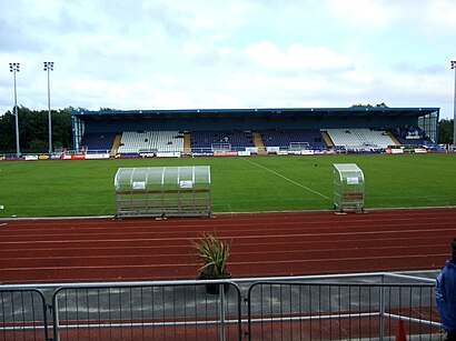
Waterford Regional Sports Centre Address: Waterford Regional Sports Centre, Cork Road, Waterford, County Waterford street in Waterford
Attractions near Waterford Regional Sports Centre
Morris Diy A/C Kitche,Morris Diy TRD 5,Morris Diy S5,Affordable Luxury Furniture,Orchardstown Garden Centre,Tradesales,Sheridan Waterford,Tom Murphycar Sales,PM Autos,Institute of Eye Surge,Bausch & Lomb Ireland,Waterford College,Motorcity Auto,Morris Diy A/C 3,Affordable Luxury Fur,Morris Diy A/C Plumb,Waterford Spraoi,Teva Pharmaceuticals,Teva Pharmaceuticals Ireland,Rigney Dolphin GroupHow to get to popular attractions in Waterford with public transit
Phibsborough / Baile Phib, Dublin,Dcu, Dublin,IKEA, Dubber,Seafront Clontarf,Navan / an Uaimh, Navan,Malahide, Malahide,Beaumont Hospital, Dublin,Dublin Heuston Railway Station, Dublin,Limerick / Luimneach, Henry Street,St. Stephen's Green East, Dublin,Dundalk Clarke Railway Station, Dundalk,Swords Pavilions Shopping Centre, Swords Village,Howth, Howth,National Botanic Gardens, Dublin,Galway, Galway,Temple Bar, Dublin,Dame Street, Dublin,The G Hotel, Galway,Sandymount DART Station, Dublin,Citywest Business Campus, TallaghtGet around Waterford by public transit!
Traveling around Waterford has never been so easy. See step by step directions as you travel to any attraction, street or major public transit station. View bus and train schedules, arrival times, service alerts and detailed routes on a map, so you know exactly how to get to anywhere in Waterford.
When traveling to any destination around Waterford use Moovit's Live Directions with Get Off Notifications to know exactly where and how far to walk, how long to wait for your line, and how many stops are left. Moovit will alert you when it's time to get off — no need to constantly re-check whether yours is the next stop.
Wondering how to use public transit in Waterford or how to pay for public transit in Waterford? Moovit public transit app can help you navigate your way with public transit easily, and at minimum cost. It includes public transit fees, ticket prices, and costs. Looking for a map of Waterford public transit lines? Moovit public transit app shows all public transit maps in Waterford with all bus routes and stops on an interactive map.
Waterford has 1 transit type(s), including: bus, operated by several transit agencies, including Luas, Bus Átha Cliath – Dublin Bus, Bus Éireann, Go-Ahead Ireland, Nitelink, Dublin Bus, Citylink, Kenneally's Bus Service, Aircoach, TFI Local Link Mayo, Irish Rail, Express Bus, JJ/Bernard Kavanagh, Dublin Coach, Kearns Transport and Matthews Coach Hire