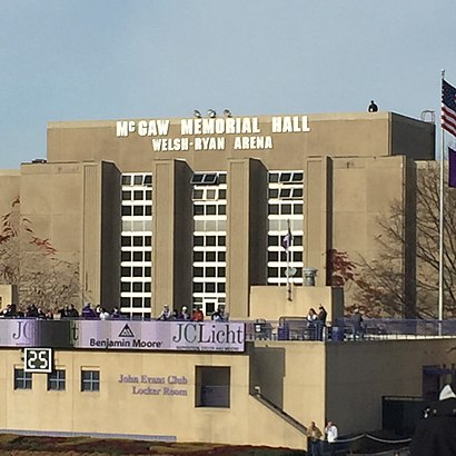
See Welsh Ryan Arena, Evanston, on the map
Directions to Welsh Ryan Arena (Evanston) with public transportation
The following transit lines have routes that pass near Welsh Ryan Arena
 Bus:
Bus: - Train:
- Chicago 'L':
How to get to Welsh Ryan Arena by bus?
Click on the bus route to see step by step directions with maps, line arrival times and updated time schedules.
How to get to Welsh Ryan Arena by train?
Click on the train route to see step by step directions with maps, line arrival times and updated time schedules.
How to get to Welsh Ryan Arena by Chicago 'L'?
Click on the Chicago 'L' route to see step by step directions with maps, line arrival times and updated time schedules.
Bus stations near Welsh Ryan Arena in Evanston
- Central Street & Ashland,5 min walk,
- Green Bay Rd & Central St,11 min walk,
- Central Street & Green Bay Rd,11 min walk,
Train stations near Welsh Ryan Arena in Evanston
- Central St.,26 min walk,
Chicago 'l' stations near Welsh Ryan Arena in Evanston
- Noyes,28 min walk,
Bus lines to Welsh Ryan Arena in Evanston
- 201,Central Street & Cowper,
- 213,Highland Park Metra Station,
- 206,Paulina & Howard Terminal (North),
What are the closest stations to Welsh Ryan Arena?
The closest stations to Welsh Ryan Arena are:
- Central Street & Ashland is 394 yards away, 5 min walk.
- Green Bay Rd & Central St is 842 yards away, 11 min walk.
- Central Street & Green Bay Rd is 865 yards away, 11 min walk.
- Central St. is 2186 yards away, 26 min walk.
- Noyes is 2323 yards away, 28 min walk.
Which bus lines stop near Welsh Ryan Arena?
These bus lines stop near Welsh Ryan Arena: 201, 213.
Which train line stops near Welsh Ryan Arena?
UP-N
Which Chicago 'L' line stops near Welsh Ryan Arena?
PURPLE LINE
What’s the nearest Chicago 'L' station to Welsh Ryan Arena in Evanston?
The nearest Chicago 'L' station to Welsh Ryan Arena in Evanston is Noyes. It’s a 28 min walk away.
What’s the nearest train station to Welsh Ryan Arena in Evanston?
The nearest train station to Welsh Ryan Arena in Evanston is Central St.. It’s a 26 min walk away.
What’s the nearest bus stop to Welsh Ryan Arena in Evanston?
The nearest bus stop to Welsh Ryan Arena in Evanston is Central Street & Ashland. It’s a 5 min walk away.
What time is the first Chicago 'L' to Welsh Ryan Arena in Evanston?
The PURPLE LINE is the first Chicago 'L' that goes to Welsh Ryan Arena in Evanston. It stops nearby at 4:36 AM.
What time is the last Chicago 'L' to Welsh Ryan Arena in Evanston?
The PURPLE LINE is the last Chicago 'L' that goes to Welsh Ryan Arena in Evanston. It stops nearby at 1:33 AM.
What time is the first train to Welsh Ryan Arena in Evanston?
The UP-N is the first train that goes to Welsh Ryan Arena in Evanston. It stops nearby at 4:52 AM.
What time is the last train to Welsh Ryan Arena in Evanston?
The UP-N is the last train that goes to Welsh Ryan Arena in Evanston. It stops nearby at 12:58 AM.
What time is the first bus to Welsh Ryan Arena in Evanston?
The 201 is the first bus that goes to Welsh Ryan Arena in Evanston. It stops nearby at 5:21 AM.
What time is the last bus to Welsh Ryan Arena in Evanston?
The 213 is the last bus that goes to Welsh Ryan Arena in Evanston. It stops nearby at 9:47 PM.
How much is the train fare to Welsh Ryan Arena?
The train fare to Welsh Ryan Arena costs about $3.75 - $6.75.
How much is the Chicago 'L' fare to Welsh Ryan Arena?
The Chicago 'L' fare to Welsh Ryan Arena costs about $2.50.
How much is the bus fare to Welsh Ryan Arena?
The bus fare to Welsh Ryan Arena costs about $2.00 - $2.25.
See Welsh Ryan Arena, Evanston, on the map
Public Transit to Welsh Ryan Arena in Evanston
Wondering how to get to Welsh Ryan Arena in Evanston, United States? Moovit helps you find the best way to get to Welsh Ryan Arena with step-by-step directions from the nearest public transit station.
Moovit provides free maps and live directions to help you navigate through your city. View schedules, routes, timetables, and find out how long does it take to get to Welsh Ryan Arena in real time.
Looking for the nearest stop or station to Welsh Ryan Arena? Check out this list of stops closest to your destination: Central Street & Ashland; Green Bay Rd & Central St; Central Street & Green Bay Rd; Central St.; Noyes.
Bus:Train:Chicago 'L':
Want to see if there’s another route that gets you there at an earlier time? Moovit helps you find alternative routes or times. Get directions from and directions to Welsh Ryan Arena easily from the Moovit App or Website.
We make riding to Welsh Ryan Arena easy, which is why over 1.5 million users, including users in Evanston, trust Moovit as the best app for public transit. You don’t need to download an individual bus app or train app, Moovit is your all-in-one transit app that helps you find the best bus time or train time available.
For information on prices of bus, Chicago 'L' and train, costs and ride fares to Welsh Ryan Arena, please check the Moovit app.
Use the app to navigate to popular places including to the airport, hospital, stadium, grocery store, mall, coffee shop, school, college, and university.
Location: Evanston, Chicago
Attractions near Welsh Ryan Arena
Welsh-Ryan Arena,Sharon J. Drysdale Field,Northwestern Intercampus Shuttle- Ryan Field,Ryan Field - West Lot,Ryan Field stadium,Ryan Field,Northwestern Baseball Field,Dyche Stadium,Gingold Legal,Northwestern Athletics,Wildcat Wrestling Club,Livingston St,Hot Dog Stands & Restaurant,Jenks St,FedEx,Canal Shores Golf Course,Electronic Processing of,Evanston Hospital,Dr Michael Waligora MD,Baha'Is of the United StatesHow to get to popular attractions in Evanston with public transit
FitzGerald's, Berwyn,Hotel Arista, Naperville,Metra - Glenview, Glenview,Museum Of Science And Industry, Chicago,Saint Xavier University (Warde Academic Center), Chicago,Texas Roadhouse, Naperville,Chicago Ridge Mall, Chicago Ridge,Advocate Sherman Hospital, Elgin,Zurich North America, Schaumburg,Metra/Amtrak - Homewood, Homewood,Rt 83 & Thorndale, Bensenville,360 Chicago, Chicago,Downtown La Grange, La Grange,Palos Heights, IL,Boeing Building, Chicago,Lake Cook Rd & 94/294 Overpass,Shedd Aquarium, Chicago,Metra - Itasca, Itasca,Ford City Mall, Chicago,Chicago Marriott Naperville, NapervilleGet around Evanston by public transit!
Traveling around Evanston has never been so easy. See step by step directions as you travel to any attraction, street or major public transit station. View bus and train schedules, arrival times, service alerts and detailed routes on a map, so you know exactly how to get to anywhere in Evanston.
When traveling to any destination around Evanston use Moovit's Live Directions with Get Off Notifications to know exactly where and how far to walk, how long to wait for your line, and how many stops are left. Moovit will alert you when it's time to get off — no need to constantly re-check whether yours is the next stop.
Wondering how to use public transit in Evanston or how to pay for public transit in Evanston? Moovit public transit app can help you navigate your way with public transit easily, and at minimum cost. It includes public transit fees, ticket prices, and costs. Looking for a map of Evanston public transit lines? Moovit public transit app shows all public transit maps in Evanston with all bus, Chicago 'L' or train routes and stops on an interactive map.
Evanston has 3 transit type(s), including: bus, Chicago 'L' or train, operated by several transit agencies, including CTA 'L', Metra, Northern Indiana Commuter Transportation District, CTA, PACE, O'Hare International Airport Shuttle Bus, Gary Public Transit, Amtrak, River Valley Metro, Valpo Transit, DeKalb Public Transit, FlixBus-us, Greyhound-us, Van Galder (Coach USA) and Wisconsin Coach Lines