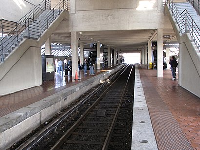
Directions to West Falls Church Metro (Washington, D.C. - Baltimore, MD) with public transportation
The following transit lines have routes that pass near West Falls Church Metro
How to get to West Falls Church Metro by bus?
Click on the bus route to see step by step directions with maps, line arrival times and updated time schedules.
How to get to West Falls Church Metro by metro?
Click on the metro route to see step by step directions with maps, line arrival times and updated time schedules.
Metro stations near West Falls Church Metro in Washington, D.C. - Baltimore, MD
- West Falls Church , 1 min walk,
Bus stops near West Falls Church Metro in Washington, D.C. - Baltimore, MD
- Haycock Rd & Falls Church City Park, 9 min walk,
Bus lines to West Falls Church Metro in Washington, D.C. - Baltimore, MD
- 28A, East To King Street-Old Town,
What are the closest stations to West Falls Church Metro?
The closest stations to West Falls Church Metro are:
- West Falls Church is 58 yards away, 1 min walk.
- Haycock Rd & Falls Church City Park is 725 yards away, 9 min walk.
Which bus lines stop near West Falls Church Metro?
These bus lines stop near West Falls Church Metro: 28A, 2A.
Which metro line stops near West Falls Church Metro?
METRORAIL ORANGE LINE
What’s the nearest metro station to West Falls Church Metro in Washington, D.C. - Baltimore, MD?
The nearest metro station to West Falls Church Metro in Washington, D.C. - Baltimore, MD is West Falls Church. It’s a 1 min walk away.
What’s the nearest bus stop to West Falls Church Metro in Washington, D.C. - Baltimore, MD?
The nearest bus stop to West Falls Church Metro in Washington, D.C. - Baltimore, MD is Haycock Rd & Falls Church City Park. It’s a 9 min walk away.
See West Falls Church Metro, Washington, D.C. - Baltimore, MD, on the map
Public Transit to West Falls Church Metro in Washington, D.C. - Baltimore, MD
Wondering how to get to West Falls Church Metro in Washington, D.C. - Baltimore, MD, United States? Moovit helps you find the best way to get to West Falls Church Metro with step-by-step directions from the nearest public transit station.
Moovit provides free maps and live directions to help you navigate through your city. View schedules, routes, timetables, and find out how long does it take to get to West Falls Church Metro in real time.
Looking for the nearest stop or station to West Falls Church Metro? Check out this list of stops closest to your destination: West Falls Church ; Haycock Rd & Falls Church City Park.
Bus: 28A, 2A.Metro: METRORAIL ORANGE LINE.
Want to see if there’s another route that gets you there at an earlier time? Moovit helps you find alternative routes or times. Get directions from and directions to West Falls Church Metro easily from the Moovit App or Website.
We make riding to West Falls Church Metro easy, which is why over 1.5 million users, including users in Washington, D.C. - Baltimore, MD, trust Moovit as the best app for public transit. You don’t need to download an individual bus app or train app, Moovit is your all-in-one transit app that helps you find the best bus time or train time available.
For information on prices of bus and metro, costs and ride fares to West Falls Church Metro, please check the Moovit app.
Use the app to navigate to popular places including to the airport, hospital, stadium, grocery store, mall, coffee shop, school, college, and university.
West Falls Church Metro Address: West Falls Church METRO street in Washington, D.C. - Baltimore, MD
Attractions near West Falls Church Metro
Washington Flyer,505 Bus Route Heading To Reston Town Center,West Falls Church Bus Roundabout,GM Auditorium,WMATA West Falls Church Rail Yard,West Falls Church-VT / UVA Metro Station,GWU SE Hall,LCC Lowes Island, Lady Of Hope, Cascades, Broad Run,Shuttle To Wolf Trap,West Falls Church Metro Parking Garage,7040 Haycock Road,West Falls Church Station & Bus Bay C,West Falls Church Metrorail Station Kiss N Ride Lot,Interstate 66,Tre,Exit/E,Metropolitan Pl,VA-267 Dulles Toll Road To I-66 East,GMHS Football Stadium,PavillionHow to get to popular attractions in Washington, D.C. - Baltimore, MD with public transit
I-270 Exit 26 (Fingerboard Road), Urbana,Dangerously Delicious Pies, Washington,Liberty Crossing, Fairfax County,Dunkin Donuts, Washington,Caboose Brewing Company, Fairfax County,U.S. Customs And Border Protection (CBP), Washington,Francis C. Hammond Middle School, Alexandria,Broken Land Park & Ride, Howard County,PRTC Transit Center, Prince William County,Fairchild Building, Washington,Kensington Park, Montgomery County,1301 Pennsylvania Ave, Washington,Wyndham Old Town Alexandria, Alexandria,Clipper Mill, Baltimore,Hillendale Shopping Center, Baltimore County,Federal Reserve Board, Washington,Cherry Hill, Baltimore,Gate #8 - U.S. Naval Academy, Anne Arundel County,Woodlawn High School, Baltimore County,Kenilworth Ave & Route 50, Prince George's CountyGet around Washington, D.C. - Baltimore, MD by public transit!
Traveling around Washington, D.C. - Baltimore, MD has never been so easy. See step by step directions as you travel to any attraction, street or major public transit station. View bus and train schedules, arrival times, service alerts and detailed routes on a map, so you know exactly how to get to anywhere in Washington, D.C. - Baltimore, MD.
When traveling to any destination around Washington, D.C. - Baltimore, MD use Moovit's Live Directions with Get Off Notifications to know exactly where and how far to walk, how long to wait for your line, and how many stops are left. Moovit will alert you when it's time to get off — no need to constantly re-check whether yours is the next stop.
Wondering how to use public transit in Washington, D.C. - Baltimore, MD or how to pay for public transit in Washington, D.C. - Baltimore, MD? Moovit public transit app can help you navigate your way with public transit easily, and at minimum cost. It includes public transit fees, ticket prices, and costs. Looking for a map of Washington, D.C. - Baltimore, MD public transit lines? Moovit public transit app shows all public transit maps in Washington, D.C. - Baltimore, MD with all Bus, Train, Metro, Light Rail and Ferry routes and stops on an interactive map.
Washington, D.C. - Baltimore, MD has 5 transit type(s), including: Bus, Train, Metro, Light Rail and Ferry, operated by several transit agencies, including WMATA, Montgomery County Ride On, Montgomery County MD Ride On, Fairfax Connector, TheBus, PRTC, DC Circulator, DASH - Alexandria, Arlington Transit (ART), DC Streetcar, RTA of Central Maryland, FRED, MDOT MTA, Marc, Virginia Railway Express (VRE)