Directions to West Falls Church Metro (Idylwood) with public transportation
The following transit lines have routes that pass near West Falls Church Metro
How to get to West Falls Church Metro by bus?
Click on the bus route to see step by step directions with maps, line arrival times and updated time schedules.
How to get to West Falls Church Metro by metro?
Click on the metro route to see step by step directions with maps, line arrival times and updated time schedules.
Metro stations near West Falls Church Metro in Idylwood
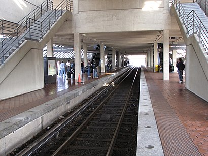
- West Falls Church- Vt/Uva, 8 min walk,
Bus stations near West Falls Church Metro in Idylwood
- Rt 7 W Broad St & West St, 11 min walk,
Bus lines to West Falls Church Metro in Idylwood
- 28A, East To King Street-Old Town,
What are the closest stations to West Falls Church Metro?
The closest stations to West Falls Church Metro are:
- West Falls Church- Vt/Uva is 610 yards away, 8 min walk.
- Rt 7 W Broad St & West St is 895 yards away, 11 min walk.
Which bus line stops near West Falls Church Metro?
28A
Which metro line stops near West Falls Church Metro?
METRORAIL ORANGE LINE
What’s the nearest metro station to West Falls Church Metro in Idylwood?
The nearest metro station to West Falls Church Metro in Idylwood is West Falls Church- Vt/Uva. It’s a 8 min walk away.
What’s the nearest bus stop to West Falls Church Metro in Idylwood?
The nearest bus stop to West Falls Church Metro in Idylwood is Rt 7 W Broad St & West St. It’s a 11 min walk away.
See West Falls Church Metro, Idylwood, on the map
Public Transit to West Falls Church Metro in Idylwood
Wondering how to get to West Falls Church Metro in Idylwood, United States? Moovit helps you find the best way to get to West Falls Church Metro with step-by-step directions from the nearest public transit station.
Moovit provides free maps and live directions to help you navigate through your city. View schedules, routes, timetables, and find out how long does it take to get to West Falls Church Metro in real time.
Looking for the nearest stop or station to West Falls Church Metro? Check out this list of stops closest to your destination: West Falls Church- Vt/Uva; Rt 7 W Broad St & West St.
Bus: 28A.Metro: METRORAIL ORANGE LINE.
Want to see if there’s another route that gets you there at an earlier time? Moovit helps you find alternative routes or times. Get directions from and directions to West Falls Church Metro easily from the Moovit App or Website.
We make riding to West Falls Church Metro easy, which is why over 1.5 million users, including users in Idylwood, trust Moovit as the best app for public transit. You don’t need to download an individual bus app or train app, Moovit is your all-in-one transit app that helps you find the best bus time or train time available.
For information on prices of bus and metro, costs and ride fares to West Falls Church Metro, please check the Moovit app.
Use the app to navigate to popular places including to the airport, hospital, stadium, grocery store, mall, coffee shop, school, college, and university.
Location: Idylwood, Washington, D.C. - Baltimore, MD
Attractions near West Falls Church Metro
Univ,West Falls Church-VT / UVA Metro Station,United States Svc Industries,Jefferson Commercial,Jbg Properties,Condori Travel,Maria E Ramirez,Visitors,Haycock Rd & Leesburg Pk,Northern Virginia Center (Virginia Tech / University Of Virginia),VT / UVA Northern Virginia Center,Ciprico Inc,Geoff Thompson Consulting,Virginia Commonwealth of,171 Haycock Rd,James S Halter,Vl Elliott,Brocam,Haycock Rd,SH-703How to get to popular attractions in Idylwood with public transit
Bar Louie, Washington,Renaissance Baltimore Harborplace Hotel, Baltimore,Pi Pizzeria, Washington,Merriweather Post Pavilion, Howard County,Big Bear Cafe, Washington,Walmart Supercenter, Anne Arundel County,BWI Amtrak / MARC Rail Station , Anne Arundel County,BWI Rental Car Facility, Anne Arundel County,Pearl Dive Oyster Palace, Washington,The Park at 14th, Washington,The Washington Post, Washington,Nordstrom, Arlington County,Crystal City Sports Pub, Arlington County,Local 16, Washington,Greater Baltimore Medical Center, Baltimore County,Patterson Park, Baltimore,Biergarten Haus, Washington,Target, Howard County,Lost Society, Washington,Maryland, BaltimoreGet around Washington, D.C. - Baltimore, MD by public transit!
Traveling around Washington, D.C. - Baltimore, MD has never been so easy. See step by step directions as you travel to any attraction, street or major public transit station. View bus and train schedules, arrival times, service alerts and detailed routes on a map, so you know exactly how to get to anywhere in Washington, D.C. - Baltimore, MD.
When traveling to any destination around Washington, D.C. - Baltimore, MD use Moovit's Live Directions with Get Off Notifications to know exactly where and how far to walk, how long to wait for your line, and how many stops are left. Moovit will alert you when it's time to get off — no need to constantly re-check whether yours is the next stop.
Wondering how to use public transit in Washington, D.C. - Baltimore, MD or how to pay for public transit in Washington, D.C. - Baltimore, MD? Moovit public transit app can help you navigate your way with public transit easily, and at minimum cost. It includes public transit fees, ticket prices, and costs. Looking for a map of Washington, D.C. - Baltimore, MD public transit lines? Moovit public transit app shows all public transit maps in Washington, D.C. - Baltimore, MD with all Bus, Train, Metro, Light Rail and Ferry routes and stops on an interactive map.
Washington, D.C. - Baltimore, MD has 5 transit type(s), including: Bus, Train, Metro, Light Rail and Ferry, operated by several transit agencies, including WMATA, Montgomery County Ride On, Fairfax Connector, TheBus, DC Circulator, MDOT MTA, Marc, Virginia Railway Express (VRE), PRTC, DASH - Alexandria, Arlington Transit (ART), DC Streetcar, RTA of Central Maryland, FRED, University of Maryland Shuttle-UM