Directions to West Lake Hills with public transportation
The following transit lines have routes that pass near West Lake Hills
How to get to West Lake Hills by bus?
Click on the bus route to see step by step directions with maps, line arrival times and updated time schedules.
Bus stations near West Lake Hills
- Kermit/Lufkin,27 min walk,
- 3825 Lake Austin/Enfield,29 min walk,
- 1007 Walsh Tarlton/Bee Caves,36 min walk,
Bus lines to West Lake Hills
- 663,663 Ut Campus Ib,
- 18,18 Exposition Wb,
- 30,30 Northcross Nb,
What are the closest stations to West Lake Hills?
The closest stations to West Lake Hills are:
- Kermit/Lufkin is 2305 yards away, 27 min walk.
- 3825 Lake Austin/Enfield is 2442 yards away, 29 min walk.
- 1007 Walsh Tarlton/Bee Caves is 2986 yards away, 36 min walk.
Which bus lines stop near West Lake Hills?
These bus lines stop near West Lake Hills: 18, 30, 663.
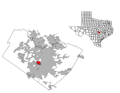
See West Lake Hills on the map
Public Transportation to West Lake Hills
Wondering how to get to West Lake Hills, United States? Moovit helps you find the best way to get to West Lake Hills with step-by-step directions from the nearest public transit station.
Moovit provides free maps and live directions to help you navigate through your city. View schedules, routes, timetables, and find out how long does it take to get to West Lake Hills in real time.
Looking for the nearest stop or station to West Lake Hills? Check out this list of stops closest to your destination: Kermit/Lufkin; 3825 Lake Austin/Enfield; 1007 Walsh Tarlton/Bee Caves.
Bus:1830663
Want to see if there’s another route that gets you there at an earlier time? Moovit helps you find alternative routes or times. Get directions from and directions to West Lake Hills easily from the Moovit App or Website.
We make riding to West Lake Hills easy, which is why over 1.5 million users, including users in West Lake Hills, trust Moovit as the best app for public transit. You don’t need to download an individual bus app or train app, Moovit is your all-in-one transit app that helps you find the best bus time or train time available.
For information on prices of bus, costs and ride fares to West Lake Hills, please check the Moovit app.
Use the app to navigate to popular places including to the airport, hospital, stadium, grocery store, mall, coffee shop, school, college, and university.
West Lake Hills Address: Travis, Texas street in West Lake Hills
Attractions near West Lake Hills
Mobile Veterinary Services,West Lake Hills Municipal Court,Sloan Construction Company,West Lake Hills City Hall,West Lake Hills Police,West Lake Hills Police Department,Goldrick Cindy Rltr,West Lake Hills Municipal Offices,City Of West Lake Hills,Westlake Dr,Come and Take It Structural Movers,Rhett Hoestenbach, P.C.,Travis County Emergency Services District 9 Westlake Fire Department,Robert Wood Associates Inc,Enviro Air & Water,Westlake Grocery,Shell,Peach Spa,West Lake Hills Fire Station,Travis County Emergency Services District 9 Station 1How to get to popular attractions in West Lake Hills with public transit
Capital MetroRail - Lakeline Station, Austin,Bejucos Bus Line, Austin,Wayside: Sci-Tech High School, Austin,William Cannon and IH 35, Austin,Turimex Internacional, Austin,El Buen Samaritano, Austin,Amazon, Austin,Live Oak Brewing, Austin,Mopac & William Cannon, Austin,Tesla,Harry Ransom Center, Austin,Austin Centre/Omni Hotel Atm, Austin,MetroRail - Leander Station, Leander,Moody Center, Austin,Austin Can Academy, Austin,Zilker Botanical Gardens, Austin,W 13th St, Austin,1800 E Parmer Ln, Austin,Apple - Parmer Lane 1, Austin,-Austin Vending Machines, AustinGet around West Lake Hills by public transit!
Traveling around West Lake Hills has never been so easy. See step by step directions as you travel to any attraction, street or major public transit station. View bus and train schedules, arrival times, service alerts and detailed routes on a map, so you know exactly how to get to anywhere in West Lake Hills.
When traveling to any destination around West Lake Hills use Moovit's Live Directions with Get Off Notifications to know exactly where and how far to walk, how long to wait for your line, and how many stops are left. Moovit will alert you when it's time to get off — no need to constantly re-check whether yours is the next stop.
Wondering how to use public transit in West Lake Hills or how to pay for public transit in West Lake Hills? Moovit public transit app can help you navigate your way with public transit easily, and at minimum cost. It includes public transit fees, ticket prices, and costs. Looking for a map of West Lake Hills public transit lines? Moovit public transit app shows all public transit maps in West Lake Hills with all bus routes and stops on an interactive map.
West Lake Hills has 1 transit type(s), including: bus, operated by several transit agencies, including Capital Metro-Bus, Capital Metro-Tram, CARTS, Capital Area Rural Transportation System, San Marcos Transit, Greyhound-us, Megabus, FlixBus-us and Bobcat Shuttle