Directions to West Palm Beach with public transportation
The following transit lines have routes that pass near West Palm Beach
How to get to West Palm Beach by bus?
Click on the bus route to see step by step directions with maps, line arrival times and updated time schedules.
How to get to West Palm Beach by train?
Click on the train route to see step by step directions with maps, line arrival times and updated time schedules.
Bus stations near West Palm Beach
- Wpb Itc at Bay F, 1 min walk,
- Wpb Itc at Bay G, 1 min walk,
- Wpb Itc at Bay H, 1 min walk,
- Wpb Itc at Bay P, 2 min walk,
- Wpb Itc at Tri Rail, 2 min walk,
- West Palm Beach Bus Station, 5 min walk,
Train stations near West Palm Beach
- West Palm Beach, 53 min walk,
- West Palm Beach Amtrak Station, 59 min walk,
- West Palm Beach Station, 61 min walk,
Bus lines to West Palm Beach
- 41, Rt 41 Southbound,
- 31, Rt 31 Southbound,
- 43, Rt 43 Eastbound,
- 40, Rt 40 Westbound,
- 1, Rt 1 Southbound,
- 2, Rt 2 Northbound,
- 20, Rt 20 Northbound,
- 44, Rt 44 Westbound,
- 60, Rt 60 Eastbound,
- FLIXBUS 2431, Miami - Orlando - Jacksonville,
- FLIXBUS N2411, Tampa - Orlando - Miami,
- GREYHOUND US0630, Miami - Atlanta,
- GREYHOUND US0710, Miami - Jacksonville,
- GREYHOUND US0799, Miami - Houston,
- GREYHOUND US0710S, Miami - Titusville - Jacksonville,
- GREYHOUND US0740S, Tampa - Lakeland - Miami,
What are the closest stations to West Palm Beach?
The closest stations to West Palm Beach are:
- Wpb Itc at Bay F is 23 yards away, 1 min walk.
- Wpb Itc at Bay G is 44 yards away, 1 min walk.
- Wpb Itc at Bay H is 65 yards away, 1 min walk.
- Wpb Itc at Bay P is 77 yards away, 2 min walk.
- Wpb Itc at Tri Rail is 89 yards away, 2 min walk.
- West Palm Beach Bus Station is 359 yards away, 5 min walk.
- West Palm Beach is 4388 yards away, 53 min walk.
- West Palm Beach Amtrak Station is 5005 yards away, 59 min walk.
- West Palm Beach Station is 5171 yards away, 61 min walk.
Which bus lines stop near West Palm Beach?
These bus lines stop near West Palm Beach: 1, 20, 31, 40, 43, 60.
Which train line stops near West Palm Beach?
TRI-RAIL
What’s the nearest bus stop to West Palm Beach?
The nearest bus stops to West Palm Beach are Wpb Itc at Bay F, Wpb Itc at Bay G and Wpb Itc at Bay H. The closest one is a 1 min walk away.
What time is the first train to West Palm Beach?
The TRI-RAIL is the first train that goes to West Palm Beach. It stops nearby at 3:56 AM.
What time is the last train to West Palm Beach?
The SILVER METEOR is the last train that goes to West Palm Beach. It stops nearby at 5:10 PM.
What time is the first bus to West Palm Beach?
The FLIXBUS N2411 is the first bus that goes to West Palm Beach. It stops nearby at 4:20 AM.
What time is the last bus to West Palm Beach?
The GREYHOUND US0799 is the last bus that goes to West Palm Beach. It stops nearby at 11:48 PM.
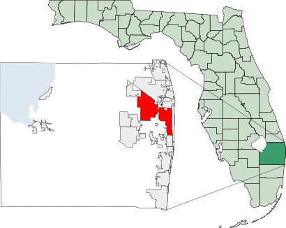
See West Palm Beach on the map
Public Transportation to West Palm Beach
Wondering how to get to West Palm Beach, United States? Moovit helps you find the best way to get to West Palm Beach with step-by-step directions from the nearest public transit station.
Moovit provides free maps and live directions to help you navigate through your city. View schedules, routes, timetables, and find out how long does it take to get to West Palm Beach in real time.
Looking for the nearest stop or station to West Palm Beach? Check out this list of stops closest to your destination: Wpb Itc at Bay F; Wpb Itc at Bay G; Wpb Itc at Bay H; Wpb Itc at Bay P; Wpb Itc at Tri Rail; West Palm Beach Bus Station; West Palm Beach; West Palm Beach Amtrak Station; West Palm Beach Station.
Bus: 1, 20, 31, 40, 43, 60, 41.Train: TRI-RAIL, BLFM, SILVER METEOR, SILVER STAR.
Want to see if there’s another route that gets you there at an earlier time? Moovit helps you find alternative routes or times. Get directions from and directions to West Palm Beach easily from the Moovit App or Website.
We make riding to West Palm Beach easy, which is why over 1.5 million users, including users in West Palm Beach, trust Moovit as the best app for public transit. You don’t need to download an individual bus app or train app, Moovit is your all-in-one transit app that helps you find the best bus time or train time available.
For information on prices of bus and train, costs and ride fares to West Palm Beach, please check the Moovit app.
Use the app to navigate to popular places including to the airport, hospital, stadium, grocery store, mall, coffee shop, school, college, and university.
West Palm Beach Address: Clearwater Drive street in West Palm Beach
Attractions near West Palm Beach
West Palm Beach Tri Rail Station,Greyhound Bus,WPB Itc @ Bus TRM,Greyhound-West Palm Beach,Flixbus West Palm Beach,Tri-Rail-West Palm Beach Station,Greyhound Bus Lines,West Palm Beach,Clearwater Dr,Fourth District Court of Appeal,Piper Creek Pet Resort,Artesian Spring Water,Most Recent Pcas,150 Clearwater Drive,Intermodal TRANSIT Center,WPB TRANSIT Center,One Clearlake,Bertisch Flynn P Attorney,Rogers and Paladino PA,Russell M Anderson, MetlifeHow to get to popular attractions in West Palm Beach with public transit
LIV Miami, Miami Beach,City of Oakland Park, Fort Lauderdale,Novecento, Miami,Shake Shack, Kendall-Palmetto Bay,The Galleria, Fort Lauderdale,Coral Square, Coral Springs-Margate,Broward County, Fort Lauderdale,The Breakers Palm Beach, West Palm Beach,Town of Palm Beach, West Palm Beach,Hunters, Fort Lauderdale,Walmart Supercenter, Miramar-Pembroke Pines,City of Miami, Miami,Costco Wholesale, Boca Raton,Sebastian Street Beach, Fort Lauderdale,Festival Flea Market, Pompano Beach,Roger Dean Stadium, Jupiter,Starbucks, Fort Lauderdale,Duffy's Sports Grill, Miami,The Cheesecake Factory, Boca Raton,Publix, Fort LauderdaleGet around Miami by public transit!
Traveling around Miami has never been so easy. See step by step directions as you travel to any attraction, street or major public transit station. View bus and train schedules, arrival times, service alerts and detailed routes on a map, so you know exactly how to get to anywhere in Miami.
When traveling to any destination around Miami use Moovit's Live Directions with Get Off Notifications to know exactly where and how far to walk, how long to wait for your line, and how many stops are left. Moovit will alert you when it's time to get off — no need to constantly re-check whether yours is the next stop.
Wondering how to use public transit in Miami or how to pay for public transit in Miami? Moovit public transit app can help you navigate your way with public transit easily, and at minimum cost. It includes public transit fees, ticket prices, and costs. Looking for a map of Miami public transit lines? Moovit public transit app shows all public transit maps in Miami with all Bus, Train, Subway, Light Rail and Ferry routes and stops on an interactive map.
Miami has 5 transit type(s), including: Bus, Train, Subway, Light Rail and Ferry, operated by several transit agencies, including Miami-Dade Transit, Miami Dade Transit-Rail, Tri-Rail, Broward County Transit, Palm Tran, Brightline, MARTY, City of Homestead Trolley, Key West Transit, Treasure Coast Connector, GoLine IRT, Amtrak, Greyhound-us, Megabus, FlixBus-us