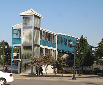
See West Side Avenue Station, Jersey City, Nj, on the map
Directions to West Side Avenue Station (Jersey City, Nj) with public transportation
The following transit lines have routes that pass near West Side Avenue Station
 Bus:
Bus: - Train:
- Light Rail:
How to get to West Side Avenue Station by bus?
Click on the bus route to see step by step directions with maps, line arrival times and updated time schedules.
How to get to West Side Avenue Station by train?
Click on the train route to see step by step directions with maps, line arrival times and updated time schedules.
Bus stations near West Side Avenue Station in Jersey City, Nj
- West Side Ave at Claremont Ave - Hblr,1 min walk,
- JFK Blvd at Claremont Ave,7 min walk,
Light Rail stations near West Side Avenue Station in Jersey City, Nj
- Danforth Avenue Light Rail Station,36 min walk,
Bus lines to West Side Avenue Station in Jersey City, Nj
- 9,Montgomery St West Side Ave Society Hill,
- 14,Journal Sq Via Mallory & Duncan Aves,
- 80,Gates Avenue,
- 10,Jersey City Journal Square,
- 119,Jersey City and Bayonne,
What are the closest stations to West Side Avenue Station?
The closest stations to West Side Avenue Station are:
- West Side Ave at Claremont Ave - Hblr is 67 yards away, 1 min walk.
- JFK Blvd at Claremont Ave is 568 yards away, 7 min walk.
- Danforth Avenue Light Rail Station is 3064 yards away, 36 min walk.
Which bus line stops near West Side Avenue Station?
119
Which train line stops near West Side Avenue Station?
PATH
Which light rail line stops near West Side Avenue Station?
HLR
What’s the nearest bus stop to West Side Avenue Station in Jersey City, Nj?
The nearest bus stop to West Side Avenue Station in Jersey City, Nj is West Side Ave at Claremont Ave - Hblr. It’s a 1 min walk away.
What time is the first light rail to West Side Avenue Station in Jersey City, Nj?
The HLR is the first light rail that goes to West Side Avenue Station in Jersey City, Nj. It stops nearby at 4:57 AM.
What time is the last light rail to West Side Avenue Station in Jersey City, Nj?
The HLR is the last light rail that goes to West Side Avenue Station in Jersey City, Nj. It stops nearby at 2:26 AM.
What time is the first bus to West Side Avenue Station in Jersey City, Nj?
The 119 is the first bus that goes to West Side Avenue Station in Jersey City, Nj. It stops nearby at 3:23 AM.
What time is the last bus to West Side Avenue Station in Jersey City, Nj?
The 119 is the last bus that goes to West Side Avenue Station in Jersey City, Nj. It stops nearby at 2:51 AM.
How much is the bus fare to West Side Avenue Station?
The bus fare to West Side Avenue Station costs about $2.90.
How much is the train fare to West Side Avenue Station?
The train fare to West Side Avenue Station costs about $2.75.
How much is the subway fare to West Side Avenue Station?
The subway fare to West Side Avenue Station costs about $2.90.
See West Side Avenue Station, Jersey City, Nj, on the map
Public Transit to West Side Avenue Station in Jersey City, Nj
Wondering how to get to West Side Avenue Station in Jersey City, Nj, United States? Moovit helps you find the best way to get to West Side Avenue Station with step-by-step directions from the nearest public transit station.
Moovit provides free maps and live directions to help you navigate through your city. View schedules, routes, timetables, and find out how long does it take to get to West Side Avenue Station in real time.
Looking for the nearest stop or station to West Side Avenue Station? Check out this list of stops closest to your destination: West Side Ave at Claremont Ave - Hblr; JFK Blvd at Claremont Ave; Danforth Avenue Light Rail Station.
Bus:Train:Light Rail:
Want to see if there’s another route that gets you there at an earlier time? Moovit helps you find alternative routes or times. Get directions from and directions to West Side Avenue Station easily from the Moovit App or Website.
We make riding to West Side Avenue Station easy, which is why over 1.5 million users, including users in Jersey City, Nj, trust Moovit as the best app for public transit. You don’t need to download an individual bus app or train app, Moovit is your all-in-one transit app that helps you find the best bus time or train time available.
For information on prices of train, bus, light rail and subway, costs and ride fares to West Side Avenue Station, please check the Moovit app.
Use the app to navigate to popular places including to the airport, hospital, stadium, grocery store, mall, coffee shop, school, college, and university.
Location: Jersey City, Nj, New York - New Jersey
Attractions near West Side Avenue Station
West Side Ave Light Rail Station,Division B Drone Project,NJ TRANSIT-West Side Avenue,Raj Patel,Palermo Jersey City,John J. Moore Athletics and Fitness Center,Social Security,Atlas Express Padala,Hackensack River Waterfront,Grant Ave,Washington Rock State Park,West Side Ave,Robert Scott Pr,Ege Ave,Mallory Ave,Jungle Films,West Bergen NJ USA,Lee Family Dentistry,West Bergen, New Jersey,PNC BankHow to get to popular attractions in Jersey City, Nj with public transit
The Stumble Inn, Manhattan,Avenue, Manhattan,Hair of the Dog, Manhattan,Long Island, NY, Huntington Station, Ny,Great Lawn, Manhattan,Dinosaur Bar-B-Que, Manhattan,Culture Espresso, Manhattan,The Meatball Shop,The Tippler, Manhattan,MTA Subway - Fulton St (A / C/J / Z/2 / 3/4 / 5), Manhattan,New Jersey, Nutley, Nj,Spring Lounge, Manhattan,I-80 (Interstate 80), Paterson, Nj,Eataly, Manhattan,J.G. Melon, Manhattan,Cookshop, Manhattan,Harrah's Resort Hotel & Casino, Atlantic City, Nj,The Park, Manhattan,Planet Fitness, Queens,Brass Monkey, ManhattanGet around Jersey City, Nj by public transit!
Traveling around Jersey City, Nj has never been so easy. See step by step directions as you travel to any attraction, street or major public transit station. View bus and train schedules, arrival times, service alerts and detailed routes on a map, so you know exactly how to get to anywhere in Jersey City, Nj.
When traveling to any destination around Jersey City, Nj use Moovit's Live Directions with Get Off Notifications to know exactly where and how far to walk, how long to wait for your line, and how many stops are left. Moovit will alert you when it's time to get off — no need to constantly re-check whether yours is the next stop.
Wondering how to use public transit in Jersey City, Nj or how to pay for public transit in Jersey City, Nj? Moovit public transit app can help you navigate your way with public transit easily, and at minimum cost. It includes public transit fees, ticket prices, and costs. Looking for a map of Jersey City, Nj public transit lines? Moovit public transit app shows all public transit maps in Jersey City, Nj with all train, bus, light rail or subway routes and stops on an interactive map.
Jersey City, Nj has 4 transit type(s), including: train, bus, light rail or subway, operated by several transit agencies, including MTA Subway, Metro-North Railroad, LIRR, PATH, Shore Line East, MTA Bus Company, MTA New York City Transit - Express routes, MTA Bus, NJ Transit, NYC Ferry, NICE bus, Bee-Line Bus, NJ Transit Rail, NJ Transit Rail and Norwalk Transit District