See Westend City Center, Budapest, on the map
Directions to Westend City Center (Budapest) with public transportation
The following transit lines have routes that pass near Westend City Center
 Bus:
Bus: - Train:
- Metro:
How to get to Westend City Center by bus?
Click on the bus route to see step by step directions with maps, line arrival times and updated time schedules.
How to get to Westend City Center by train?
Click on the train route to see step by step directions with maps, line arrival times and updated time schedules.
How to get to Westend City Center by metro?
Click on the metro route to see step by step directions with maps, line arrival times and updated time schedules.
Bus stations near Westend City Center in Budapest
- Csanády Utca (Lehel Tér M),1 min walk,
- Lehel Tér M,2 min walk,
- Balzac Utca,4 min walk,
- Nyugati Pályaudvar M,4 min walk,
- Ferdinánd Híd (Izabella Utca),11 min walk,
Metro stations near Westend City Center in Budapest
- Lehel Tér,4 min walk,
Light Rail stations near Westend City Center in Budapest
- Lehel Tér M,4 min walk,
- Nyugati Pályaudvar M,5 min walk,
Bus lines to Westend City Center in Budapest
- 15,Astoria M ► Gyöngyösi Utca M,
- 914,Dél-Pesti Autóbuszgarázs,
- 914A,Határ Út M,
- 950,Pestszentlőrinc, Béke Tér,
- 950A,Pestszentlőrinc, Szarvas Csárda Tér,
- 76,Jászai Mari Tér,
- 73,Keleti Pályaudvar M,
- 26,Nyugati pályaudvar M / Nyugati pályaudvar M,
- 226,Nyugati pályaudvar M / Óbudai-sziget,
- 91,Rózsadomb ► Nyugati Pályaudvar M,
- 191,Szemlőhegy,
- 291,Nyugati Pályaudvar M,
- 931,Nyugati Pályaudvar M ► Zöldmál,
- 931,Zöldmál ► Nyugati Pályaudvar M,
- 4-6,Nyugati Pályaudvar M,
- 934,Békásmegyer H,
- 923,Békásmegyer H,
- 6,Széll Kálmán Tér M,
- 9,Óbuda, Bogdáni Út,
- 72,Deák Ferenc Tér M ► Zugló Vasútállomás,
What are the closest stations to Westend City Center?
The closest stations to Westend City Center are:
- Csanády Utca (Lehel Tér M) is 17 meters away, 1 min walk.
- Lehel Tér M is 74 meters away, 2 min walk.
- Lehel Tér is 253 meters away, 4 min walk.
- Balzac Utca is 268 meters away, 4 min walk.
- Nyugati Pályaudvar M is 274 meters away, 4 min walk.
- Ferdinánd Híd (Izabella Utca) is 835 meters away, 11 min walk.
Which bus lines stop near Westend City Center?
These bus lines stop near Westend City Center: 15, 26, 72, 76, 9, 91.
Which train line stops near Westend City Center?
H5
Which metro line stops near Westend City Center?
M3
What’s the nearest light rail station to Westend City Center in Budapest?
The nearest light rail station to Westend City Center in Budapest is Lehel Tér M. It’s a 4 min walk away.
What’s the nearest metro station to Westend City Center in Budapest?
The nearest metro station to Westend City Center in Budapest is Lehel Tér. It’s a 4 min walk away.
What’s the nearest bus stop to Westend City Center in Budapest?
The nearest bus stop to Westend City Center in Budapest is Csanády Utca (Lehel Tér M). It’s a 1 min walk away.
What time is the first light rail to Westend City Center in Budapest?
The 4-6 is the first light rail that goes to Westend City Center in Budapest. It stops nearby at 3:03 AM.
What time is the last light rail to Westend City Center in Budapest?
The 6 is the last light rail that goes to Westend City Center in Budapest. It stops nearby at 3:18 AM.
What time is the first metro to Westend City Center in Budapest?
The M3 is the first metro that goes to Westend City Center in Budapest. It stops nearby at 4:31 AM.
What time is the last metro to Westend City Center in Budapest?
The M3 is the last metro that goes to Westend City Center in Budapest. It stops nearby at 11:48 PM.
What time is the first bus to Westend City Center in Budapest?
The 914A is the first bus that goes to Westend City Center in Budapest. It stops nearby at 3:00 AM.
What time is the last bus to Westend City Center in Budapest?
The 931 is the last bus that goes to Westend City Center in Budapest. It stops nearby at 3:50 AM.
See Westend City Center, Budapest, on the map
Public Transit to Westend City Center in Budapest
Wondering how to get to Westend City Center in Budapest, Hungary? Moovit helps you find the best way to get to Westend City Center with step-by-step directions from the nearest public transit station.
Moovit provides free maps and live directions to help you navigate through your city. View schedules, routes, timetables, and find out how long does it take to get to Westend City Center in real time.
Looking for the nearest stop or station to Westend City Center? Check out this list of stops closest to your destination: Csanády Utca (Lehel Tér M); Lehel Tér M; Lehel Tér; Balzac Utca; Nyugati Pályaudvar M; Ferdinánd Híd (Izabella Utca).
Bus:Train:Metro:
Want to see if there’s another route that gets you there at an earlier time? Moovit helps you find alternative routes or times. Get directions from and directions to Westend City Center easily from the Moovit App or Website.
We make riding to Westend City Center easy, which is why over 1.5 million users, including users in Budapest, trust Moovit as the best app for public transit. You don’t need to download an individual bus app or train app, Moovit is your all-in-one transit app that helps you find the best bus time or train time available.
For information on prices of bus, metro, light rail and train, costs and ride fares to Westend City Center, please check the Moovit app.
Use the app to navigate to popular places including to the airport, hospital, stadium, grocery store, mall, coffee shop, school, college, and university.
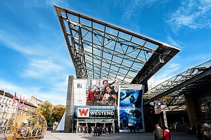
Westend City Center Address: Váci út street in Budapest
Attractions near Westend City Center
Váci út 3,Samsung Experience Store - WestEnd,McDonald's,Jackpot & Cottonfield Westend,Váci utca,Tatuum,S72 • Budapest-Nyugati – Esztergom,TOP CLEAN ruhatisztító,Tezenis,Séf Asztala - Westend City Center Budapest,Marks & Spencer,Tigáz Ügyfélszolgálat,WestEnd,Hilton,Swatch Store,Koboldok és Tündérek Budapest,Westend Drive-In Cinema,Seacret-Minerals From The Dead Sea,Budapest-Nyugati,Giorgio Armani @ WestEnd City Center Budapest, Váci út 1-3., Hungary.How to get to popular attractions in Budapest with public transit
Kelenvölgy (XI.ker.), Budapest,Arena Mall Üzletközpont, Budapest,Csalánosi Csárda, Budapest,Csepel Plaza, Budapest,SPAR, Budapest,SPAR, Gödöllo,Aschner Lipót tér, Budapest,Fellini Római Kultúrbisztró, Budapest,TEN HQ, Budapest,Mom Park, Budapest,Kis Fecó, Budapest,Starbucks, Budapest,Árpád híd, budai hídfő, Budapest,Márton Áron tér (59, 59A), Budapest,Pizza Paradicsom, Budapest,TESCO Hipermarket, Budapest,Flórián Bevásárlóközpont, Budapest,Reckitt Benckiser Hungary, Budapest,Auchan Pilis, Pilisvörösvár,Csörsz utca (17, 61), BudapestGet around Budapest by public transit!
Traveling around Budapest has never been so easy. See step by step directions as you travel to any attraction, street or major public transit station. View bus and train schedules, arrival times, service alerts and detailed routes on a map, so you know exactly how to get to anywhere in Budapest.
When traveling to any destination around Budapest use Moovit's Live Directions with Get Off Notifications to know exactly where and how far to walk, how long to wait for your line, and how many stops are left. Moovit will alert you when it's time to get off — no need to constantly re-check whether yours is the next stop.
Wondering how to use public transit in Budapest or how to pay for public transit in Budapest? Moovit public transit app can help you navigate your way with public transit easily, and at minimum cost. It includes public transit fees, ticket prices, and costs. Looking for a map of Budapest public transit lines? Moovit public transit app shows all public transit maps in Budapest with all bus, metro, light rail or train routes and stops on an interactive map.
Budapest has 4 transit type(s), including: bus, metro, light rail or train, operated by several transit agencies, including BKK, BKK, BKK, BKK and MÁV-HÉV