See Western Bicutan, Taguig, on the map
Directions to Western Bicutan (Taguig) with public transportation
The following transit lines have routes that pass near Western Bicutan
 Bus:
Bus: - Train:
How to get to Western Bicutan by bus?
Click on the bus route to see step by step directions with maps, line arrival times and updated time schedules.
How to get to Western Bicutan by train?
Click on the train route to see step by step directions with maps, line arrival times and updated time schedules.
Bus stations near Western Bicutan in Taguig
- Carlos P. Garcia Ave, Taguig City, Manila,13 min walk,
- Dbp Ave, Taguig City, Manila, Manila,14 min walk,
- E Service Rd, Parañaque City, Manila,17 min walk,
- South Luzon Expressway, Taguig City, Manila,18 min walk,
- Food Terminal Incorporated, Dbp Ave, Taguig City, Manila, Manila,20 min walk,
Train stations near Western Bicutan in Taguig
- Nichols Pnr,34 min walk,
Bus lines to Western Bicutan in Taguig
- BUS,Eastwood Libis - Marriot Terminal via Acropolis,
- JEEP,GUDALUPE-FTI via J.P.RIZAL Ext. C5,
- JEEP,Sucat - Market-Market,
- JEEP,Guadalupe (ABC) - FTI via J.P. Rizal Extension,
- BUS,Taguig City Navotas,
- BUS,FTI-Monumento via EDSA,
- JEEP,Alabang - Signal Village via South Expressway Service Road,
- JEEP,FTI - Kayaman C,
- JEEP,Alabang - Pasay RTDA. Via South Super Highway,
- JEEP,ALABANG - SIGNAL VILLAGE via SERVICE ROAD,
- JEEP,Pasay Rotonda - Signal Village,
- JEEP,Alabang - Pasay RTDA. Via FTI Service Rd.,
- JEEP,Guadalupe FTI v JP Rizal,
- JEEP,PASAY ROTUNDA - ALABANG (KANAN) via NICHOLS SERVICE RD,
- JEEP,Alabang - FTI via South Super Highway,
- JEEP,PASAY ROTUNDA - FTI via SIGNAL VILLAGE,
- JEEP,FTI - Uniwide Coastal Mall via VAB, NAB,
- BUS,FTI - Navotas Terminal via EDSA,
- BUS,FTI - Tungko, SJDM via Lagro, C'wealth Ave EDSA,
- BUS,FTI - SM Fairview via Lagro Commonwealth,
What are the closest stations to Western Bicutan?
The closest stations to Western Bicutan are:
- Carlos P. Garcia Ave, Taguig City, Manila is 969 meters away, 13 min walk.
- Dbp Ave, Taguig City, Manila, Manila is 1031 meters away, 14 min walk.
- E Service Rd, Parañaque City, Manila is 1295 meters away, 17 min walk.
- South Luzon Expressway, Taguig City, Manila is 1320 meters away, 18 min walk.
- Food Terminal Incorporated, Dbp Ave, Taguig City, Manila, Manila is 1519 meters away, 20 min walk.
- Nichols Pnr is 2617 meters away, 34 min walk.
Which bus lines stop near Western Bicutan?
These bus lines stop near Western Bicutan: BUS, JEEP, UV.
Which train line stops near Western Bicutan?
PNR MC
What’s the nearest bus stop to Western Bicutan in Taguig?
The nearest bus stop to Western Bicutan in Taguig is Carlos P. Garcia Ave, Taguig City, Manila. It’s a 13 min walk away.
What time is the first train to Western Bicutan in Taguig?
The PNR MC is the first train that goes to Western Bicutan in Taguig. It stops nearby at 5:48 AM.
What time is the last train to Western Bicutan in Taguig?
The PNR MC is the last train that goes to Western Bicutan in Taguig. It stops nearby at 1:00 AM.
What time is the first bus to Western Bicutan in Taguig?
The BUS is the first bus that goes to Western Bicutan in Taguig. It stops nearby at 3:26 AM.
What time is the last bus to Western Bicutan in Taguig?
The BUS is the last bus that goes to Western Bicutan in Taguig. It stops nearby at 3:29 AM.
See Western Bicutan, Taguig, on the map
Public Transit to Western Bicutan in Taguig
Wondering how to get to Western Bicutan in Taguig, Philippines? Moovit helps you find the best way to get to Western Bicutan with step-by-step directions from the nearest public transit station.
Moovit provides free maps and live directions to help you navigate through your city. View schedules, routes, timetables, and find out how long does it take to get to Western Bicutan in real time.
Looking for the nearest stop or station to Western Bicutan? Check out this list of stops closest to your destination: Carlos P. Garcia Ave; Dbp Ave; E Service Rd; South Luzon Expressway; Food Terminal Incorporated; Nichols Pnr.
Bus:Train:
Want to see if there’s another route that gets you there at an earlier time? Moovit helps you find alternative routes or times. Get directions from and directions to Western Bicutan easily from the Moovit App or Website.
We make riding to Western Bicutan easy, which is why over 1.5 million users, including users in Taguig, trust Moovit as the best app for public transit. You don’t need to download an individual bus app or train app, Moovit is your all-in-one transit app that helps you find the best bus time or train time available.
For information on prices of bus and train, costs and ride fares to Western Bicutan, please check the Moovit app.
Use the app to navigate to popular places including to the airport, hospital, stadium, grocery store, mall, coffee shop, school, college, and university.
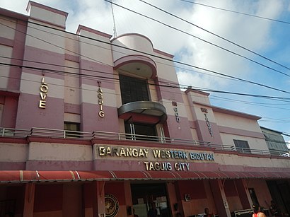
Western Bicutan Address: Kabline street in Taguig
Attractions near Western Bicutan
Philippine Airlines Helipad,Makabuhay St,Manila Botanical Zoo,Pama Lying - in Clinic,Sampaloc St,Bethany Baptist Church,western bicutan taguig city,Heralva Technologies,Alaska Caraan Bakery,Aling Banang's,Manggahan,Benosa Natural Alkaline Water,Wow! Salon,Rabe Store,Paanakan Lying In Center,RRS Overruns Factory,Divisoria Price Store,MDC Road,Opsify Philippines, Inc.,Yap10 Covered CourtHow to get to popular attractions in Taguig with public transit
Zapote Flyover, Las Piñas,Flora Vista Condominiums, Quezon City,New Haven Village, Quezon City,The PICC Forum,The SM Store,Damar Village, Quezon City,San Benissa Garden Villas, Quezon City,Cathedral Parish of St. Andrew, Parañaque,Roosevelt Avenue, Quezon City,F&E De Castro Village, Bacoor,Montalban, Rizal, Rodriguez,Susana Heights Bus Stop, Muntinlupa,Slimmers World International, Manila,Capitol Park Homes II, Kalookan City,The Feast Bay Area,Sykes Asia Inc. K-Pointe, Quezon City,Bambang Street, Manila,The District Dasmariñas, Dasmariñas,Concorde Village,Muntinlupa, MuntinlupaGet around Taguig by public transit!
Traveling around Taguig has never been so easy. See step by step directions as you travel to any attraction, street or major public transit station. View bus and train schedules, arrival times, service alerts and detailed routes on a map, so you know exactly how to get to anywhere in Taguig.
When traveling to any destination around Taguig use Moovit's Live Directions with Get Off Notifications to know exactly where and how far to walk, how long to wait for your line, and how many stops are left. Moovit will alert you when it's time to get off — no need to constantly re-check whether yours is the next stop.
Wondering how to use public transit in Taguig or how to pay for public transit in Taguig? Moovit public transit app can help you navigate your way with public transit easily, and at minimum cost. It includes public transit fees, ticket prices, and costs. Looking for a map of Taguig public transit lines? Moovit public transit app shows all public transit maps in Taguig with all bus or train routes and stops on an interactive map.
Taguig has 2 transit type(s), including: bus or train, operated by several transit agencies, including MRTC, LRTA, PNR, LTFRB, BGC Bus, P2P and UV Express