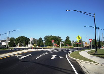
See White Horse Circle on the map
Directions to White Horse Circle with public transportation
The following transit lines have routes that pass near White Horse Circle
 Bus:
Bus:
How to get to White Horse Circle by bus?
Click on the bus route to see step by step directions with maps, line arrival times and updated time schedules.
Bus stations near White Horse Circle
- Us-206 (S. Broad St) At Parent Ave,3 min walk,
- White Horse Ave At Locust Ave,3 min walk,
- S Broad St At Maple Shade Ave,3 min walk,
Bus lines to White Horse Circle
- 409,Philadelphia Via Cntry Plz,
- 603,Mercer Mall,
- 613,Lawrence Frnkln Cnr Rd,
What are the closest stations to White Horse Circle?
The closest stations to White Horse Circle are:
- Us-206 (S. Broad St) At Parent Ave is 159 yards away, 3 min walk.
- White Horse Ave At Locust Ave is 189 yards away, 3 min walk.
- S Broad St At Maple Shade Ave is 227 yards away, 3 min walk.
Which bus lines stop near White Horse Circle?
These bus lines stop near White Horse Circle: 409, 603, 613.
What’s the nearest bus stop to White Horse Circle?
The nearest bus stops to White Horse Circle are Us-206 (S. Broad St) At Parent Ave, White Horse Ave At Locust Ave and S Broad St At Maple Shade Ave. The closest one is a 3 min walk away.
See White Horse Circle on the map
Public Transportation to White Horse Circle
Wondering how to get to White Horse Circle, United States? Moovit helps you find the best way to get to White Horse Circle with step-by-step directions from the nearest public transit station.
Moovit provides free maps and live directions to help you navigate through your city. View schedules, routes, timetables, and find out how long does it take to get to White Horse Circle in real time.
Looking for the nearest stop or station to White Horse Circle? Check out this list of stops closest to your destination: Us-206 (S. Broad St) At Parent Ave; White Horse Ave At Locust Ave; S Broad St At Maple Shade Ave.
Bus:
Want to see if there’s another route that gets you there at an earlier time? Moovit helps you find alternative routes or times. Get directions from and directions to White Horse Circle easily from the Moovit App or Website.
We make riding to White Horse Circle easy, which is why over 1.5 million users, including users in White Horse, trust Moovit as the best app for public transit. You don’t need to download an individual bus app or train app, Moovit is your all-in-one transit app that helps you find the best bus time or train time available.
For information on prices of bus and train, costs and ride fares to White Horse Circle, please check the Moovit app.
Use the app to navigate to popular places including to the airport, hospital, stadium, grocery store, mall, coffee shop, school, college, and university.
White Horse Circle Address: 107 Bordentown Rd (White Horse Ave) street in White Horse
Attractions near White Horse Circle
South Broad Street,Advance Auto Parts,3200 South Broad Street,Michael McGrath's Hair Port The Professional Salon,Taco Bell,Midas,Circle Deli,Ivy Tavern,Circle O Death,Parent Ave,collura's house,White Horse Volunteer Fire Department,Delaware Valley School For Exceptional Children,Pearson Memorial Church,Hamilton Fire District 6,AsFit Training Center,Town & Country Aluminum Center,Allquatics Inc,Bus Stop,Meridian Property ServicesHow to get to popular attractions in White Horse with public transit
The Franklin Fountain, Philadelphia,University Medical Center of Princeton at Plainsboro,Yardville, NJ, Yardville,Continental Restaurant & Martini Bar, Philadelphia,Lansdowne, PA, Lansdowne,Philadelphia Premium Outlets, Limerick,Gloucester City, NJ, Gloucester City,Lockheed Martin Rotary and Mission Systems,Sampan, Philadelphia,Collegeville, PA, Collegeville,Mantua, NJ,Mount Airy, Philadelphia,Gibbon Building, Philadelphia,Lawrenceville, NJ,Havertown, PA, Haverford,Pottstown, PA, Pottstown,Fado Irish Pub, Philadelphia,Walmart Supercenter, Tullytown,Princeton Theological Seminary, Princeton,SEPTA Elm Street Station (Norristown), NorristownGet around White Horse by public transit!
Traveling around White Horse has never been so easy. See step by step directions as you travel to any attraction, street or major public transit station. View bus and train schedules, arrival times, service alerts and detailed routes on a map, so you know exactly how to get to anywhere in White Horse.
When traveling to any destination around White Horse use Moovit's Live Directions with Get Off Notifications to know exactly where and how far to walk, how long to wait for your line, and how many stops are left. Moovit will alert you when it's time to get off — no need to constantly re-check whether yours is the next stop.
Wondering how to use public transit in White Horse or how to pay for public transit in White Horse? Moovit public transit app can help you navigate your way with public transit easily, and at minimum cost. It includes public transit fees, ticket prices, and costs. Looking for a map of White Horse public transit lines? Moovit public transit app shows all public transit maps in White Horse with all bus or train routes and stops on an interactive map.
White Horse has 2 transit type(s), including: bus or train, operated by several transit agencies, including SEPTA Subway, SEPTA Trolley, SEPTA Rail, SEPTA, SEPTA, NJ TRANSIT RAIL-Rail, NJ TRANSIT RAIL-Tram, NJ TRANSIT BUS, Port Authority Transit Corporation, Navy Yard, Penn Transit, Drexel University, Pottstown Area Rapid Transit (PART), Fullington Tours and Chescobus