How to get to Who's Back by bus?
Click on the bus route to see step by step directions with maps, line arrival times and updated time schedules.
From Antarès, Le Mans
79 minFrom Auvours, Yvré-L'Évêque
87 minFrom Rue Alcide de Gasperi, Le Mans
56 minFrom Lycée Polyvalent Gabriel Touchard-Washington-Lycée des Métiers, Le Mans
38 minFrom Abbaye Royale de l'Epau, Le Mans
51 minFrom Château D'Auvours, Yvré-L'Évêque
87 minFrom Kfc, Le Mans
81 minFrom Rond point de César Antares, Le Mans
81 minFrom 6 Av. d'Haouza, Le Mans
59 min
Bus stops near Who's Back in La Chapelle-Saint-Aubin
Bus lines to Who's Back in La Chapelle-Saint-Aubin
What are the closest stations to Who's Back?
The closest stations to Who's Back are:
- Église La Chapelle-St-Aubin is 319 meters away, 5 min walk.
- Frères Renault is 507 meters away, 7 min walk.
- Panhard is 634 meters away, 9 min walk.
- Bourdonnière is 1070 meters away, 14 min walk.
- Lafayette is 3489 meters away, 45 min walk.
Which bus lines stop near Who's Back?
These bus lines stop near Who's Back: 14, 7.
What’s the nearest bus station to Who's Back in La Chapelle-Saint-Aubin?
The nearest bus station to Who's Back in La Chapelle-Saint-Aubin is Église La Chapelle-St-Aubin. It’s a 5 min walk away.
What time is the first light rail to Who's Back in La Chapelle-Saint-Aubin?
The T1 is the first light rail that goes to Who's Back in La Chapelle-Saint-Aubin. It stops nearby at 5:24 AM.
What time is the last light rail to Who's Back in La Chapelle-Saint-Aubin?
The T1 is the last light rail that goes to Who's Back in La Chapelle-Saint-Aubin. It stops nearby at 1:03 AM.
What time is the first bus to Who's Back in La Chapelle-Saint-Aubin?
The 16 is the first bus that goes to Who's Back in La Chapelle-Saint-Aubin. It stops nearby at 6:30 AM.
What time is the last bus to Who's Back in La Chapelle-Saint-Aubin?
The 7 is the last bus that goes to Who's Back in La Chapelle-Saint-Aubin. It stops nearby at 10:21 PM.
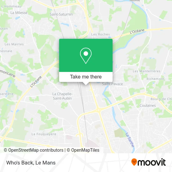
See Who's Back, La Chapelle-Saint-Aubin, on the map
Public Transit to Who's Back in La Chapelle-Saint-Aubin
Wondering how to get to Who's Back in La Chapelle-Saint-Aubin? Moovit helps you find the best way to get to Who's Back with step-by-step directions from the nearest public transit station.
Moovit provides free maps and live directions to help you navigate through your city. View schedules, routes, timetables, and find out how long does it take to get to Who's Back in real time.
Looking for the nearest stop or station to Who's Back? Check out this list of stops closest to your destination: Église La Chapelle-St-Aubin; Frères Renault; Panhard; Bourdonnière; Lafayette.
Bus: 14, 7, 11, 28, 101, 20, 16, 17, T1.
Want to see if there’s another route that gets you there at an earlier time? Moovit helps you find alternative routes or times. Get directions from and directions to Who's Back easily from the Moovit App or Website.
We make riding to Who's Back easy, which is why over 1.5 million users, including users in La Chapelle-Saint-Aubin, trust Moovit as the best app for public transit. You don’t need to download an individual bus app or train app, Moovit is your all-in-one transit app that helps you find the best bus time or train time available.
For information on prices of bus and light rail, costs and ride fares to Who's Back, please check the Moovit app.
Use the app to navigate to popular places including to the airport, hospital, stadium, grocery store, mall, coffee shop, school, college, and university.
Who's Back Address: 56 Rue Louis Delage 72650 La Chapelle-Saint-Aubin street in La Chapelle-Saint-Aubin
- GiFi,
- Zone d'activité Nord,
- Go Sport,
- Conforama,
- Conforama Le Mans,
- ZI Nord,
- Stokomani,
- Intersport,
- Boulanger,
- Sarl Philhand,
- La Scep Sidi,
- Centre Routier le Relais du Mans,
- C d'Enfer,
- IZIVIA Fast,
- Darty,
- La HALLE,
- Gemo,
- Chaussea,
- Action,
- Heppner Le Mans
Places Near Who's Back (La Chapelle-Saint-Aubin)
- Auchan le Mans, La Chapelle-Saint-Aubin,
- Place des Jacobins (le Mans), Le Mans,
- Circuit des 24 Heures du Mans, Le Mans,
- Changé, Changé,
- Family Village, Ruaudin,
- La Chapelle-Saint-Aubin, La Chapelle-Saint-Aubin,
- Pôle Santé Sud-Elsan, Le Mans,
- E.Leclerc, Le Mans,
- Hôpital, Le Mans,
- Maison D'Arrêt Le Mans - Les Croisettes, Coulaines,
- Gare SNCF du Mans, Le Mans,
- Clinique Du Pré, Le Mans,
- Clinique Pôle Santé Sud, Le Mans,
- Coulaines, Coulaines,
- Avenue Bollée, Le Mans,
- Saint-Saturnin, Saint-Saturnin,
- Centre Hospitalier Du Mans, Le Mans,
- Camp du 2e RIMa, Champagné,
- Parc Des Expositions, Le Mans,
- Université, Le Mans
How to get to popular places in Le Mans with public transit
Get around La Chapelle-Saint-Aubin by public transit!
Traveling around La Chapelle-Saint-Aubin has never been so easy. See step by step directions as you travel to any attraction, street or major public transit station. View bus and train schedules, arrival times, service alerts and detailed routes on a map, so you know exactly how to get to anywhere in La Chapelle-Saint-Aubin.
When traveling to any destination around La Chapelle-Saint-Aubin use Moovit's Live Directions with Get Off Notifications to know exactly where and how far to walk, how long to wait for your line, and how many stops are left. Moovit will alert you when it's time to get off — no need to constantly re-check whether yours is the next stop.
Wondering how to use public transit in La Chapelle-Saint-Aubin or how to pay for public transit in La Chapelle-Saint-Aubin? Moovit public transit app can help you navigate your way with public transit easily, and at minimum cost. It includes public transit fees, ticket prices, and costs. Looking for a map of La Chapelle-Saint-Aubin public transit lines? Moovit public transit app shows all public transit maps in La Chapelle-Saint-Aubin with all Bus and Light Rail routes and stops on an interactive map.
Le Mans has 2 transit type(s), including: Bus and Light Rail, operated by several transit agencies, including SETRAM