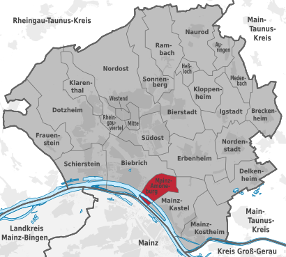
See Wiesbaden-Amöneburg on the map
Directions to Wiesbaden-Amöneburg with public transportation
The following transit lines have routes that pass near Wiesbaden-Amöneburg
 Train:
 - Bus:
- Ferry:
How to get to Wiesbaden-Amöneburg by bus?
Click on the bus route to see step by step directions with maps, line arrival times and updated time schedules.
How to get to Wiesbaden-Amöneburg by train?
Click on the train route to see step by step directions with maps, line arrival times and updated time schedules.
Ferry stations near Wiesbaden-Amöneburg
- Wiesbaden-Biebr. Kd,10 min walk,
Bus stations near Wiesbaden-Amöneburg
- Wiesbaden-Biebrich Kalle,11 min walk,
- Wiesbaden-Biebrich Bahnhof Wiesbaden Ost,12 min walk,
- Wiesbaden-Mainz-Amöneburg Dyckerhoffstraße,24 min walk,
Train stations near Wiesbaden-Amöneburg
- Wiesbaden-Biebrich Bahnhof,16 min walk,
- Wiesbaden-Biebrich Bahnhof Wiesbaden Ost,21 min walk,
Light Rail stations near Wiesbaden-Amöneburg
- Mainz, Zollhafen/Inge-Reitz-Straße,35 min walk,
Bus lines to Wiesbaden-Amöneburg
- 9,Wiesbaden-Schierstein Oderstraße,
- E,Wiesbaden-Schierstein Zeilstraße,
- 39,Wiesbaden-Dotzheim Dr.H.Schmidt-Kliniken - Wiesbaden-Biebrich Bahnhof Wiesbaden Ost,
- E39,Wiesbaden-Biebrich Robert-Krekel-Anlage - Wiesbaden-Dotzheim Wilh.-Leuschner-Straße,
- E6,Wiesbaden Nordfriedhof,
What are the closest stations to Wiesbaden-Amöneburg?
The closest stations to Wiesbaden-Amöneburg are:
- Wiesbaden-Biebr. Kd is 770 meters away, 10 min walk.
- Wiesbaden-Biebrich Kalle is 797 meters away, 11 min walk.
- Wiesbaden-Biebrich Bahnhof Wiesbaden Ost is 849 meters away, 12 min walk.
- Wiesbaden-Biebrich Bahnhof is 1225 meters away, 16 min walk.
- Wiesbaden-Mainz-Amöneburg Dyckerhoffstraße is 1829 meters away, 24 min walk.
- Mainz, Zollhafen/Inge-Reitz-Straße is 2750 meters away, 35 min walk.
Which train lines stop near Wiesbaden-Amöneburg?
These train lines stop near Wiesbaden-Amöneburg: S1, S8, S9.
Which bus lines stop near Wiesbaden-Amöneburg?
These bus lines stop near Wiesbaden-Amöneburg: 6, 9.
What’s the nearest train station to Wiesbaden-Amöneburg?
The nearest train station to Wiesbaden-Amöneburg is Wiesbaden-Biebrich Bahnhof. It’s a 16 min walk away.
What’s the nearest bus stop to Wiesbaden-Amöneburg?
The nearest bus stop to Wiesbaden-Amöneburg is Wiesbaden-Biebrich Kalle. It’s a 11 min walk away.
What’s the nearest ferry station to Wiesbaden-Amöneburg?
The nearest ferry station to Wiesbaden-Amöneburg is Wiesbaden-Biebr. Kd. It’s a 10 min walk away.
What time is the first train to Wiesbaden-Amöneburg?
The S8 is the first train that goes to Wiesbaden-Amöneburg. It stops nearby at 3:07 AM.
What time is the last train to Wiesbaden-Amöneburg?
The S1 is the last train that goes to Wiesbaden-Amöneburg. It stops nearby at 3:49 AM.
What time is the first bus to Wiesbaden-Amöneburg?
The 6 is the first bus that goes to Wiesbaden-Amöneburg. It stops nearby at 3:13 AM.
What time is the last bus to Wiesbaden-Amöneburg?
The 6 is the last bus that goes to Wiesbaden-Amöneburg. It stops nearby at 2:42 AM.
How much is the train fare to Wiesbaden-Amöneburg?
The train fare to Wiesbaden-Amöneburg costs about €2.25.
See Wiesbaden-Amöneburg on the map
Public Transportation to Wiesbaden-Amöneburg
Wondering how to get to Wiesbaden-Amöneburg, Germany? Moovit helps you find the best way to get to Wiesbaden-Amöneburg with step-by-step directions from the nearest public transit station.
Moovit provides free maps and live directions to help you navigate through your city. View schedules, routes, timetables, and find out how long does it take to get to Wiesbaden-Amöneburg in real time.
Looking for the nearest stop or station to Wiesbaden-Amöneburg? Check out this list of stops closest to your destination: Wiesbaden-Biebr. Kd; Wiesbaden-Biebrich Kalle; Wiesbaden-Biebrich Bahnhof Wiesbaden Ost; Wiesbaden-Biebrich Bahnhof; Wiesbaden-Mainz-Amöneburg Dyckerhoffstraße; Mainz.
Train:Bus:Ferry:
Want to see if there’s another route that gets you there at an earlier time? Moovit helps you find alternative routes or times. Get directions from and directions to Wiesbaden-Amöneburg easily from the Moovit App or Website.
We make riding to Wiesbaden-Amöneburg easy, which is why over 1.5 million users, including users in Wiesbaden, trust Moovit as the best app for public transit. You don’t need to download an individual bus app or train app, Moovit is your all-in-one transit app that helps you find the best bus time or train time available.
For information on prices of bus and train, costs and ride fares to Wiesbaden-Amöneburg, please check the Moovit app.
Use the app to navigate to popular places including to the airport, hospital, stadium, grocery store, mall, coffee shop, school, college, and university.
Location: Wiesbaden, Rhein-Main Gebiet
Attractions near Wiesbaden-Amöneburg
Hochhuth,Kalle,Industriepark Kalle-Albert,Mainz-Amöneburg,Biebricher Straße 88,Bizka,Azubi,A.T.U die Nr.1 Meisterwerkstatt,Atu Auto-Teile-Unger,A.T.U,Grund,Soultana,Gerüstebau und Bedachungen Yassin Soultana,Süd Zement Marketing,Johanniter-Unfall-Hilfe e.V. - Ambulanter Pflegedienst Wiesbaden,Kasteler Straße 45,Wfb Fliesen & Bau,Johanniter Unfall-Hilfe Amöneburg,Henry Zocher,Rheingaustraße 190How to get to popular attractions in Wiesbaden with public transit
Compiricus AG, Solmsstrasse, Frankfurt Am Main,Bushaltestelle Pendelbus P43, Frankfurt Am Main,Binding Brauerei, Frankfurt Am Main,Allianz, Frankfurt Am Main,Zoo & Co., Frankfurt Am Main,Ringeltaube, Groß-Gerau,Fernbussteig Mannheimer Straße, Frankfurt Am Main,VDMA, Frankfurt Am Main,FFH HQ, Wetteraukreis,H Heinrich-Hoffmann Straße / Blutspendedienst, Frankfurt Am Main,Goethe Hotel Frankfurt, Frankfurt Am Main,Neuer Jüdischer Friedhof, Frankfurt Am Main,Galeria Kaufhof, Main-Kinzig-Kreis,Galeria Kaufhof, Main-Taunus-Kreis,Nordend, Frankfurt Am Main,Restaurant "Endstation" am Bahnhof Buchschlag, Offenbach,Drees & Sommer GmbH, Frankfurt Am Main,ACHAT Plaza Frankfurt / Offenbach, Offenbach Am Main,Schloß Heusenstamm, Offenbach,ICE 523 Frankfurt - München, Frankfurt Am MainGet around Wiesbaden by public transit!
Traveling around Wiesbaden has never been so easy. See step by step directions as you travel to any attraction, street or major public transit station. View bus and train schedules, arrival times, service alerts and detailed routes on a map, so you know exactly how to get to anywhere in Wiesbaden.
When traveling to any destination around Wiesbaden use Moovit's Live Directions with Get Off Notifications to know exactly where and how far to walk, how long to wait for your line, and how many stops are left. Moovit will alert you when it's time to get off — no need to constantly re-check whether yours is the next stop.
Wondering how to use public transit in Wiesbaden or how to pay for public transit in Wiesbaden? Moovit public transit app can help you navigate your way with public transit easily, and at minimum cost. It includes public transit fees, ticket prices, and costs. Looking for a map of Wiesbaden public transit lines? Moovit public transit app shows all public transit maps in Wiesbaden with all bus or train routes and stops on an interactive map.
Wiesbaden has 2 transit type(s), including: bus or train, operated by several transit agencies, including Stadtwerke Verkehrsgesellschaft Frankfurt, In-der-City-Bus, Stadtwerke Verkehrsgesellschaft Frankfurt, Stadtwerke Verkehrsgesellschaft Frankfurt, DB Regio AG S-Bahn Rhein-Main, Mainzer Mobilität, Mainzer Mobilität, Verkehrsbetriebe Westfalen-Süd GmbH, Magistrat der Stadt Homburg v.d.H., HEAG Mobilo, Stadtverkehr Ingelheim, DB Regio Mitte, Stadtwerke Rüsselsheim, Stadtwerke Gießen and HEAG mobiBus GmbH + Co. KG