Directions to Wildwood State Park (Wading River, Ny) with public transportation
The following transit lines have routes that pass near Wildwood State Park
How to get to Wildwood State Park by bus?
Click on the bus route to see step by step directions with maps, line arrival times and updated time schedules.
Which bus line stops near Wildwood State Park?
S62
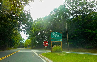
See Wildwood State Park, Wading River, Ny, on the map
Own work
Public Transit to Wildwood State Park in Wading River, Ny
Wondering how to get to Wildwood State Park in Wading River, Ny, United States? Moovit helps you find the best way to get to Wildwood State Park with step-by-step directions from the nearest public transit station.
Moovit provides free maps and live directions to help you navigate through your city. View schedules, routes, timetables, and find out how long does it take to get to Wildwood State Park in real time.
Bus: S62.
Want to see if there’s another route that gets you there at an earlier time? Moovit helps you find alternative routes or times. Get directions from and directions to Wildwood State Park easily from the Moovit App or Website.
We make riding to Wildwood State Park easy, which is why over 1.5 million users, including users in Wading River, Ny, trust Moovit as the best app for public transit. You don’t need to download an individual bus app or train app, Moovit is your all-in-one transit app that helps you find the best bus time or train time available.
For information on prices of bus, subway and train, costs and ride fares to Wildwood State Park, please check the Moovit app.
Get to Wildwood State Park with public transit and pay for the ride in the Moovit app. In addition to all info you may need for your trip to Wildwood State Park, including live directions, real-time arrivals and fare prices, you can also buy public transit passes for your rides. No need for cash or paper tickets to get to Wildwood State Park - everything you need is accessible in the app with a click of the button.
Use the app to navigate to popular places including to the airport, hospital, stadium, grocery store, mall, coffee shop, school, college, and university.
Wildwood State Park Address: Riverhead, NY street in Wading River, Ny
Own work
Attractions near Wildwood State Park
Wildwood Camp Store,Wildwood State Park Beach,1255 Sound Avenue,Wildwood Park Office,Fresh Pond Ave,Sound Fresh Pond Ave,786 Fresh Pond Ave,5th Ave 1st,148 5th Ave,4th St,Pond Ave & 1st St,20 2nd St,Hayden Peach Orchard,113 5th St,39 3rd St,599 Hulse Landing Rd,22nd CR-54,Derby Hill,3rd St,21st HulseHow to get to popular attractions in Wading River, Ny with public transit
Whitestone, NY, Queens,25 Beaver St (Beaver St,25), Manhattan,Harlem Hospital, Manhattan,Florham Park, NJ, Florham Park, Nj,14th St & 8th Ave, Manhattan,Fulton St, Manhattan,Church Street, Manhattan,500 Pearl St, Manhattan,103 Canal St Bus Stop, Manhattan,5 East 98th Street, Manhattan,The Philippine Consulate General, Manhattan,Hunter College, Manhattan,Bloomingdale's, Manhattan,767 3rd Ave, Manhattan,Sojo Spa Club, Edgewater, Nj,299 Broadway, Manhattan,eBay NYC, Manhattan,Edge NYC, Manhattan,Calvary Hospital, Bronx,Paramount Hotel Times Square New York, ManhattanGet around New York - New Jersey by public transit!
Traveling around New York - New Jersey has never been so easy. See step by step directions as you travel to any attraction, street or major public transit station. View bus and train schedules, arrival times, service alerts and detailed routes on a map, so you know exactly how to get to anywhere in New York - New Jersey.
When traveling to any destination around New York - New Jersey use Moovit's Live Directions with Get Off Notifications to know exactly where and how far to walk, how long to wait for your line, and how many stops are left. Moovit will alert you when it's time to get off — no need to constantly re-check whether yours is the next stop.
Wondering how to use public transit in New York - New Jersey or how to pay for public transit in New York - New Jersey? Moovit public transit app can help you navigate your way with public transit easily, and at minimum cost. It includes public transit fees, ticket prices, and costs. Looking for a map of New York - New Jersey public transit lines? Moovit public transit app shows all public transit maps in New York - New Jersey with all Bus, Train, Subway, Light Rail, Ferry and Cable Car routes and stops on an interactive map.
New York - New Jersey has 6 transit type(s), including: Bus, Train, Subway, Light Rail, Ferry and Cable Car, operated by several transit agencies, including MTA Subway, Metro-North Railroad, LIRR, PATH, Shore Line East, MTA Bus Company, MTA New York City Transit - Express routes, MTA Bus, NJ Transit, NYC Ferry, NICE bus, Bee-Line Bus, NJ Transit Rail, Norwalk Transit District, CTTransit - Waterbury-Meriden