See Winooski Falls, Chittenden, on the map
Directions to Winooski Falls (Chittenden) with public transportation
The following transit lines have routes that pass near Winooski Falls
 Bus:
Bus: - Train:
How to get to Winooski Falls by bus?
Click on the bus route to see step by step directions with maps, line arrival times and updated time schedules.
Bus stations near Winooski Falls in Chittenden
- Winooski Falls/Champlain Mill,2 min walk,
- 83 Barlow Street,6 min walk,
- Main Street at Platt Street,9 min walk,
Train stations near Winooski Falls in Chittenden
- Burlington,36 min walk,
Bus lines to Winooski Falls in Chittenden
- 2,Downtown Transit Center - A, C, E, G, I,
- 9,Hickok Street at Elm Street,
- 36,Downtown Transit Center - Spot O,
- 56,Milton Town Office Park & Ride,
- 20,Price Chopper,
- 96,Highgate Commons,
What are the closest stations to Winooski Falls?
The closest stations to Winooski Falls are:
- Winooski Falls/Champlain Mill is 126 yards away, 2 min walk.
- 83 Barlow Street is 457 yards away, 6 min walk.
- Main Street at Platt Street is 757 yards away, 9 min walk.
- Burlington is 2998 yards away, 36 min walk.
Which bus lines stop near Winooski Falls?
These bus lines stop near Winooski Falls: 2, 56.
What’s the nearest bus stop to Winooski Falls in Chittenden?
The nearest bus stop to Winooski Falls in Chittenden is Winooski Falls/Champlain Mill. It’s a 2 min walk away.
What time is the first train to Winooski Falls in Chittenden?
The ETHAN ALLEN EXPRESS is the first train that goes to Winooski Falls in Chittenden. It stops nearby at 10:10 AM.
What time is the last train to Winooski Falls in Chittenden?
The ETHAN ALLEN EXPRESS is the last train that goes to Winooski Falls in Chittenden. It stops nearby at 9:55 PM.
What time is the first bus to Winooski Falls in Chittenden?
The 36 is the first bus that goes to Winooski Falls in Chittenden. It stops nearby at 4:45 AM.
What time is the last bus to Winooski Falls in Chittenden?
The 2 is the last bus that goes to Winooski Falls in Chittenden. It stops nearby at 11:26 PM.
See Winooski Falls, Chittenden, on the map
Public Transit to Winooski Falls in Chittenden
Wondering how to get to Winooski Falls in Chittenden, United States? Moovit helps you find the best way to get to Winooski Falls with step-by-step directions from the nearest public transit station.
Moovit provides free maps and live directions to help you navigate through your city. View schedules, routes, timetables, and find out how long does it take to get to Winooski Falls in real time.
Looking for the nearest stop or station to Winooski Falls? Check out this list of stops closest to your destination: Winooski Falls/Champlain Mill; 83 Barlow Street; Main Street at Platt Street; Burlington.
Bus:Train:
Want to see if there’s another route that gets you there at an earlier time? Moovit helps you find alternative routes or times. Get directions from and directions to Winooski Falls easily from the Moovit App or Website.
We make riding to Winooski Falls easy, which is why over 1.5 million users, including users in Chittenden, trust Moovit as the best app for public transit. You don’t need to download an individual bus app or train app, Moovit is your all-in-one transit app that helps you find the best bus time or train time available.
For information on prices of bus, costs and ride fares to Winooski Falls, please check the Moovit app.
Get to Winooski Falls with public transit and pay for the ride in the Moovit app. In addition to all info you may need for your trip to Winooski Falls, including live directions, real-time arrivals and fare prices, you can also buy public transit passes for your rides. No need for cash or paper tickets to get to Winooski Falls - everything you need is accessible in the app with a click of the button.
Use the app to navigate to popular places including to the airport, hospital, stadium, grocery store, mall, coffee shop, school, college, and university.
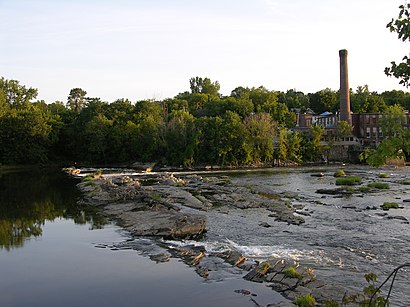
Winooski Falls Address: Cascade Way street in Chittenden
Attractions near Winooski Falls
Cascades at Winooski Falls,Waterworks Food + Drink,Commodities Natural Market,Happy Belly Deli & Grill,Pueblo Bank Trust Company,Reserve My Cube,Riverwatch,Citizens Bank,Winooski Historical Society,Mycube,United Somali Community Counsel,Mobius,Safespace,Vermont Municipal Bond Bank,Lake Champlain Chamber Music Festival,J Loukos Painting,Keen's Crossing,Salon Salon,ChargePoint,Studio SXBHow to get to popular attractions in Chittenden with public transit
Amtrak train 290 Rutland to New York City, Rutland,Dunkin' Donuts, Chittenden,Olive Garden, Chittenden,Killington Ski Resort, Rutland,Lyndonville, VT, Caledonia,Thaddeus Fairbanks Science Wing, Caledonia,Shelburne, VT, Chittenden,I-89 Exit 10,West Rutland, VT, Rutland,Rutland Train Station (RUD) - Amtrak, Rutland,Price Chopper,St. Albans, VT,St Johnsbury, VT, Caledonia,Centennial Parking -UVM Medical Center, Chittenden,CCTA Montpelier LINK,Dirt Chic Resale Clothing, Chittenden,Brandon, VT, Rutland,Faulkner Building - Dartmouth-Hitchcock, Grafton,Poultney, VT, Rutland,Waterbury Park & RideGet around Chittenden by public transit!
Traveling around Chittenden has never been so easy. See step by step directions as you travel to any attraction, street or major public transit station. View bus and train schedules, arrival times, service alerts and detailed routes on a map, so you know exactly how to get to anywhere in Chittenden.
When traveling to any destination around Chittenden use Moovit's Live Directions with Get Off Notifications to know exactly where and how far to walk, how long to wait for your line, and how many stops are left. Moovit will alert you when it's time to get off — no need to constantly re-check whether yours is the next stop.
Wondering how to use public transit in Chittenden or how to pay for public transit in Chittenden? Moovit public transit app can help you navigate your way with public transit easily, and at minimum cost. It includes public transit fees, ticket prices, and costs. Looking for a map of Chittenden public transit lines? Moovit public transit app shows all public transit maps in Chittenden with all bus routes and stops on an interactive map.
Chittenden has 1 transit type(s), including: bus, operated by several transit agencies, including Green Mountain Transit, Wilmington MOOver, Advance Transit, Vermont Translines, Rockingham MOOver, The Bus (Marble Valley Regional Transit District), Green Mountain Express, Rural Community Transportation, Addison County Transit Resources, Stagecoach Transportation Services, Amtrak, Greyhound-us and FlixBus-us