Directions to Winooski Falls Mill District (Chittenden) with public transportation
The following transit lines have routes that pass near Winooski Falls Mill District
How to get to Winooski Falls Mill District by bus?
Click on the bus route to see step by step directions with maps, line arrival times and updated time schedules.
Bus stops near Winooski Falls Mill District in Chittenden
- Winooski Falls/Champlain Mill, 1 min walk,
Bus lines to Winooski Falls Mill District in Chittenden
- 2, Downtown Transit Center - A, C, E, G, I,
- 9, Winooski Falls/Champlain Mill,
- 36, Downtown Transit Center - Spot O,
- 56, Milton Town Office Park & Ride,
What are the closest stations to Winooski Falls Mill District?
The closest stations to Winooski Falls Mill District are:
- Winooski Falls/Champlain Mill is 55 yards away, 1 min walk.
Which bus lines stop near Winooski Falls Mill District?
These bus lines stop near Winooski Falls Mill District: 36, 56.
What’s the nearest bus stop to Winooski Falls Mill District in Chittenden?
The nearest bus stop to Winooski Falls Mill District in Chittenden is Winooski Falls/Champlain Mill. It’s a 1 min walk away.
See Winooski Falls Mill District, Chittenden, on the map
Public Transit to Winooski Falls Mill District in Chittenden
Wondering how to get to Winooski Falls Mill District in Chittenden, United States? Moovit helps you find the best way to get to Winooski Falls Mill District with step-by-step directions from the nearest public transit station.
Moovit provides free maps and live directions to help you navigate through your city. View schedules, routes, timetables, and find out how long does it take to get to Winooski Falls Mill District in real time.
Looking for the nearest stop or station to Winooski Falls Mill District? Check out this list of stops closest to your destination: Winooski Falls/Champlain Mill.
Bus: 36, 56, 2, 9.
Want to see if there’s another route that gets you there at an earlier time? Moovit helps you find alternative routes or times. Get directions from and directions to Winooski Falls Mill District easily from the Moovit App or Website.
We make riding to Winooski Falls Mill District easy, which is why over 1.5 million users, including users in Chittenden, trust Moovit as the best app for public transit. You don’t need to download an individual bus app or train app, Moovit is your all-in-one transit app that helps you find the best bus time or train time available.
For information on prices of bus, costs and ride fares to Winooski Falls Mill District, please check the Moovit app.
Get to Winooski Falls Mill District with public transit and pay for the ride in the Moovit app. In addition to all info you may need for your trip to Winooski Falls Mill District, including live directions, real-time arrivals and fare prices, you can also buy public transit passes for your rides. No need for cash or paper tickets to get to Winooski Falls Mill District - everything you need is accessible in the app with a click of the button.
Use the app to navigate to popular places including to the airport, hospital, stadium, grocery store, mall, coffee shop, school, college, and university.
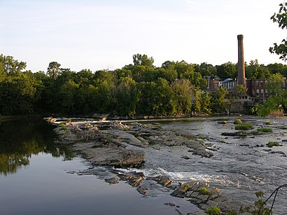
Winooski Falls Mill District Address: Winooski Falls Way street in Chittenden
Attractions near Winooski Falls Mill District
Champlain Mill,Physicians Computer Co,Misery Loves Company Bakeshop,Asian Bistro,Opportunities Credit Union,Victory Circle,Historic Marker: Fort Frederick,Vermont Student Assistance Corporation,Sneakers,Our House,Tiny Thai,Mule Bar,Monkey House,Td Bank,Donny's New York Pizza & Sports Bar,Mckee's Pub & Grill,Edward Jones Investments,Pingala,Purple Shutter Herbs,Aartistic IncHow to get to popular attractions in Chittenden with public transit
Hodson Hall, Chittenden,GVH Studio, Bennington,Vermont FCU (Vermont Federal Credit Union), Addison,New Haven Commons, Addison,Barre Auditorium,Freedley Quarry (historical), Bennington,Champlain Valley Dinner Train, Chittenden,Franklin / Grand Isle Counties Bar Association,Derby Line, VT, Orleans,Windsor Post Office, Windsor,Caring Hearts Pregnancy Center, Addison,Burton Flagship — Headquarters, Chittenden,Littleton Regional Hospital - Joseph P Dellavalla MD, Grafton,Siam Valley Thai Restaurant, Lamoille,Green Mountain Power Substation,Tunbridge Public Library, Orange,Dartmouth Real Estate - Sachem Village, Grafton,Fair Haven, VT, Rutland,Jefferson,Ferry Boat Xing, WindsorGet around Vermont by public transit!
Traveling around Vermont has never been so easy. See step by step directions as you travel to any attraction, street or major public transit station. View bus and train schedules, arrival times, service alerts and detailed routes on a map, so you know exactly how to get to anywhere in Vermont.
When traveling to any destination around Vermont use Moovit's Live Directions with Get Off Notifications to know exactly where and how far to walk, how long to wait for your line, and how many stops are left. Moovit will alert you when it's time to get off — no need to constantly re-check whether yours is the next stop.
Wondering how to use public transit in Vermont or how to pay for public transit in Vermont? Moovit public transit app can help you navigate your way with public transit easily, and at minimum cost. It includes public transit fees, ticket prices, and costs. Looking for a map of Vermont public transit lines? Moovit public transit app shows all public transit maps in Vermont with all Bus and Train routes and stops on an interactive map.
Vermont has 2 transit type(s), including: Bus and Train, operated by several transit agencies, including Green Mountain Transit, Wilmington MOOver, Advance Transit, Vermont Translines, Rockingham MOOver, The Bus (Marble Valley Regional Transit District), Green Mountain Express, Rural Community Transportation, Addison County Transit Resources, Stagecoach Transportation Services, Amtrak, Greyhound-us, FlixBus-us