See Winston Churchill Collegiate, Toronto, on the map
Directions to Winston Churchill Collegiate (Toronto) with public transportation
The following transit lines have routes that pass near Winston Churchill Collegiate
 Bus:
Bus: - Train:
- Subway:
How to get to Winston Churchill Collegiate by bus?
Click on the bus route to see step by step directions with maps, line arrival times and updated time schedules.
How to get to Winston Churchill Collegiate by train?
Click on the train route to see step by step directions with maps, line arrival times and updated time schedules.
How to get to Winston Churchill Collegiate by subway?
Click on the subway route to see step by step directions with maps, line arrival times and updated time schedules.
Bus stations near Winston Churchill Collegiate in Toronto
- 2239 Lawrence Ave East,2 min walk,
- Lawrence Ave East At Canlish Rd West Side,3 min walk,
Bus lines to Winston Churchill Collegiate in Toronto
- 54A,Starspray Loop at Lawrence Ave East,
- 54B,Brimorton Dr at Orton Park Rd,
- 354,Eglinton Ave West at Yonge St West Side,
- 54,Eglinton Station,
What are the closest stations to Winston Churchill Collegiate?
The closest stations to Winston Churchill Collegiate are:
- 2239 Lawrence Ave East is 103 meters away, 2 min walk.
- Lawrence Ave East At Canlish Rd West Side is 189 meters away, 3 min walk.
Which bus line stops near Winston Churchill Collegiate?
54
Which train line stops near Winston Churchill Collegiate?
ST
Which subway lines stop near Winston Churchill Collegiate?
These subway lines stop near Winston Churchill Collegiate: 2, 3.
What’s the nearest bus stop to Winston Churchill Collegiate in Toronto?
The nearest bus stop to Winston Churchill Collegiate in Toronto is 2239 Lawrence Ave East. It’s a 2 min walk away.
See Winston Churchill Collegiate, Toronto, on the map
Public Transit to Winston Churchill Collegiate in Toronto
Wondering how to get to Winston Churchill Collegiate in Toronto, Canada? Moovit helps you find the best way to get to Winston Churchill Collegiate with step-by-step directions from the nearest public transit station.
Moovit provides free maps and live directions to help you navigate through your city. View schedules, routes, timetables, and find out how long does it take to get to Winston Churchill Collegiate in real time.
Looking for the nearest stop or station to Winston Churchill Collegiate? Check out this list of stops closest to your destination: 2239 Lawrence Ave East; Lawrence Ave East At Canlish Rd West Side.
Bus:Train:Subway:
Want to see if there’s another route that gets you there at an earlier time? Moovit helps you find alternative routes or times. Get directions from and directions to Winston Churchill Collegiate easily from the Moovit App or Website.
We make riding to Winston Churchill Collegiate easy, which is why over 1.5 million users, including users in Toronto, trust Moovit as the best app for public transit. You don’t need to download an individual bus app or train app, Moovit is your all-in-one transit app that helps you find the best bus time or train time available.
For information on prices of bus, subway and train, costs and ride fares to Winston Churchill Collegiate, please check the Moovit app.
Use the app to navigate to popular places including to the airport, hospital, stadium, grocery store, mall, coffee shop, school, college, and university.
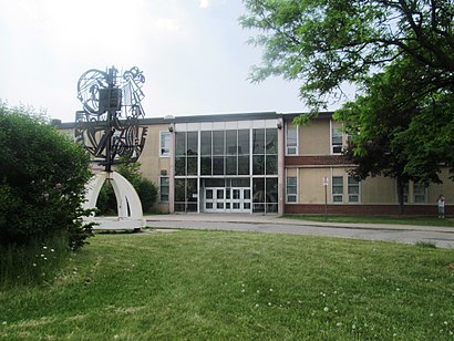
Winston Churchill Collegiate Address: 2239 Lawrence Ave E (at Kennedy) street in Toronto
Attractions near Winston Churchill Collegiate
M1P 2P7,Scarborough Mcgregor Park Ctr,2239 Lawrence Avenue East,McGregor Park Arena,Pizza Nova Dining Rooms,McGregor Park,Brideo of Yeshua Ministry,Winston Churchill Collegiate Institute,McGregor Park Recreation Centre,#2,Toronto Home Comfort,Mcgregor Arena,Mcgregor Park Community Recreation Centre,Mc Gregor Park Library,McGregor Community Centre,St. Lawrence Catholic School,National Bank of Greece,St Lawrence Church,Church Of St. Lawrence Martyr (R-C),2210 Lawrence Ave EHow to get to popular attractions in Toronto with public transit
Fresh On Spadina, Toronto,Kinka Izakaya, Toronto,Barrie, Ontario, Barrie,Gateway Terminal, Brampton,Union Restaurant, Toronto,Brampton ON, Brampton,Starbucks, Toronto,Starbucks, Waterloo,Starbucks, Toronto,Outlet Collection at Niagara, Niagara-On-The-Lake,Humber College - Lakeshore Campus, Toronto,Phoenix Restaurant 金鳳餐廳, Markham,City of St. Catharines, St. Catharines,Niagara College, Welland,Oshawa GO Station, Oshawa,GoodLife Fitness Centres, Toronto,Jack Astor's Bar & Grill, Toronto,Insomnia Restaurant and Lounge, Toronto,Canadian Tire Home Office, Toronto,Terminal 1 - Toronto Pearson Int'L Airport, MississaugaGet around Toronto by public transit!
Traveling around Toronto has never been so easy. See step by step directions as you travel to any attraction, street or major public transit station. View bus and train schedules, arrival times, service alerts and detailed routes on a map, so you know exactly how to get to anywhere in Toronto.
When traveling to any destination around Toronto use Moovit's Live Directions with Get Off Notifications to know exactly where and how far to walk, how long to wait for your line, and how many stops are left. Moovit will alert you when it's time to get off — no need to constantly re-check whether yours is the next stop.
Wondering how to use public transit in Toronto or how to pay for public transit in Toronto? Moovit public transit app can help you navigate your way with public transit easily, and at minimum cost. It includes public transit fees, ticket prices, and costs. Looking for a map of Toronto public transit lines? Moovit public transit app shows all public transit maps in Toronto with all bus, subway or train routes and stops on an interactive map.
Toronto has 3 transit type(s), including: bus, subway or train, operated by several transit agencies, including TTC, TTC Streetcar, Toronto Subway, GO Transit Bus, GO Transit, Amtrak, York Region Transit, Grand River Transit, Guelph Transit, grt, Hamilton Street Railway, MiWay, Brampton Transit, Burlington Transit and Oakville Transit