How to get to Wireless Zone by bus?
Click on the bus route to see step by step directions with maps, line arrival times and updated time schedules.
How to get to Wireless Zone by train?
Click on the train route to see step by step directions with maps, line arrival times and updated time schedules.
How to get to Wireless Zone by subway?
Click on the subway route to see step by step directions with maps, line arrival times and updated time schedules.
Bus stop near Wireless Zone in Braintree Town
- Granite St @ West St, 2 min walk,VIEW
Train station near Wireless Zone in Braintree Town
- Braintree, 27 min walk,VIEW
Subway station near Wireless Zone in Braintree Town
- Braintree, 29 min walk,VIEW
What are the closest stations to Wireless Zone?
The closest stations to Wireless Zone are:
- Granite St @ West St is 109 yards away, 2 min walk.
- Braintree is 2281 yards away, 27 min walk.
Which bus lines stop near Wireless Zone?
These bus lines stop near Wireless Zone: 230, 236, 238.
Which train lines stop near Wireless Zone?
These train lines stop near Wireless Zone: FALL RIVER/NEW BEDFORD, KINGSTON.
Which subway line stops near Wireless Zone?
RED LINE (Ashmont/Braintree)
What’s the nearest subway station to Wireless Zone in Braintree Town?
The nearest subway station to Wireless Zone in Braintree Town is Braintree. It’s a 29 min walk away.
What’s the nearest train station to Wireless Zone in Braintree Town?
The nearest train station to Wireless Zone in Braintree Town is Braintree. It’s a 27 min walk away.
What’s the nearest bus station to Wireless Zone in Braintree Town?
The nearest bus station to Wireless Zone in Braintree Town is Granite St @ West St. It’s a 2 min walk away.
What time is the first subway to Wireless Zone in Braintree Town?
The RED LINE is the first subway that goes to Wireless Zone in Braintree Town. It stops nearby at 5:09 AM.
What time is the last subway to Wireless Zone in Braintree Town?
The RED LINE is the last subway that goes to Wireless Zone in Braintree Town. It stops nearby at 2:00 AM.
What time is the first train to Wireless Zone in Braintree Town?
The FALL RIVER/NEW BEDFORD is the first train that goes to Wireless Zone in Braintree Town. It stops nearby at 5:27 AM.
What time is the last train to Wireless Zone in Braintree Town?
The KINGSTON is the last train that goes to Wireless Zone in Braintree Town. It stops nearby at 12:25 AM.
What time is the first bus to Wireless Zone in Braintree Town?
The 238 is the first bus that goes to Wireless Zone in Braintree Town. It stops nearby at 5:16 AM.
What time is the last bus to Wireless Zone in Braintree Town?
The 238 is the last bus that goes to Wireless Zone in Braintree Town. It stops nearby at 11:20 PM.
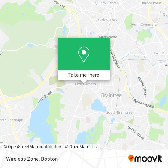
See Wireless Zone, Braintree Town, on the map
Public Transit to Wireless Zone in Braintree Town
Wondering how to get to Wireless Zone in Braintree Town? Moovit helps you find the best way to get to Wireless Zone with step-by-step directions from the nearest public transit station.
Moovit provides free maps and live directions to help you navigate through your city. View schedules, routes, timetables, and find out how long does it take to get to Wireless Zone in real time.
Looking for the nearest stop or station to Wireless Zone? Check out this list of stops closest to your destination: Granite St @ West St; Braintree.
Bus: 230, 236, 238.Train: FALL RIVER/NEW BEDFORD, KINGSTON, CAPEFLYER.Subway: RED LINE.
Want to see if there’s another route that gets you there at an earlier time? Moovit helps you find alternative routes or times. Get directions from and directions to Wireless Zone easily from the Moovit App or Website.
We make riding to Wireless Zone easy, which is why over 1.7 million users, including users in Braintree Town, trust Moovit as the best app for public transit. You don’t need to download an individual bus app or train app, Moovit is your all-in-one transit app that helps you find the best bus time or train time available.
For information on prices of bus, train and subway, costs and ride fares to Wireless Zone, please check the Moovit app.
Use the app to navigate to popular places including to the airport, hospital, stadium, grocery store, mall, coffee shop, school, college, and university.
Wireless Zone Address: 539 Granite St Braintree, MA 02184 street in Braintree Town
- Chase Atm,
- Braintree Carpet Cleaning,
- US Trust,
- Chase Home Lending,
- Affordable Housing And Services Collaborative,
- Peabody Companies,
- Bank Of America Walk-Up Atm | Braintree-Franklin Remote,
- Visiting Nurse Associations,
- Edward J Deluca Jr & Company PC,
- 5 Corners Convenience Store,
- Montessori Kids Universe Of Braintree,
- Friends' Automotive,
- Bertucci's Italian Restaurant,
- Curtin-Twinbrook Insurance Agency,
- Children of America Braintree,
- Edward J. Deluca Jr. And Company,
- Rockland Recovery,
- Kaplansky Insurance,
- Coinhub,
- Braintree Five Corners Center
Places Near Wireless Zone (Braintree Town)
- Museum Of Science, Boston,
- Quincy Market, Boston,
- Wilbur Theatre, Boston,
- Wang Theater, Boston,
- Faneuil Hall, Boston,
- North End, Boston,
- House Of Blues, Boston,
- Boston Common, Boston,
- Seaport District, Boston,
- Prudential Center, Boston,
- Cheers, Boston,
- Boston Children's Hospital, Boston,
- Mgm Music Hall, Boston,
- Boston Medical Center, Boston,
- Castle Island, Boston,
- Isabella Stewart Gardner Museum, Boston,
- Boston Convention & Exhibition Center, Boston,
- Massachusetts General Hospital, Boston,
- Td Garden, Boston,
- Leader Bank Pavilion (Leader Bank Pavillion), Boston
How to get to popular places in Boston with public transit
Get around Braintree Town by public transit!
Traveling around Braintree Town has never been so easy. See step by step directions as you travel to any attraction, street or major public transit station. View bus and train schedules, arrival times, service alerts and detailed routes on a map, so you know exactly how to get to anywhere in Braintree Town.
When traveling to any destination around Braintree Town use Moovit's Live Directions with Get Off Notifications to know exactly where and how far to walk, how long to wait for your line, and how many stops are left. Moovit will alert you when it's time to get off — no need to constantly re-check whether yours is the next stop.
Wondering how to use public transit in Braintree Town or how to pay for public transit in Braintree Town? Moovit public transit app can help you navigate your way with public transit easily, and at minimum cost. It includes public transit fees, ticket prices, and costs. Looking for a map of Braintree Town public transit lines? Moovit public transit app shows all public transit maps in Braintree Town with all Bus, Train, Subway and Ferry routes and stops on an interactive map.
Boston has 4 transit type(s), including: Bus, Train, Subway and Ferry, operated by several transit agencies, including MBTA, Southeastern Regional Transit Authority, MetroWest Regional Transit Authority, Rhode Island Public Transit Authority, WRTA, Lowell Regional Transit Authority, Merrimack Valley Transit, Montachusett Regional Transit Authority, Cape Cod Regional Transit Authority, Brockton Area Transit Authority, Martha's Vineyard Transit Authority, the WAVE - Nantucket Regional Transit Authority, GATRA, Cape Ann Transportation Authority and Massport