Directions to Wisconsin Lutheran High School (Milwaukee - Waukesha, WI) with public transportation
The following transit lines have routes that pass near Wisconsin Lutheran High School
How to get to Wisconsin Lutheran High School by bus?
Click on the bus route to see step by step directions with maps, line arrival times and updated time schedules.
Bus stations near Wisconsin Lutheran High School in Milwaukee - Waukesha, WI
- Glenview & Wisc Luth High School,3 min walk,
- Bluemound & Glenview Brt Station,6 min walk,
- Doyne & Coffey,16 min walk,
Bus lines to Wisconsin Lutheran High School in Milwaukee - Waukesha, WI
- 33,To Downtown - Vliet - 84th,
- CN1,Connect 1 - To Medical Center,
- 1,Downtown Transit Center,
What are the closest stations to Wisconsin Lutheran High School?
The closest stations to Wisconsin Lutheran High School are:
- Glenview & Wisc Luth High School is 175 yards away, 3 min walk.
- Bluemound & Glenview Brt Station is 401 yards away, 6 min walk.
- Doyne & Coffey is 1283 yards away, 16 min walk.
Which bus lines stop near Wisconsin Lutheran High School?
These bus lines stop near Wisconsin Lutheran High School: 33, CN1.
What’s the nearest bus stop to Wisconsin Lutheran High School in Milwaukee - Waukesha, WI?
The nearest bus stop to Wisconsin Lutheran High School in Milwaukee - Waukesha, WI is Glenview & Wisc Luth High School. It’s a 3 min walk away.
What time is the first bus to Wisconsin Lutheran High School in Milwaukee - Waukesha, WI?
The CN1 is the first bus that goes to Wisconsin Lutheran High School in Milwaukee - Waukesha, WI. It stops nearby at 4:51 AM.
What time is the last bus to Wisconsin Lutheran High School in Milwaukee - Waukesha, WI?
The CN1 is the last bus that goes to Wisconsin Lutheran High School in Milwaukee - Waukesha, WI. It stops nearby at 1:41 AM.
See Wisconsin Lutheran High School, Milwaukee - Waukesha, WI, on the map
Public Transit to Wisconsin Lutheran High School in Milwaukee - Waukesha, WI
Wondering how to get to Wisconsin Lutheran High School in Milwaukee - Waukesha, WI, United States? Moovit helps you find the best way to get to Wisconsin Lutheran High School with step-by-step directions from the nearest public transit station.
Moovit provides free maps and live directions to help you navigate through your city. View schedules, routes, timetables, and find out how long does it take to get to Wisconsin Lutheran High School in real time.
Looking for the nearest stop or station to Wisconsin Lutheran High School? Check out this list of stops closest to your destination: Glenview & Wisc Luth High School; Bluemound & Glenview Brt Station; Doyne & Coffey.
Bus:33CN11
Want to see if there’s another route that gets you there at an earlier time? Moovit helps you find alternative routes or times. Get directions from and directions to Wisconsin Lutheran High School easily from the Moovit App or Website.
We make riding to Wisconsin Lutheran High School easy, which is why over 1.5 million users, including users in Milwaukee - Waukesha, WI, trust Moovit as the best app for public transit. You don’t need to download an individual bus app or train app, Moovit is your all-in-one transit app that helps you find the best bus time or train time available.
For information on prices of bus, costs and ride fares to Wisconsin Lutheran High School, please check the Moovit app.
Use the app to navigate to popular places including to the airport, hospital, stadium, grocery store, mall, coffee shop, school, college, and university.
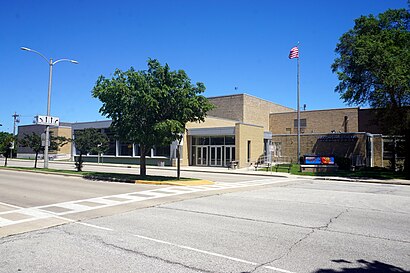
Wisconsin Lutheran High School Address: North Glenview Avenue street in Milwaukee - Waukesha, WI
Attractions near Wisconsin Lutheran High School
Wisconsin Lutheran High School,Jackson Hewitt Tax Service,Brown Deer Track & Field,Shorewest,84th And Bluemound,Coinstar,Coinstar - Bitcoin ATM,Ch2m Hill,New York Life,Time of Grace,New York Life - Milwaukee,Good of Calvary Assembly,Ete Esthetics,Wisconsin Lutheran College - Fine Arts Building,Ustitleco,St Charles Main Campus R,Honey Creek Parkway, Wisconsin,Mike Quist,Rob's Pub,67 Bus Northbound (Glenview & Wisconsin)How to get to popular attractions in Milwaukee - Waukesha, WI with public transit
Division Of Vocational Rehabilitation (DVR), Waukesha,Froedtert Hospital Cafeteria, Wauwatosa,JJ Wigglebutt's Gloryhole Emporium,Educators Credit Union,Golda Meir Library,Raccoon City, Cudahy,Bell Therapy Day One,Rockwell Automation - Temperature Bldg,St. Luke's Dakota Parking Structure,Barstow Street Dam, Waukesha,Aurora West Allis Memorial Physicians Office Building,Keyser Hall- St. Anthony,Waukesha Memorial Hospital Day Surgery waiting Room, Waukesha,124th & national,Hales Corners, Hales Corners,Greenline Bus Stop (Cambridge & Brady / Farwell),Woodman's Oil Change, Oak Creek,Drexel Town Square, Oak Creek,Grant Park Mill Pond, South Milwaukee,Lad Lake Synergy SchoolGet around Milwaukee - Waukesha, WI by public transit!
Traveling around Milwaukee - Waukesha, WI has never been so easy. See step by step directions as you travel to any attraction, street or major public transit station. View bus and train schedules, arrival times, service alerts and detailed routes on a map, so you know exactly how to get to anywhere in Milwaukee - Waukesha, WI.
When traveling to any destination around Milwaukee - Waukesha, WI use Moovit's Live Directions with Get Off Notifications to know exactly where and how far to walk, how long to wait for your line, and how many stops are left. Moovit will alert you when it's time to get off — no need to constantly re-check whether yours is the next stop.
Wondering how to use public transit in Milwaukee - Waukesha, WI or how to pay for public transit in Milwaukee - Waukesha, WI? Moovit public transit app can help you navigate your way with public transit easily, and at minimum cost. It includes public transit fees, ticket prices, and costs. Looking for a map of Milwaukee - Waukesha, WI public transit lines? Moovit public transit app shows all public transit maps in Milwaukee - Waukesha, WI with all bus routes and stops on an interactive map.
Milwaukee - Waukesha, WI has 1 transit type(s), including: bus, operated by several transit agencies, including Milwaukee County Transit System, City of Milwaukee, City of Waukesha, Waukesha County Transit, Shoreline Metro, Janesville Transit System, Beloit Transit System, Indian Trails, Wisconsin Coach Lines and Van Galder (Coach USA)