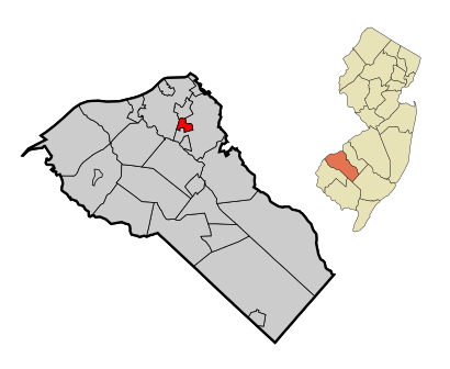
See Woodbury Heights on the map
Directions to Woodbury Heights with public transportation
The following transit lines have routes that pass near Woodbury Heights
 Bus:
Bus:
How to get to Woodbury Heights by bus?
Click on the bus route to see step by step directions with maps, line arrival times and updated time schedules.
Bus stations near Woodbury Heights
- Woodbury-Glassboro Rd At Elm Ave#,7 min walk,
Bus lines to Woodbury Heights
- 412,Brooklawn Exp Glassboro Holly Dell,
What are the closest stations to Woodbury Heights?
The closest stations to Woodbury Heights are:
- Woodbury-Glassboro Rd At Elm Ave# is 552 yards away, 7 min walk.
Which bus line stops near Woodbury Heights?
410
What’s the nearest bus stop to Woodbury Heights?
The nearest bus stop to Woodbury Heights is Woodbury-Glassboro Rd At Elm Ave#. It’s a 7 min walk away.
See Woodbury Heights on the map
Public Transportation to Woodbury Heights
Wondering how to get to Woodbury Heights, United States? Moovit helps you find the best way to get to Woodbury Heights with step-by-step directions from the nearest public transit station.
Moovit provides free maps and live directions to help you navigate through your city. View schedules, routes, timetables, and find out how long does it take to get to Woodbury Heights in real time.
Looking for the nearest stop or station to Woodbury Heights? Check out this list of stops closest to your destination: Woodbury-Glassboro Rd At Elm Ave#.
Bus:
Want to see if there’s another route that gets you there at an earlier time? Moovit helps you find alternative routes or times. Get directions from and directions to Woodbury Heights easily from the Moovit App or Website.
We make riding to Woodbury Heights easy, which is why over 1.5 million users, including users in Woodbury Heights, trust Moovit as the best app for public transit. You don’t need to download an individual bus app or train app, Moovit is your all-in-one transit app that helps you find the best bus time or train time available.
For information on prices of bus and subway, costs and ride fares to Woodbury Heights, please check the Moovit app.
Use the app to navigate to popular places including to the airport, hospital, stadium, grocery store, mall, coffee shop, school, college, and university.
Location: Woodbury Heights, Philadelphia
Attractions near Woodbury Heights
Вудбюри Хэйтс,وودبوری هایتس، نیوجرسی,Вудбери Хајтс,08097,Cana Inc,Phalines JD Inc,First Presbyterian Chr,421 Elm Ave,Grove Construction Co,313 Elm Ave,415 Poplar Ave,Central Avenue,TBL Drainage & Mechanical,New Jersey Tpke,J&M Enterprises,Lit Enterprises Inc,P C S Consulting & Services In,315 Maple Ave,St. Margaret Regional School - Woodbury Heights, NJ,St Margaret Regional SchoolHow to get to popular attractions in Woodbury Heights with public transit
McCarter Theatre, Princeton,Newtown Athletic Club,Spring Valley YMCA, Limerick,Community College Of Philadelphia, Philadelphia,Iron Abbey, Horsham,Moriarty's Restaurant & Irish Pub, Philadelphia,Burlington Coat Factory Corporate Office,Hyatt Regency Princeton,Three Monkeys Café, Philadelphia,McCormick & Schmick's Seafood and Steaks, Philadelphia,Gloucester City, NJ, Gloucester City,Lawrenceville, NJ,Hamilton Square, NJ, Hamilton Square,Vedge, Philadelphia,Continental Restaurant & Martini Bar, Philadelphia,Amtrak / SEPTA: Exton Station (EXT), West Whiteland,Independence Blue Cross, Philadelphia,Pottstown, PA, Pottstown,Plainsboro, NJ, Plainsboro Center,Cuba Libre Restaurant & Rum Bar, PhiladelphiaGet around Woodbury Heights by public transit!
Traveling around Woodbury Heights has never been so easy. See step by step directions as you travel to any attraction, street or major public transit station. View bus and train schedules, arrival times, service alerts and detailed routes on a map, so you know exactly how to get to anywhere in Woodbury Heights.
When traveling to any destination around Woodbury Heights use Moovit's Live Directions with Get Off Notifications to know exactly where and how far to walk, how long to wait for your line, and how many stops are left. Moovit will alert you when it's time to get off — no need to constantly re-check whether yours is the next stop.
Wondering how to use public transit in Woodbury Heights or how to pay for public transit in Woodbury Heights? Moovit public transit app can help you navigate your way with public transit easily, and at minimum cost. It includes public transit fees, ticket prices, and costs. Looking for a map of Woodbury Heights public transit lines? Moovit public transit app shows all public transit maps in Woodbury Heights with all bus or subway routes and stops on an interactive map.
Woodbury Heights has 2 transit type(s), including: bus or subway, operated by several transit agencies, including SEPTA Subway, SEPTA Trolley, SEPTA Rail, SEPTA, SEPTA, NJ TRANSIT RAIL-Rail, NJ TRANSIT RAIL-Tram, NJ TRANSIT BUS, Port Authority Transit Corporation, Navy Yard, Penn Transit, Drexel University, Pottstown Area Rapid Transit (PART), Fullington Tours and Chescobus