How to get to Working Data Everywhere by bus?
Click on the bus route to see step by step directions with maps, line arrival times and updated time schedules.
From BG-Unfallklinik, Ludwigshafen-Nördliche Innenstadt
76 minFrom Möbel Höffner, Schwetzingen
71 minFrom Globus Getränkemarkt, Ludwigshafen-Oggersheim
111 minFrom Berufsbildende Schule Technik 2, Ludwigshafen-Mundenheim
216 minFrom Hauptfeuerwache, Berufsfeuerwehr Mannheim, Neckarau
73 minFrom Hans-Warsch-Platz,Ludwigshafen Oggersheim, Ludwigshafen-Oggersheim
68 minFrom GRN-Klinik Schwetzingen, Schwetzingen
117 minFrom Globus Getränkecenter, Ludwigshafen-Oggersheim
110 min
How to get to Working Data Everywhere by train?
Click on the train route to see step by step directions with maps, line arrival times and updated time schedules.
From BG-Unfallklinik, Ludwigshafen-Nördliche Innenstadt
52 minFrom Möbel Höffner, Schwetzingen
52 minFrom Berufsbildende Schule Technik 2, Ludwigshafen-Mundenheim
63 minFrom Hauptfeuerwache, Berufsfeuerwehr Mannheim, Neckarau
46 minFrom Hans-Warsch-Platz,Ludwigshafen Oggersheim, Ludwigshafen-Oggersheim
48 minFrom GRN-Klinik Schwetzingen, Schwetzingen
56 minFrom Krankenhaus GRN, Weinheim
85 minFrom Schön Klinik Lorsch Se, Lorsch
61 min
Bus stops near Working Data Everywhere in Waldhof
Light Rail stations near Working Data Everywhere in Waldhof
- Waldstraße, 6 min walk,VIEW
Train station near Working Data Everywhere in Waldhof
- Waldhof, Bahnhof, 9 min walk,VIEW
Bus lines to Working Data Everywhere in Waldhof
- RNV 53, Luzenberg,VIEW
- 55, Käfertal Bf,VIEW
- RNV 55, Waldhof, Bahnhof,VIEW
- RNV 4, Waldhof, Waldfriedhof,VIEW
- 55E, Herzogenriedstraße,VIEW
- 1, Rheinau Bahnhof,VIEW
- 50, Waldhof Bahnhof,VIEW
- 41, Feudenheim,VIEW
- RE70, Mannheim, Hauptbahnhof - Frankfurt (Main) Hauptbahnhof,VIEW
- RNV 1, Neckarau, Friedrichstraße Bstg A - Schönau Bstg A,VIEW
- RNV 45, Neuostheim Bstg A - Waldhof, Bahnhof Bstg B,VIEW
- RNV 50, Neckarau, West - Schönau Bstg C,VIEW
- S8, Mannheim, Hauptbahnhof - Biblis, Bahnhof,VIEW
- S9, Graben-Neudorf Gleis 5 - Mannheim, Hauptbahnhof,VIEW
What are the closest stations to Working Data Everywhere?
The closest stations to Working Data Everywhere are:
- Waldhof, Haus Waldhof is 115 meters away, 2 min walk.
- Haus Waldhof is 139 meters away, 2 min walk.
- Waldhof, Waldstraße is 430 meters away, 6 min walk.
- Waldstraße is 442 meters away, 6 min walk.
- Waldhof Bahnhof is 615 meters away, 9 min walk.
- Waldhof, Bahnhof is 660 meters away, 9 min walk.
Which train lines stop near Working Data Everywhere?
These train lines stop near Working Data Everywhere: RE70, S10, S9.
Which light rail lines stop near Working Data Everywhere?
These light rail lines stop near Working Data Everywhere: 1, S9.
Which bus lines stop near Working Data Everywhere?
These bus lines stop near Working Data Everywhere: 50, 60, RNV 50, RNV 53.
What’s the nearest light rail station to Working Data Everywhere in Waldhof?
The nearest light rail station to Working Data Everywhere in Waldhof is Waldstraße. It’s a 6 min walk away.
What’s the nearest train station to Working Data Everywhere in Waldhof?
The nearest train station to Working Data Everywhere in Waldhof is Waldhof, Bahnhof. It’s a 9 min walk away.
What’s the nearest bus station to Working Data Everywhere in Waldhof?
The nearest bus stations to Working Data Everywhere in Waldhof are Waldhof, Haus Waldhof and Haus Waldhof. The closest one is a 2 min walk away.
What time is the first light rail to Working Data Everywhere in Waldhof?
The 1 is the first light rail that goes to Working Data Everywhere in Waldhof. It stops nearby at 3:15 AM.
What time is the last light rail to Working Data Everywhere in Waldhof?
The 1 is the last light rail that goes to Working Data Everywhere in Waldhof. It stops nearby at 3:15 AM.
What time is the first train to Working Data Everywhere in Waldhof?
The RE70 is the first train that goes to Working Data Everywhere in Waldhof. It stops nearby at 4:40 AM.
What time is the last train to Working Data Everywhere in Waldhof?
The RE70 is the last train that goes to Working Data Everywhere in Waldhof. It stops nearby at 1:17 AM.
What time is the first bus to Working Data Everywhere in Waldhof?
The 55 is the first bus that goes to Working Data Everywhere in Waldhof. It stops nearby at 5:00 AM.
What time is the last bus to Working Data Everywhere in Waldhof?
The 53 is the last bus that goes to Working Data Everywhere in Waldhof. It stops nearby at 12:41 AM.
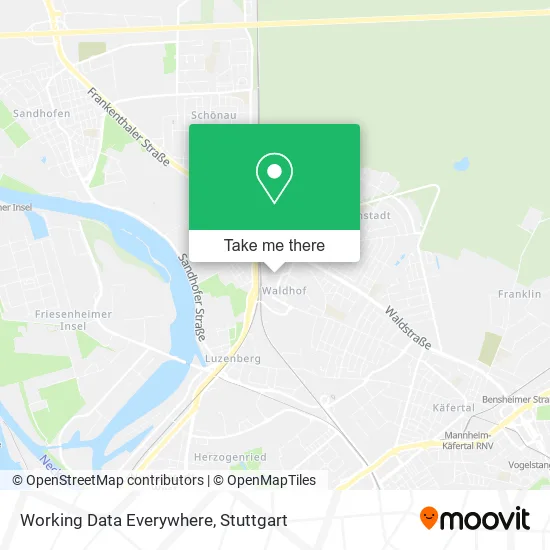
See Working Data Everywhere, Waldhof, on the map
Public Transit to Working Data Everywhere in Waldhof
Wondering how to get to Working Data Everywhere in Waldhof? Moovit helps you find the best way to get to Working Data Everywhere with step-by-step directions from the nearest public transit station.
Moovit provides free maps and live directions to help you navigate through your city. View schedules, routes, timetables, and find out how long does it take to get to Working Data Everywhere in real time.
Looking for the nearest stop or station to Working Data Everywhere? Check out this list of stops closest to your destination: Waldhof, Haus Waldhof; Haus Waldhof; Waldhof, Waldstraße; Waldstraße; Waldhof Bahnhof; Waldhof, Bahnhof.
Train: RE70, S10, S9.Light Rail: 1, S9.Bus: 50, 60, RNV 50, RNV 53, 55, RNV 55, RNV 4, 55E.
Want to see if there’s another route that gets you there at an earlier time? Moovit helps you find alternative routes or times. Get directions from and directions to Working Data Everywhere easily from the Moovit App or Website.
We make riding to Working Data Everywhere easy, which is why over 1.5 million users, including users in Waldhof, trust Moovit as the best app for public transit. You don’t need to download an individual bus app or train app, Moovit is your all-in-one transit app that helps you find the best bus time or train time available.
For information on prices of light rail, bus and train, costs and ride fares to Working Data Everywhere, please check the Moovit app.
Use the app to navigate to popular places including to the airport, hospital, stadium, grocery store, mall, coffee shop, school, college, and university.
Working Data Everywhere Address: Carl-Reuther-Straße 1 Käfertal, 68305 Mannheim street in Waldhof
- Sowge,
- Abex Gienger,
- Hiphop Danceschool Shakadelix,
- Applus Rtd Mannheim,
- Brandsync,
- Altun Isoliertechnik,
- Demirdag Bautechnik & Bausanierung,
- Trio-Group I.Am Communication & Marketing,
- Ciper & Coll. Rechtsanwälte Mannheim,
- Bf Baukonzept Fidelitas,
- Baubüro by Rhein-Neckar,
- Aginag,
- Tsm Total Safety Management,
- Ocs Gesellschaft für EDV-Dienstleistungen,
- Gif Solutions,
- Moreweb Solutions,
- Kfz-Gutachter Wolf,
- Interlogis-Consult,
- Piening Personal,
- Vag-Armaturen
Places Near Working Data Everywhere (Waldhof)
- Klinikum Stuttgart - Katharinenhospital, Stuttgart-Mitte,
- Geilhaus Haus 33a, Reutlingen-Betzingen,
- Wilhelma (U-Bahn Wilhelma), Bad Cannstatt,
- Porsche Museum, Zuffenhausen,
- Im Wizemann (Halle), Bad Cannstatt,
- Waldfriedhof, Degerloch,
- Mercedes-Benz Museum, Bad Cannstatt,
- Pariser Platz Stuttgart, Stuttgart-Mitte,
- Hauptbahnhof Stuttgart, Stuttgart-Mitte,
- Hanns-Martin-Schleyer-Halle (Stuttgart Hans-Martin-Schleyerhalle), Bad Cannstatt,
- SI-Centrum, Möhringen,
- Mercedes-Benz Museum (Mercedes Museum Stuttgart), Bad Cannstatt,
- Marmorsaal Im Weissenburgpark, Stuttgart-Süd,
- FlixBus Haltestelle, Stuttgart,
- Hanns-Martin-Schleyer-Halle, Bad Cannstatt,
- Gasometer Pforzheim, Pforzheim,
- Porsche-Arena, Bad Cannstatt,
- Schleyerhalle, Bad Cannstatt,
- Gleis 101/102 (tief), Stuttgart-Mitte,
- Mettingen Eros-Center Puff Laufhaus, Esslingen Am Neckar
How to get to popular places in Stuttgart with public transit
Get around Waldhof by public transit!
Traveling around Waldhof has never been so easy. See step by step directions as you travel to any attraction, street or major public transit station. View bus and train schedules, arrival times, service alerts and detailed routes on a map, so you know exactly how to get to anywhere in Waldhof.
When traveling to any destination around Waldhof use Moovit's Live Directions with Get Off Notifications to know exactly where and how far to walk, how long to wait for your line, and how many stops are left. Moovit will alert you when it's time to get off — no need to constantly re-check whether yours is the next stop.
Wondering how to use public transit in Waldhof or how to pay for public transit in Waldhof? Moovit public transit app can help you navigate your way with public transit easily, and at minimum cost. It includes public transit fees, ticket prices, and costs. Looking for a map of Waldhof public transit lines? Moovit public transit app shows all public transit maps in Waldhof with all Bus, Train, Subway, Light Rail, Ferry, S-Bahn and Funicular routes and stops on an interactive map.
Stuttgart has 7 transit type(s), including: Bus, Train, Subway, Light Rail, Ferry, S-Bahn and Funicular, operated by several transit agencies, including SSB - Stadtbahn, SSB, SSB - Seilbahn / Zacke, S-Bahn Stuttgart, Rhein-Neckar-Verkehr GmbH (rnv), Karlsruher Verkehrsverbund, DB AG, DB Regiobus BW, Arverio Baden-Württemberg GmbH, DB RegioNetz Verkehrs GmbH Westfrankenbahn, DB Regio AG Baden-Württemberg, Südwestdeutsche Verkehrs-AG, DB Regio AG Mitte Region Hessen, DB and Bodensee-Oberschwaben-Bahn