Directions to Wren Building (Washington, D.C. - Baltimore, MD) with public transportation
The following transit lines have routes that pass near Wren Building
 Bus: 1, 6, FLIXBUS N2601, 2, 5.
- Train: NORTHEAST REGIONAL.
How to get to Wren Building by bus?
Click on the bus route to see step by step directions with maps, line arrival times and updated time schedules.
From Lorton, VA - Amtrak Auto Train Station (LOR), Fairfax County
560 minFrom Hampton University, Hampton
193 minFrom Potomac Mills Mall, Prince William County
545 minFrom Busch Gardens Williamsburg (Employee Parking Lot), James City County
37 minFrom Rose Gaming Resort, Prince William County
570 minFrom Lorton, VA, Fairfax County
555 minFrom Amazon Fulfillment Center-Ric3, Richmond
160 minFrom Woodbridge, VA, Prince William County
485 min
How to get to Wren Building by train?
Click on the train route to see step by step directions with maps, line arrival times and updated time schedules.
Bus stops near Wren Building in Washington, D.C. - Baltimore, MD
Train station near Wren Building in Washington, D.C. - Baltimore, MD
- Williamsburg Amtrak Station, 24 min walk,VIEW
Bus lines to Wren Building in Washington, D.C. - Baltimore, MD
What are the closest stations to Wren Building?
The closest stations to Wren Building are:
- Richmond Rd at Blow Hall is 382 yards away, 5 min walk.
- Armistead Ave. at Blayton Building is 428 yards away, 6 min walk.
- Williamsburg Bus Stop is 811 yards away, 10 min walk.
- Boundary & Armistead is 813 yards away, 11 min walk.
- N Boundary St at Williamsburg Tc is 844 yards away, 11 min walk.
- Williamsburg Amtrak Station is 2006 yards away, 24 min walk.
Which bus lines stop near Wren Building?
These bus lines stop near Wren Building: 1, 6, FLIXBUS N2601.
Which train line stops near Wren Building?
NORTHEAST REGIONAL (Newport News)
What’s the nearest train station to Wren Building in Washington, D.C. - Baltimore, MD?
The nearest train station to Wren Building in Washington, D.C. - Baltimore, MD is Williamsburg Amtrak Station. It’s a 24 min walk away.
What’s the nearest bus station to Wren Building in Washington, D.C. - Baltimore, MD?
The nearest bus station to Wren Building in Washington, D.C. - Baltimore, MD is Richmond Rd at Blow Hall. It’s a 5 min walk away.
What time is the first train to Wren Building in Washington, D.C. - Baltimore, MD?
The NORTHEAST REGIONAL is the first train that goes to Wren Building in Washington, D.C. - Baltimore, MD. It stops nearby at 4:24 AM.
What time is the last train to Wren Building in Washington, D.C. - Baltimore, MD?
The NORTHEAST REGIONAL is the last train that goes to Wren Building in Washington, D.C. - Baltimore, MD. It stops nearby at 7:44 PM.
What time is the first bus to Wren Building in Washington, D.C. - Baltimore, MD?
The 921 is the first bus that goes to Wren Building in Washington, D.C. - Baltimore, MD. It stops nearby at 3:35 AM.
What time is the last bus to Wren Building in Washington, D.C. - Baltimore, MD?
The FLIXBUS N2601 is the last bus that goes to Wren Building in Washington, D.C. - Baltimore, MD. It stops nearby at 8:45 AM.
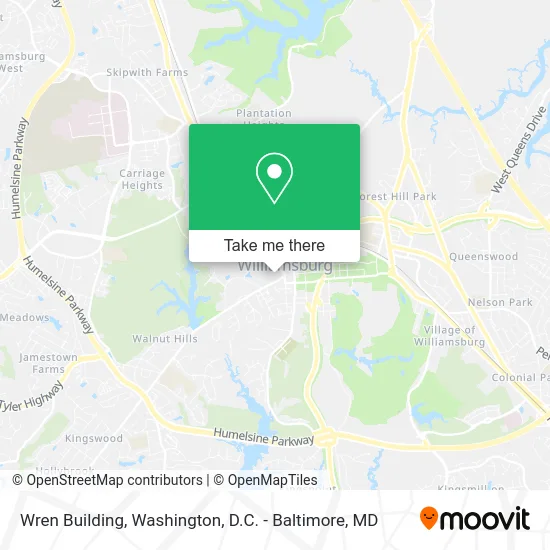
See Wren Building, Washington, D.C. - Baltimore, MD, on the map
Public Transit to Wren Building in Washington, D.C. - Baltimore, MD
Wondering how to get to Wren Building in Washington, D.C. - Baltimore, MD? Moovit helps you find the best way to get to Wren Building with step-by-step directions from the nearest public transit station.
Moovit provides free maps and live directions to help you navigate through your city. View schedules, routes, timetables, and find out how long does it take to get to Wren Building in real time.
Looking for the nearest stop or station to Wren Building? Check out this list of stops closest to your destination: Richmond Rd at Blow Hall; Armistead Ave. at Blayton Building; Williamsburg Bus Stop; Boundary & Armistead; N Boundary St at Williamsburg Tc; Williamsburg Amtrak Station.
Bus: 1, 6, FLIXBUS N2601, 2, 5, 12, 12A, 3, 7, 1000, 921.Train: NORTHEAST REGIONAL.
Want to see if there’s another route that gets you there at an earlier time? Moovit helps you find alternative routes or times. Get directions from and directions to Wren Building easily from the Moovit App or Website.
We make riding to Wren Building easy, which is why over 1.5 million users, including users in Washington, D.C. - Baltimore, MD, trust Moovit as the best app for public transit. You don’t need to download an individual bus app or train app, Moovit is your all-in-one transit app that helps you find the best bus time or train time available.
For information on prices of bus and train, costs and ride fares to Wren Building, please check the Moovit app.
Use the app to navigate to popular places including to the airport, hospital, stadium, grocery store, mall, coffee shop, school, college, and university.
Wren Building Address: W Duke of Gloucester St Williamsburg, VA 23185 street in Washington, D.C. - Baltimore, MD
- Sir Christopher Wren Building,
- William & Mary,
- Wren Outbuilding South,
- Brafferton Kitchen,
- Williamsburg Colonial Tours,
- President's House,
- RALPH LAUREN,
- Brafferton,
- 360 Air Tech,
- Statue Of James Monroe,
- Kate Spade,
- Tucker Hall,
- Ewell Hall,
- Marina Vatchenkova,
- Sor 7: Delta Gamma,
- Mike's Towing & Recovery,
- Iron Pen Web Design & Printing Service,
- Williamsburg Convention & Visitors Bureau,
- Netsenses,
- Ciao: Colonial Italian American Organization
Places Near Wren Building (Washington, D.C. - Baltimore, MD)
- M&T Bank Stadium, Baltimore,
- Warner Theatre, Washington,
- National Zoo, Washington,
- National Mall, Washington,
- Westfield Montgomery Mall, Montgomery County,
- Basilica of the National Shrine, Washington,
- Washington National Cathedral, Washington,
- Pennsylvania Ave NW (3rd st and pennsylvania), Washington,
- The Anthem, Washington,
- National Museum of African American History and Culture, Washington,
- Georgetown, Washington,
- Washington DC VA Medical Center, Washington,
- Rock Creek Tennis Center, Washington,
- Amazon Hq2, Arlington County,
- PG Mall, Prince George's County,
- Marriott Marquis Washington, DC, Washington,
- Capital One Arena, Washington,
- Camden Yards, Baltimore,
- Museum Of The Bible, Washington,
- Sibley Memorial Hospital, Washington
How to get to popular places in Washington, D.C. - Baltimore, MD with public transit
Get around Washington, D.C. - Baltimore, MD by public transit!
Traveling around Washington, D.C. - Baltimore, MD has never been so easy. See step by step directions as you travel to any attraction, street or major public transit station. View bus and train schedules, arrival times, service alerts and detailed routes on a map, so you know exactly how to get to anywhere in Washington, D.C. - Baltimore, MD.
When traveling to any destination around Washington, D.C. - Baltimore, MD use Moovit's Live Directions with Get Off Notifications to know exactly where and how far to walk, how long to wait for your line, and how many stops are left. Moovit will alert you when it's time to get off — no need to constantly re-check whether yours is the next stop.
Wondering how to use public transit in Washington, D.C. - Baltimore, MD or how to pay for public transit in Washington, D.C. - Baltimore, MD? Moovit public transit app can help you navigate your way with public transit easily, and at minimum cost. It includes public transit fees, ticket prices, and costs. Looking for a map of Washington, D.C. - Baltimore, MD public transit lines? Moovit public transit app shows all public transit maps in Washington, D.C. - Baltimore, MD with all Bus, Train, Metro, Light Rail and Ferry routes and stops on an interactive map.
Washington, D.C. - Baltimore, MD has 5 transit type(s), including: Bus, Train, Metro, Light Rail and Ferry, operated by several transit agencies, including WMATA, Montgomery County Ride On, Fairfax Connector, TheBus, PRTC, DASH - Alexandria, Arlington Transit (ART), RTA of Central Maryland, MDOT MTA, MDOT MTA Light RailLink, MDOT MTA Commuter Bus, MDOT MTA Local Bus, FXBGO!, Virginia Railway Express (VRE) and MARC