Wynnefield Avenue station - Sunday schedule
| Line | Direction | Time |
|---|---|---|
| CYN | #1052 - Suburban Station | 6:05 AM |
| CYN | #1055 - Cynwyd | 7:02 AM |
| CYN | #1056 - Suburban Station | 7:33 AM |
| CYN | #1059 - Cynwyd | 8:26 AM |
| CYN | #1060 - Suburban Station | 8:51 AM |
| CYN | #1071 - Cynwyd | 12:16 PM |
| CYN | #1072 - Suburban Station | 12:41 PM |
| CYN | #1081 - Cynwyd | 3:32 PM |
| CYN | #1082 - Suburban Station | 3:57 PM |
| CYN | #1083 - Cynwyd | 4:53 PM |
| CYN | #1084 - Suburban Station | 5:20 PM |
| CYN | #1085 - Cynwyd | 6:13 PM |
Directions to Wynnefield Avenue (Philadelphia) with public transportation
The following transit lines have routes that pass near Wynnefield Avenue
How to get to Wynnefield Avenue by bus?
Click on the bus route to see step by step directions with maps, line arrival times and updated time schedules.
How to get to Wynnefield Avenue by train?
Click on the train route to see step by step directions with maps, line arrival times and updated time schedules.
How to get to Wynnefield Avenue by subway?
Click on the subway route to see step by step directions with maps, line arrival times and updated time schedules.
Bus stops near Wynnefield Avenue in Philadelphia
- Wynnfield Av & 50th St, 2 min walk,
Light Rail stations near Wynnefield Avenue in Philadelphia
- Lancaster Av & 52nd St, 23 min walk,
Train stations near Wynnefield Avenue in Philadelphia
- Bala, 40 min walk,
Bus lines to Wynnefield Avenue in Philadelphia
- 40, 2nd-Lombard,
What are the closest stations to Wynnefield Avenue?
The closest stations to Wynnefield Avenue are:
- Wynnfield Av & 50th St is 125 yards away, 2 min walk.
- Lancaster Av & 52nd St is 1888 yards away, 23 min walk.
- Bala is 3403 yards away, 40 min walk.
Which bus lines stop near Wynnefield Avenue?
These bus lines stop near Wynnefield Avenue: 40, 65.
Which train lines stop near Wynnefield Avenue?
These train lines stop near Wynnefield Avenue: CYN, PAO.
Which subway line stops near Wynnefield Avenue?
MFL
What’s the nearest light rail station to Wynnefield Avenue in Philadelphia?
The nearest light rail station to Wynnefield Avenue in Philadelphia is Lancaster Av & 52nd St. It’s a 23 min walk away.
What’s the nearest bus stop to Wynnefield Avenue in Philadelphia?
The nearest bus stop to Wynnefield Avenue in Philadelphia is Wynnfield Av & 50th St. It’s a 2 min walk away.
What time is the first light rail to Wynnefield Avenue in Philadelphia?
The 10 is the first light rail that goes to Wynnefield Avenue in Philadelphia. It stops nearby at 3:25 AM.
What time is the last light rail to Wynnefield Avenue in Philadelphia?
The 10 is the last light rail that goes to Wynnefield Avenue in Philadelphia. It stops nearby at 2:52 AM.
What time is the first train to Wynnefield Avenue in Philadelphia?
The CYN is the first train that goes to Wynnefield Avenue in Philadelphia. It stops nearby at 6:02 AM.
What time is the last train to Wynnefield Avenue in Philadelphia?
The CYN is the last train that goes to Wynnefield Avenue in Philadelphia. It stops nearby at 6:16 PM.
What time is the first bus to Wynnefield Avenue in Philadelphia?
The 40 is the first bus that goes to Wynnefield Avenue in Philadelphia. It stops nearby at 5:47 AM.
What time is the last bus to Wynnefield Avenue in Philadelphia?
The 40 is the last bus that goes to Wynnefield Avenue in Philadelphia. It stops nearby at 2:27 AM.
See Wynnefield Avenue, Philadelphia, on the map
Public transit to Wynnefield Avenue station in Philadelphia
Looking for directions to Wynnefield Avenue in Philadelphia, United States?
Download the Moovit App to find the current schedule and step-by-step directions for Bus, Train or Subway routes that pass through Wynnefield Avenue.
Looking for the nearest stops closest to Wynnefield Avenue ? Check out this list of closest stops to your destination: Wynnfield Av & 50th St; Lancaster Av & 52nd St; Bala.
Bus: 40, 65.Train: CYN, PAO.Subway: MFL.
We make riding on public transit to Wynnefield Avenue easy, which is why over 1.5 million users, including users in Philadelphia trust Moovit as the best app for public transit.
Use the app to navigate to popular places including to the airport, hospital, stadium, grocery store, mall, coffee shop, school, college, and university.
The station has the following entrances: Bryn Mawr Ave and Wyndale Ave
The first line to this station is CYN, at 6:05 AM, and the last line is CYN at 6:13 PM.
2201 Bryn Mawr Ave, Philadelphia, PA, USA
This station serves SEPTA Rail’s lines
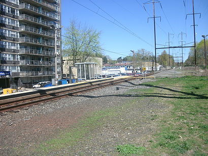
Wynnefield Avenue station is a SEPTA Regional Rail station in Philadelphia, Pennsylvania. Located at Wynnefield and Bryn Mawr Avenues, it serves the Cynwyd Line.Wiki
Popular routes from Wynnefield Avenue, Philadelphia
Bus stop near Wynnefield Avenue
Light Rail station near Wynnefield Avenue
Train station near Wynnefield Avenue
Popular public transit stations in Philadelphia
Get around Philadelphia by public transit!
Traveling around Philadelphia has never been so easy. See step by step directions as you travel to any attraction, street or major public transit station. View bus and train schedules, arrival times, service alerts and detailed routes on a map, so you know exactly how to get to anywhere in Philadelphia.
When traveling to any destination around Philadelphia use Moovit's Live Directions with Get Off Notifications to know exactly where and how far to walk, how long to wait for your line, and how many stops are left. Moovit will alert you when it's time to get off — no need to constantly re-check whether yours is the next stop.
Wondering how to use public transit in Philadelphia or how to pay for public transit in Philadelphia? Moovit public transit app can help you navigate your way with public transit easily, and at minimum cost. It includes public transit fees, ticket prices, and costs. Looking for a map of Philadelphia public transit lines? Moovit public transit app shows all public transit maps in Philadelphia with all bus, train or subway routes and stops on an interactive map.
Philadelphia has 3 transit type(s), including: bus, train or subway, operated by several transit agencies, including SEPTA Subway, SEPTA Trolley, SEPTA Rail, SEPTA, SEPTA, NJ Transit Rail, NJ Transit Rail, NJ Transit Bus, Port Authority Transit Corporation, Navy Yard, Penn Transit, Drexel University, Pottstown Area Rapid Transit (PART), Fullington Tours and Chescobus