How to get to Yae'LS Touch by bus?
Click on the bus route to see step by step directions with maps, line arrival times and updated time schedules.
From Aventura Station (Brightline), Miami
77 minFrom Tidal Cove Water Park, Miami
83 minFrom Aventura Mall, Miami
78 minFrom B Gruskin Arnie PA, Fort Lauderdale
43 minFrom B Ocean Resort, Fort Lauderdale, Fort Lauderdale
78 minFrom Mount Sinai Medical Center, Miami
81 minFrom Davie, FL, Davie
30 minFrom Brightline Aventura Station, Miami
77 minFrom Jw Marriott Miami Turnberry Resort & Spa, Miami
85 minFrom 595 Express, Davie
48 min
How to get to Yae'LS Touch by train?
Click on the train route to see step by step directions with maps, line arrival times and updated time schedules.
Bus stops near Yae'LS Touch in Hollywood
Train station near Yae'LS Touch in Hollywood
- Fort Lauderdale Airport Station, 27 min walk,VIEW
Bus lines to Yae'LS Touch in Hollywood
What are the closest stations to Yae'LS Touch?
The closest stations to Yae'LS Touch are:
- Stirling Road/Southwest 31st Avenue is 55 yards away, 2 min walk.
- Anglers Avenue/Stirling Road is 502 yards away, 7 min walk.
- North 29th Avenue/Stirling Road is 693 yards away, 9 min walk.
- Fort Lauderdale Airport Station is 2277 yards away, 27 min walk.
Which bus lines stop near Yae'LS Touch?
These bus lines stop near Yae'LS Touch: 06, 12, 16.
Which train line stops near Yae'LS Touch?
TRIRAIL (Northbound To Mangonia Park)
What’s the nearest train station to Yae'LS Touch in Hollywood?
The nearest train station to Yae'LS Touch in Hollywood is Fort Lauderdale Airport Station. It’s a 27 min walk away.
What’s the nearest bus station to Yae'LS Touch in Hollywood?
The nearest bus station to Yae'LS Touch in Hollywood is Stirling Road/Southwest 31st Avenue. It’s a 2 min walk away.
What time is the first train to Yae'LS Touch in Hollywood?
The TRIRAIL is the first train that goes to Yae'LS Touch in Hollywood. It stops nearby at 4:20 AM.
What time is the last train to Yae'LS Touch in Hollywood?
The TRIRAIL is the last train that goes to Yae'LS Touch in Hollywood. It stops nearby at 10:29 PM.
What time is the first bus to Yae'LS Touch in Hollywood?
The 12 is the first bus that goes to Yae'LS Touch in Hollywood. It stops nearby at 5:31 AM.
What time is the last bus to Yae'LS Touch in Hollywood?
The 06 is the last bus that goes to Yae'LS Touch in Hollywood. It stops nearby at 11:58 PM.
See Yae'LS Touch, Hollywood, on the map
Public Transit to Yae'LS Touch in Hollywood
Wondering how to get to Yae'LS Touch in Hollywood? Moovit helps you find the best way to get to Yae'LS Touch with step-by-step directions from the nearest public transit station.
Moovit provides free maps and live directions to help you navigate through your city. View schedules, routes, timetables, and find out how long does it take to get to Yae'LS Touch in real time.
Looking for the nearest stop or station to Yae'LS Touch? Check out this list of stops closest to your destination: Stirling Road/Southwest 31st Avenue; Anglers Avenue/Stirling Road; North 29th Avenue/Stirling Road; Fort Lauderdale Airport Station.
Bus: 06, 12, 16.Train: TRIRAIL.
Want to see if there’s another route that gets you there at an earlier time? Moovit helps you find alternative routes or times. Get directions from and directions to Yae'LS Touch easily from the Moovit App or Website.
We make riding to Yae'LS Touch easy, which is why over 1.5 million users, including users in Hollywood, trust Moovit as the best app for public transit. You don’t need to download an individual bus app or train app, Moovit is your all-in-one transit app that helps you find the best bus time or train time available.
For information on prices of bus and train, costs and ride fares to Yae'LS Touch, please check the Moovit app.
Use the app to navigate to popular places including to the airport, hospital, stadium, grocery store, mall, coffee shop, school, college, and university.
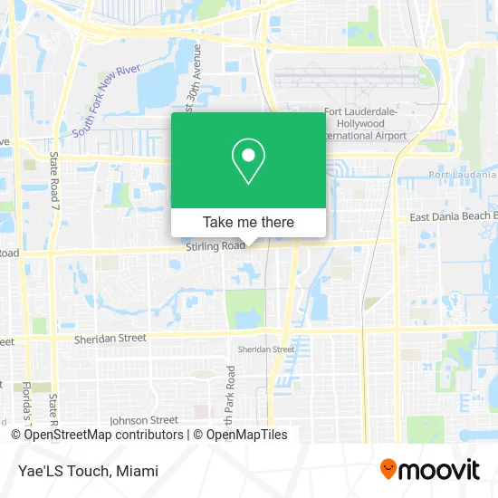
Yae'LS Touch Address: 3098 Stirling Rd Hollywood, FL 33021 street in Hollywood
- Legal Elite Title,
- Sarah G. Garon, MD,
- Caridad Sol Loeffler, Aprn,
- Pentecostal Experience,
- Oracle Elevator Service,
- NTB National Tire & Battery,
- Mavis Discount Tire,
- Pita Xpress Mediterranean Grill,
- Ecocredit,
- BS Hairshop,
- Digital Graphics Group,
- Liquid Addiction F,
- Lit Design Furniture,
- Marc Motors,
- BBK Welding Repairs and Steel Work,
- Hotel Transport So,
- American Roller Shades,
- Oppenheimer Dental and Surgical Group,
- Ivan Moldauer, DDS,
- Paddock Lounge
Places Near Yae'LS Touch (Hollywood)
- Sawgrass mall ( FL ), Miami Beach,
- Dolphin Mall, Miami,
- Wynwood, Miami,
- Miami-Dade County Courthouse, Miami,
- Aventura Mall, Miami Beach,
- Richard E. Gerstein Justice Building, Miami,
- Aventura Mall, Miami,
- Port of Miami Cruise Terminal, Miami,
- Miami Design District, Miami,
- Brickell City Centre, Miami,
- Zoo Miami, Miami,
- Keiser University Flagship Campus, West Palm Beach,
- Little Havana, Miami,
- Marlins Park, Miami,
- Dolphin Mall Bus, Miami,
- Hard Rock Stadium, Miami Gardens,
- Miami Freedom Park, Miami,
- Miami VA Hospital, Miami,
- Sawgrass Mall, Miami,
- Bayside Marketplace, Miami
How to get to popular places in Miami with public transit
Get around Hollywood by public transit!
Traveling around Hollywood has never been so easy. See step by step directions as you travel to any attraction, street or major public transit station. View bus and train schedules, arrival times, service alerts and detailed routes on a map, so you know exactly how to get to anywhere in Hollywood.
When traveling to any destination around Hollywood use Moovit's Live Directions with Get Off Notifications to know exactly where and how far to walk, how long to wait for your line, and how many stops are left. Moovit will alert you when it's time to get off — no need to constantly re-check whether yours is the next stop.
Wondering how to use public transit in Hollywood or how to pay for public transit in Hollywood? Moovit public transit app can help you navigate your way with public transit easily, and at minimum cost. It includes public transit fees, ticket prices, and costs. Looking for a map of Hollywood public transit lines? Moovit public transit app shows all public transit maps in Hollywood with all Bus, Train, Light Rail and Ferry routes and stops on an interactive map.
Miami has 4 transit type(s), including: Bus, Train, Light Rail and Ferry, operated by several transit agencies, including Broward County Transit, Miami-Dade Transit, Metrorail, Palm Tran, Tri-Rail, Brightline, MARTY, City of Homestead Trolley, Key West Transit, Treasure Coast Connector, GoLine IRT, Amtrak, Greyhound-us, FlixBus-us and Aventura Express Shuttle Bus