How to get to Yoga Direction by bus?
Click on the bus route to see step by step directions with maps, line arrival times and updated time schedules.
From Pembroke Pines, FL, Miramar-Pembroke Pines
55 minFrom 95 Express Bus Stop, Fort Lauderdale
45 minFrom Flanagan High School, Miramar-Pembroke Pines
50 minFrom Florida Turnpike Sunrise Blvd. Toll Plaza, Plantation
70 minFrom I-95, Fort Lauderdale
80 minFrom Broward Center for the Performing Arts, Fort Lauderdale
49 minFrom Fort Lauderdale airport terminal 3 Jet Blue, Hollywood
50 minFrom Broward General Hospital, Fort Lauderdale
71 minFrom Tri-Rail Shuttle To FLL Airport, Hollywood
55 minFrom Broward/Miami-Dade County Border, Miami Gardens
85 min
Bus stop near Yoga Direction in Davie
- Davie Road/Southwest 46th Street, 2 min walk,VIEW
Bus lines to Yoga Direction in Davie
What are the closest stations to Yoga Direction?
The closest stations to Yoga Direction are:
- Davie Road/Southwest 46th Street is 117 yards away, 2 min walk.
Which bus lines stop near Yoga Direction?
These bus lines stop near Yoga Direction: 09, 12.
What’s the nearest bus station to Yoga Direction in Davie?
The nearest bus station to Yoga Direction in Davie is Davie Road/Southwest 46th Street. It’s a 2 min walk away.
What time is the first bus to Yoga Direction in Davie?
The 12 is the first bus that goes to Yoga Direction in Davie. It stops nearby at 5:01 AM.
What time is the last bus to Yoga Direction in Davie?
The 12 is the last bus that goes to Yoga Direction in Davie. It stops nearby at 11:04 PM.
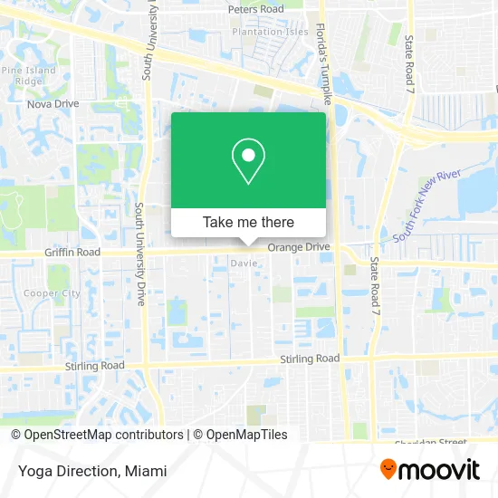
See Yoga Direction, Davie, on the map
Public Transit to Yoga Direction in Davie
Wondering how to get to Yoga Direction in Davie? Moovit helps you find the best way to get to Yoga Direction with step-by-step directions from the nearest public transit station.
Moovit provides free maps and live directions to help you navigate through your city. View schedules, routes, timetables, and find out how long does it take to get to Yoga Direction in real time.
Looking for the nearest stop or station to Yoga Direction? Check out this list of stops closest to your destination: Davie Road/Southwest 46th Street.
Bus: 09, 12.
Want to see if there’s another route that gets you there at an earlier time? Moovit helps you find alternative routes or times. Get directions from and directions to Yoga Direction easily from the Moovit App or Website.
We make riding to Yoga Direction easy, which is why over 1.5 million users, including users in Davie, trust Moovit as the best app for public transit. You don’t need to download an individual bus app or train app, Moovit is your all-in-one transit app that helps you find the best bus time or train time available.
For information on prices of bus and train, costs and ride fares to Yoga Direction, please check the Moovit app.
Use the app to navigate to popular places including to the airport, hospital, stadium, grocery store, mall, coffee shop, school, college, and university.
Yoga Direction Address: Griffin Rd Fort Lauderdale, FL 33314 street in Davie
- San Drywall & Textures,
- J&W Cabrera's Carpentry,
- Blue Chip Maids,
- Tip Top Renovation,
- Coral Cohen, DMD,
- Qe Vuelta Tax Preparation & Multi Services,
- Island Time Tiki Huts & Bars,
- Oil Change Guy,
- Griffin Road & Davie Road,
- Outdoor Cooling Systems,
- Sushi Song - Davie,
- Cubico Coffee,
- Pizza Salad Pointe & Self-Pour Beer,
- Orange Blossom Festival,
- AEF School,
- Marty's Bar & Grill,
- Nature's Botanicals,
- Barclay Color Group,
- River of Grass,
- Davie Swimming
Places Near Yoga Direction (Davie)
- Miami VA Hospital, Miami,
- Richard E. Gerstein Justice Building, Miami,
- Miami-Dade County Courthouse, Miami,
- Zoo Miami, Miami,
- Sawgrass Mall, Miami,
- Port of Miami Cruise Terminal, Miami,
- Aventura Mall, Miami Beach,
- Hard Rock Stadium, Miami Gardens,
- Little Havana, Miami,
- Aventura Mall, Miami,
- Brickell City Centre, Miami,
- Keiser University Flagship Campus, West Palm Beach,
- Dolphin Mall Bus, Miami,
- Wynwood, Miami,
- Miami Freedom Park, Miami,
- Marlins Park, Miami,
- Miami Design District, Miami,
- Dolphin Mall, Miami,
- Bayside Marketplace, Miami,
- Sawgrass mall ( FL ), Miami Beach
How to get to popular places in Miami with public transit
Get around Davie by public transit!
Traveling around Davie has never been so easy. See step by step directions as you travel to any attraction, street or major public transit station. View bus and train schedules, arrival times, service alerts and detailed routes on a map, so you know exactly how to get to anywhere in Davie.
When traveling to any destination around Davie use Moovit's Live Directions with Get Off Notifications to know exactly where and how far to walk, how long to wait for your line, and how many stops are left. Moovit will alert you when it's time to get off — no need to constantly re-check whether yours is the next stop.
Wondering how to use public transit in Davie or how to pay for public transit in Davie? Moovit public transit app can help you navigate your way with public transit easily, and at minimum cost. It includes public transit fees, ticket prices, and costs. Looking for a map of Davie public transit lines? Moovit public transit app shows all public transit maps in Davie with all Bus, Train, Light Rail and Ferry routes and stops on an interactive map.
Miami has 4 transit type(s), including: Bus, Train, Light Rail and Ferry, operated by several transit agencies, including Broward County Transit, Miami-Dade Transit, Metrorail, Palm Tran, Tri-Rail, Brightline, MARTY, City of Homestead Trolley, Key West Transit, Treasure Coast Connector, GoLine IRT, Amtrak, Greyhound-us, FlixBus-us and Aventura Express Shuttle Bus