Directions to Yonkers Public Schools (Yonkers, Ny) with public transportation
The following transit lines have routes that pass near Yonkers Public Schools
How to get to Yonkers Public Schools by bus?
Click on the bus route to see step by step directions with maps, line arrival times and updated time schedules.
How to get to Yonkers Public Schools by train?
Click on the train route to see step by step directions with maps, line arrival times and updated time schedules.
Bus stations near Yonkers Public Schools in Yonkers, Ny
- Park Ave @ Flagg St,4 min walk,
- Ashburton Ave @ Palisade Ave,5 min walk,
- Palisade Ave @ Ashburton Ave,5 min walk,
- N Broadway @ Ashburton Ave,7 min walk,
Train stations near Yonkers Public Schools in Yonkers, Ny
- Yonkers,7 min walk,
Bus lines to Yonkers Public Schools in Yonkers, Ny
- 2,242nd Street Subway Station,
- 1,X - Westchester Medical Center Via Community College,
- 3,Express - 242nd Street Subway Station,
- 25,Yonkers,
- 30,New Rochelle,
- 9,Yonkers Loop,
- 78,Getty Square,
- 6,Yonkers,
What are the closest stations to Yonkers Public Schools?
The closest stations to Yonkers Public Schools are:
- Park Ave @ Flagg St is 252 yards away, 4 min walk.
- Ashburton Ave @ Palisade Ave is 317 yards away, 5 min walk.
- Palisade Ave @ Ashburton Ave is 330 yards away, 5 min walk.
- N Broadway @ Ashburton Ave is 524 yards away, 7 min walk.
- Yonkers is 531 yards away, 7 min walk.
Which bus lines stop near Yonkers Public Schools?
These bus lines stop near Yonkers Public Schools: 1, 2, 25, 3, BX10, BX7, BX9.
Which train lines stop near Yonkers Public Schools?
These train lines stop near Yonkers Public Schools: HUDSON, MAPLE LEAF.
What’s the nearest train station to Yonkers Public Schools in Yonkers, Ny?
The nearest train station to Yonkers Public Schools in Yonkers, Ny is Yonkers. It’s a 7 min walk away.
What’s the nearest bus stop to Yonkers Public Schools in Yonkers, Ny?
The nearest bus stop to Yonkers Public Schools in Yonkers, Ny is Park Ave @ Flagg St. It’s a 4 min walk away.
What time is the first train to Yonkers Public Schools in Yonkers, Ny?
The HUDSON is the first train that goes to Yonkers Public Schools in Yonkers, Ny. It stops nearby at 5:07 AM.
What time is the last train to Yonkers Public Schools in Yonkers, Ny?
The HUDSON is the last train that goes to Yonkers Public Schools in Yonkers, Ny. It stops nearby at 2:30 AM.
What time is the first bus to Yonkers Public Schools in Yonkers, Ny?
The 2 is the first bus that goes to Yonkers Public Schools in Yonkers, Ny. It stops nearby at 5:08 AM.
What time is the last bus to Yonkers Public Schools in Yonkers, Ny?
The 78 is the last bus that goes to Yonkers Public Schools in Yonkers, Ny. It stops nearby at 12:55 AM.
How much is the subway fare to Yonkers Public Schools?
The subway fare to Yonkers Public Schools costs about $2.90.
How much is the bus fare to Yonkers Public Schools?
The bus fare to Yonkers Public Schools costs about $2.75 - $2.90.
How much is the train fare to Yonkers Public Schools?
The train fare to Yonkers Public Schools costs about $3.25 - $11.25.
See Yonkers Public Schools, Yonkers, Ny, on the map
Public Transit to Yonkers Public Schools in Yonkers, Ny
Wondering how to get to Yonkers Public Schools in Yonkers, Ny, United States? Moovit helps you find the best way to get to Yonkers Public Schools with step-by-step directions from the nearest public transit station.
Moovit provides free maps and live directions to help you navigate through your city. View schedules, routes, timetables, and find out how long does it take to get to Yonkers Public Schools in real time.
Looking for the nearest stop or station to Yonkers Public Schools? Check out this list of stops closest to your destination: Park Ave @ Flagg St; Ashburton Ave @ Palisade Ave; Palisade Ave @ Ashburton Ave; N Broadway @ Ashburton Ave; Yonkers.
Bus:12253BX10BX7BX9309786Train:HUDSONMAPLE LEAFADIRONDACKBERKSHIRE FLYEREMPIRE SERVICEETHAN ALLEN EXPRESS
Want to see if there’s another route that gets you there at an earlier time? Moovit helps you find alternative routes or times. Get directions from and directions to Yonkers Public Schools easily from the Moovit App or Website.
We make riding to Yonkers Public Schools easy, which is why over 1.5 million users, including users in Yonkers, Ny, trust Moovit as the best app for public transit. You don’t need to download an individual bus app or train app, Moovit is your all-in-one transit app that helps you find the best bus time or train time available.
For information on prices of bus, subway and train, costs and ride fares to Yonkers Public Schools, please check the Moovit app.
Use the app to navigate to popular places including to the airport, hospital, stadium, grocery store, mall, coffee shop, school, college, and university.
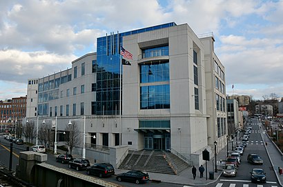
Yonkers Public Schools Address: 190 N Broadway Yonkers, NY 10701 street in Yonkers, Ny
Yonkers Public Schools is a school district that serves all of Yonkers, New York, United States. It is governed by a mayorally appointed Board of Trustees.Wiki
Attractions near Yonkers Public Schools
A Laundry Card,Bethel Temple Of Praise Food Pantry,Memorial African Methodist Episcopal Zion Church,N Broadway,Freeway 9,Maitri Center,Regency Extended Care Center,Hercules Laundry Card,242 Broadway,Cottage BLD,St Johns Riverside Hospital, HOPE Center,Palisade and Ashburton,Electrician Yonkers,Sechnv Funeral Home,Yonkers Fresh Meat Mar,N Broadway (ashburton north broadway),Blue Communities,The Ridgeway Communities,Ashburton Ave and Park,2 Park AvenueHow to get to popular attractions in Yonkers, Ny with public transit
Clinton St. Baking Co. & Restaurant, Manhattan,Central Park SummerStage, Manhattan,Gyu-Kaku Japanese BBQ, Manhattan,Rattle N Hum, Manhattan,The Standard Grill, Manhattan,Caesars Atlantic City Hotel and Casino, Atlantic City, Nj,Virgin America Ticket Counter, Elizabeth, Nj,Barrage, Manhattan,Harrah's Resort Hotel & Casino, Atlantic City, Nj,Eataly, Manhattan,Veselka, Manhattan,Ritz Bar & Lounge, Manhattan,Planet Fitness, Queens,Jing Fong Restaurant 金豐大酒樓, Manhattan,Nassau Community College, East Garden City, Ny,Sheep Meadow, Manhattan,Tom & Jerry's, Manhattan,MTA Subway - Coney Island / Stillwell Ave (D / F/N / Q),Burger Joint, Manhattan,Newark Liberty International Airport (EWR), Newark, NjGet around Yonkers, Ny by public transit!
Traveling around Yonkers, Ny has never been so easy. See step by step directions as you travel to any attraction, street or major public transit station. View bus and train schedules, arrival times, service alerts and detailed routes on a map, so you know exactly how to get to anywhere in Yonkers, Ny.
When traveling to any destination around Yonkers, Ny use Moovit's Live Directions with Get Off Notifications to know exactly where and how far to walk, how long to wait for your line, and how many stops are left. Moovit will alert you when it's time to get off — no need to constantly re-check whether yours is the next stop.
Wondering how to use public transit in Yonkers, Ny or how to pay for public transit in Yonkers, Ny? Moovit public transit app can help you navigate your way with public transit easily, and at minimum cost. It includes public transit fees, ticket prices, and costs. Looking for a map of Yonkers, Ny public transit lines? Moovit public transit app shows all public transit maps in Yonkers, Ny with all bus, subway or train routes and stops on an interactive map.
Yonkers, Ny has 3 transit type(s), including: bus, subway or train, operated by several transit agencies, including MTA Subway, Metro-North Railroad, LIRR, PATH, Shore Line East, MTA Bus Company, MTA New York City Transit - Express routes, MTA Bus, NJ Transit, NYC Ferry, NICE bus, Bee-Line Bus, NJ Transit Rail, NJ Transit Rail and Norwalk Transit District