See York Civic Centre, Toronto, on the map
Directions to York Civic Centre (Toronto) with public transportation
The following transit lines have routes that pass near York Civic Centre
 Bus:
Bus: - Train:
- Subway:
How to get to York Civic Centre by bus?
Click on the bus route to see step by step directions with maps, line arrival times and updated time schedules.
How to get to York Civic Centre by train?
Click on the train route to see step by step directions with maps, line arrival times and updated time schedules.
How to get to York Civic Centre by subway?
Click on the subway route to see step by step directions with maps, line arrival times and updated time schedules.
Bus stations near York Civic Centre in Toronto
- Keele St at Eglinton Ave West,1 min walk,
- Eglinton Ave West at Keele St/Trethewey Dr,1 min walk,
- Eglinton Ave West at Trethewey Dr/Keele St,2 min walk,
Train stations near York Civic Centre in Toronto
- Weston Go/Up,5 min walk,
- Weston,5 min walk,
Subway stations near York Civic Centre in Toronto
- Eglinton West,43 min walk,
Streetcar stations near York Civic Centre in Toronto
- St Clair Ave West at Old Weston Rd West Side,63 min walk,
Bus lines to York Civic Centre in Toronto
- 41,Trethewey Dr at Eglinton Ave West,
- 41S,Keele St at Eglinton Ave West,
- 341,Ian Macdonald Blvd at the Chimneystack Rd,
- 941,Keele St at Four Winds Dr - Finch West Station,
- 32,Eglinton Station,
- 32D,Emmett Ave at Verona Ave,
- 332,Pearson Airport Terminal 1 - Ground Level Column R4,
- 32A,Renforth Station,
- 32C,Trethewey Dr at Jane St East Side,
What are the closest stations to York Civic Centre?
The closest stations to York Civic Centre are:
- Keele St at Eglinton Ave West is 36 meters away, 1 min walk.
- Eglinton Ave West at Keele St/Trethewey Dr is 42 meters away, 1 min walk.
- Eglinton Ave West at Trethewey Dr/Keele St is 68 meters away, 2 min walk.
- Weston Go/Up is 312 meters away, 5 min walk.
- Weston is 340 meters away, 5 min walk.
- Eglinton West is 3308 meters away, 43 min walk.
- St Clair Ave West at Old Weston Rd West Side is 4840 meters away, 63 min walk.
Which bus lines stop near York Civic Centre?
These bus lines stop near York Civic Centre: 161, 32, 32A, 32D, 941.
Which train line stops near York Civic Centre?
UP
Which subway line stops near York Civic Centre?
1
What’s the nearest train station to York Civic Centre in Toronto?
The nearest train stations to York Civic Centre in Toronto are Weston Go/Up and Weston. The closest one is a 5 min walk away.
What’s the nearest bus stop to York Civic Centre in Toronto?
The nearest bus stops to York Civic Centre in Toronto are Keele St at Eglinton Ave West and Eglinton Ave West at Keele St/Trethewey Dr. The closest one is a 1 min walk away.
What time is the first Streetcar to York Civic Centre in Toronto?
The 512 is the first Streetcar that goes to York Civic Centre in Toronto. It stops nearby at 5:00 AM.
What time is the last Streetcar to York Civic Centre in Toronto?
The 512 is the last Streetcar that goes to York Civic Centre in Toronto. It stops nearby at 2:56 AM.
What time is the first subway to York Civic Centre in Toronto?
The 1 is the first subway that goes to York Civic Centre in Toronto. It stops nearby at 6:03 AM.
What time is the last subway to York Civic Centre in Toronto?
The 1 is the last subway that goes to York Civic Centre in Toronto. It stops nearby at 2:10 AM.
What time is the first train to York Civic Centre in Toronto?
The UP is the first train that goes to York Civic Centre in Toronto. It stops nearby at 5:09 AM.
What time is the last train to York Civic Centre in Toronto?
The KI is the last train that goes to York Civic Centre in Toronto. It stops nearby at 11:51 PM.
What time is the first bus to York Civic Centre in Toronto?
The 332 is the first bus that goes to York Civic Centre in Toronto. It stops nearby at 3:01 AM.
What time is the last bus to York Civic Centre in Toronto?
The 332 is the last bus that goes to York Civic Centre in Toronto. It stops nearby at 3:22 AM.
How much is the Streetcar fare to York Civic Centre?
The Streetcar fare to York Civic Centre costs about $3.30.
How much is the bus fare to York Civic Centre?
The bus fare to York Civic Centre costs about $3.30 - $3.75.
How much is the subway fare to York Civic Centre?
The subway fare to York Civic Centre costs about $3.30.
See York Civic Centre, Toronto, on the map
Public Transit to York Civic Centre in Toronto
Wondering how to get to York Civic Centre in Toronto, Canada? Moovit helps you find the best way to get to York Civic Centre with step-by-step directions from the nearest public transit station.
Moovit provides free maps and live directions to help you navigate through your city. View schedules, routes, timetables, and find out how long does it take to get to York Civic Centre in real time.
Looking for the nearest stop or station to York Civic Centre? Check out this list of stops closest to your destination: Keele St at Eglinton Ave West; Eglinton Ave West at Keele St/Trethewey Dr; Eglinton Ave West at Trethewey Dr/Keele St; Weston Go/Up; Weston; Eglinton West; St Clair Ave West at Old Weston Rd West Side.
Bus:Train:Subway:
Want to see if there’s another route that gets you there at an earlier time? Moovit helps you find alternative routes or times. Get directions from and directions to York Civic Centre easily from the Moovit App or Website.
We make riding to York Civic Centre easy, which is why over 1.5 million users, including users in Toronto, trust Moovit as the best app for public transit. You don’t need to download an individual bus app or train app, Moovit is your all-in-one transit app that helps you find the best bus time or train time available.
For information on prices of bus, subway, train and Streetcar, costs and ride fares to York Civic Centre, please check the Moovit app.
Use the app to navigate to popular places including to the airport, hospital, stadium, grocery store, mall, coffee shop, school, college, and university.
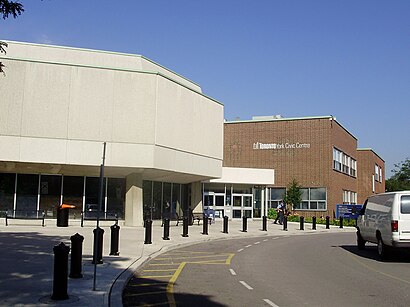
York Civic Centre Address: Municipal Drive street in Toronto
Attractions near York Civic Centre
Corporation of the City of Toronto,2700 Eglinton Avenue West,York Civic Centre,York Museum,Keelesdale Park,Coronation Park,Localcoin Bitcoin Atm - Rose Discount Variety,Law Referral Service,Wings Time,York Memorial Collegiate Institute,Captains Barber Shop,York Gymnastics Club,2690 Eglinton Avenue West,M6M,2 Trethewey Drive,Sugar Oink Oink,Toronto Foundation for Studnt SCCSS,Toronto Student Transportation Group,TD Canada Trust,Dominion LendingHow to get to popular attractions in Toronto with public transit
Earls Kitchen & Bar, Toronto,Barrie, Ontario, Barrie,Humber College - Lakeshore Campus, Toronto,Canadian Tire Home Office, Toronto,Conestoga College Doon Campus, Kitchener,City of Hamilton, Hamilton,GoodLife Fitness Centres, Toronto,Yorkdale Subway Station, Toronto,Starbucks, Toronto,York University, Toronto,Oshawa, Ontario, Oshawa,Toronto Pearson International Airport (Yyz), Mississauga,Appleby GO Station, Burlington,Ontario Tech University, Oshawa,Mapleview Shopping Centre, Burlington,Kitchener, Ontario, Kitchener,Toronto Eaton Centre, Toronto,Jane & Finch, Toronto,Charles Street Transit Terminal, Kitchener,Destiny 緣續園, Richmond HillGet around Toronto by public transit!
Traveling around Toronto has never been so easy. See step by step directions as you travel to any attraction, street or major public transit station. View bus and train schedules, arrival times, service alerts and detailed routes on a map, so you know exactly how to get to anywhere in Toronto.
When traveling to any destination around Toronto use Moovit's Live Directions with Get Off Notifications to know exactly where and how far to walk, how long to wait for your line, and how many stops are left. Moovit will alert you when it's time to get off — no need to constantly re-check whether yours is the next stop.
Wondering how to use public transit in Toronto or how to pay for public transit in Toronto? Moovit public transit app can help you navigate your way with public transit easily, and at minimum cost. It includes public transit fees, ticket prices, and costs. Looking for a map of Toronto public transit lines? Moovit public transit app shows all public transit maps in Toronto with all bus, subway, train or Streetcar routes and stops on an interactive map.
Toronto has 4 transit type(s), including: bus, subway, train or Streetcar, operated by several transit agencies, including TTC, TTC Streetcar, Toronto Subway, GO Transit Bus, GO Transit, Amtrak, York Region Transit, Grand River Transit, Guelph Transit, grt, Hamilton Street Railway, MiWay, Brampton Transit, Burlington Transit and Oakville Transit