See York Mills Centre, Toronto, on the map
Directions to York Mills Centre (Toronto) with public transportation
The following transit lines have routes that pass near York Mills Centre
 Bus:
Bus: - Train:
- Subway:
How to get to York Mills Centre by bus?
Click on the bus route to see step by step directions with maps, line arrival times and updated time schedules.
How to get to York Mills Centre by train?
Click on the train route to see step by step directions with maps, line arrival times and updated time schedules.
How to get to York Mills Centre by subway?
Click on the subway route to see step by step directions with maps, line arrival times and updated time schedules.
Bus stations near York Mills Centre in Toronto
- Bayview Ave at Bayview Ridge Cres,2 min walk,
- York Mills Rd at Bayview Ave,2 min walk,
- York Mills Rd at Bayview Ave West Side,3 min walk,
- Bayview Ave at York Mills Rd,3 min walk,
Subway stations near York Mills Centre in Toronto
- Sheppard - Yonge,17 min walk,
Train stations near York Mills Centre in Toronto
- Oriole Go,61 min walk,
Bus lines to York Mills Centre in Toronto
- 11,Davisville Station,
- 95A,Rylander Blvd at Kingston Rd,
- 95B,University Of Toronto Scarborough,
- 115,York Mills Station,
- 122,York Mills Rd at Fenside Dr,
- 395,York Mills Rd at Old York Mills Rd,
- 995,York Mills Station,
- 996,Humber College Bus Terminal,
- 95,York Mills Station,
- 996S,Wilson Station,
- 11A,Steeles Ave East Loop at Bayview Ave,
What are the closest stations to York Mills Centre?
The closest stations to York Mills Centre are:
- Bayview Ave at Bayview Ridge Cres is 50 meters away, 2 min walk.
- York Mills Rd at Bayview Ave is 93 meters away, 2 min walk.
- York Mills Rd at Bayview Ave West Side is 140 meters away, 3 min walk.
- Bayview Ave at York Mills Rd is 154 meters away, 3 min walk.
- Sheppard - Yonge is 1251 meters away, 17 min walk.
- Oriole Go is 4723 meters away, 61 min walk.
Which bus lines stop near York Mills Centre?
These bus lines stop near York Mills Centre: 11, 122, 95.
Which train line stops near York Mills Centre?
RH
Which subway line stops near York Mills Centre?
1
What’s the nearest subway station to York Mills Centre in Toronto?
The nearest subway station to York Mills Centre in Toronto is Sheppard - Yonge. It’s a 17 min walk away.
What’s the nearest bus stop to York Mills Centre in Toronto?
The nearest bus stops to York Mills Centre in Toronto are Bayview Ave at Bayview Ridge Cres and York Mills Rd at Bayview Ave. The closest one is a 2 min walk away.
What time is the first subway to York Mills Centre in Toronto?
The 4 is the first subway that goes to York Mills Centre in Toronto. It stops nearby at 5:34 AM.
What time is the last subway to York Mills Centre in Toronto?
The 4 is the last subway that goes to York Mills Centre in Toronto. It stops nearby at 2:33 AM.
What time is the first train to York Mills Centre in Toronto?
The RH is the first train that goes to York Mills Centre in Toronto. It stops nearby at 6:36 AM.
What time is the last train to York Mills Centre in Toronto?
The RH is the last train that goes to York Mills Centre in Toronto. It stops nearby at 7:12 PM.
What time is the first bus to York Mills Centre in Toronto?
The 395 is the first bus that goes to York Mills Centre in Toronto. It stops nearby at 3:01 AM.
What time is the last bus to York Mills Centre in Toronto?
The 395 is the last bus that goes to York Mills Centre in Toronto. It stops nearby at 3:32 AM.
How much is the subway fare to York Mills Centre?
The subway fare to York Mills Centre costs about $3.20.
How much is the Streetcar fare to York Mills Centre?
The Streetcar fare to York Mills Centre costs about $3.20.
How much is the bus fare to York Mills Centre?
The bus fare to York Mills Centre costs about $3.20 - $10.49.
See York Mills Centre, Toronto, on the map
Public Transit to York Mills Centre in Toronto
Wondering how to get to York Mills Centre in Toronto, Canada? Moovit helps you find the best way to get to York Mills Centre with step-by-step directions from the nearest public transit station.
Moovit provides free maps and live directions to help you navigate through your city. View schedules, routes, timetables, and find out how long does it take to get to York Mills Centre in real time.
Looking for the nearest stop or station to York Mills Centre? Check out this list of stops closest to your destination: Bayview Ave at Bayview Ridge Cres; York Mills Rd at Bayview Ave; York Mills Rd at Bayview Ave West Side; Bayview Ave at York Mills Rd; Sheppard - Yonge; Oriole Go.
Bus:Train:Subway:
Want to see if there’s another route that gets you there at an earlier time? Moovit helps you find alternative routes or times. Get directions from and directions to York Mills Centre easily from the Moovit App or Website.
We make riding to York Mills Centre easy, which is why over 1.5 million users, including users in Toronto, trust Moovit as the best app for public transit. You don’t need to download an individual bus app or train app, Moovit is your all-in-one transit app that helps you find the best bus time or train time available.
For information on prices of bus, subway, Streetcar and train, costs and ride fares to York Mills Centre, please check the Moovit app.
Use the app to navigate to popular places including to the airport, hospital, stadium, grocery store, mall, coffee shop, school, college, and university.
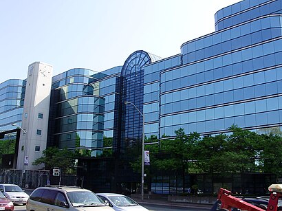
York Mills Centre Address: York Mills Road street in Toronto
Attractions near York Mills Centre
Barry Cohen Homes,Prirourose,Bento Sushi,Country Style,Toronto Laser Center,Royal Bank of Canada,Flat Roofers Toronto,MoneyGram,Appliances Repair North York,Pacific Locksmith,Pharmaprix,Luxurious Flowers,Kernels Popcorn,TD Bank Financial Group Branches,Cherry Liu - TD Financial Planner,Aiqun Sally Zhou - TD Account Manager Small Business,Bistro Deli,TD Canada Trust,Rbc,Pari Mode Inc-Royal LingerieHow to get to popular attractions in Toronto with public transit
Jack Astor's Bar & Grill, Toronto,Starbucks, Toronto,Brampton ON, Brampton,Terminal 1 - Toronto Pearson Int'L Airport, Mississauga,Costco Wholesale, Burlington,St Joseph's Healthcare (Charlton Campus), Hamilton,Cambridge, Ontario, Cambridge,Mapleview Shopping Centre, Burlington,City of St. Catharines, St. Catharines,The Rivoli, Toronto,RioCan Georgian Mall, Barrie,University of Guelph, Guelph,Landmark Theatres Whitby 24, Whitby,Toronto Pearson International Airport (Yyz), Mississauga,Burlington GO Station, Burlington,Landmark Cinemas, Waterloo,Hwy 401 & Hwy 400, Toronto,Niagara College, Welland,City of Burlington, Burlington,Mcmaster University, HamiltonGet around Toronto by public transit!
Traveling around Toronto has never been so easy. See step by step directions as you travel to any attraction, street or major public transit station. View bus and train schedules, arrival times, service alerts and detailed routes on a map, so you know exactly how to get to anywhere in Toronto.
When traveling to any destination around Toronto use Moovit's Live Directions with Get Off Notifications to know exactly where and how far to walk, how long to wait for your line, and how many stops are left. Moovit will alert you when it's time to get off — no need to constantly re-check whether yours is the next stop.
Wondering how to use public transit in Toronto or how to pay for public transit in Toronto? Moovit public transit app can help you navigate your way with public transit easily, and at minimum cost. It includes public transit fees, ticket prices, and costs. Looking for a map of Toronto public transit lines? Moovit public transit app shows all public transit maps in Toronto with all bus, subway, Streetcar or train routes and stops on an interactive map.
Toronto has 4 transit type(s), including: bus, subway, Streetcar or train, operated by several transit agencies, including TTC, TTC Streetcar, Toronto Subway, GO Transit Bus, GO Transit, Amtrak, York Region Transit, Grand River Transit, Guelph Transit, grt, Hamilton Street Railway, MiWay, Brampton Transit, Burlington Transit and Oakville Transit