See Yulman Stadium, New Orleans, on the map
Directions to Yulman Stadium (New Orleans) with public transportation
The following transit lines have routes that pass near Yulman Stadium
 Bus:
Bus:
How to get to Yulman Stadium by bus?
Click on the bus route to see step by step directions with maps, line arrival times and updated time schedules.
Bus stations near Yulman Stadium in New Orleans
- S. Claiborne at Broadway,7 min walk,
- Freret at Tulane/Loyola,9 min walk,
Streetcar stations near Yulman Stadium in New Orleans
- S. Carrollton at Birch,17 min walk,
Bus lines to Yulman Stadium in New Orleans
- 51,St. Bernard-Claiborne,
- 53-O,Paris - Claiborne OWL,
- 57,Suno,
What are the closest stations to Yulman Stadium?
The closest stations to Yulman Stadium are:
- S. Claiborne at Broadway is 513 yards away, 7 min walk.
- Freret at Tulane/Loyola is 699 yards away, 9 min walk.
- S. Carrollton at Birch is 1398 yards away, 17 min walk.
Which bus lines stop near Yulman Stadium?
These bus lines stop near Yulman Stadium: 51, 57, 9.
What’s the nearest Streetcar station to Yulman Stadium in New Orleans?
The nearest Streetcar station to Yulman Stadium in New Orleans is S. Carrollton at Birch. It’s a 17 min walk away.
What’s the nearest bus stop to Yulman Stadium in New Orleans?
The nearest bus stop to Yulman Stadium in New Orleans is S. Claiborne at Broadway. It’s a 7 min walk away.
What time is the first Streetcar to Yulman Stadium in New Orleans?
The 12 is the first Streetcar that goes to Yulman Stadium in New Orleans. It stops nearby at 3:04 AM.
What time is the last Streetcar to Yulman Stadium in New Orleans?
The 12 is the last Streetcar that goes to Yulman Stadium in New Orleans. It stops nearby at 3:23 AM.
What time is the first bus to Yulman Stadium in New Orleans?
The 53-O is the first bus that goes to Yulman Stadium in New Orleans. It stops nearby at 3:00 AM.
What time is the last bus to Yulman Stadium in New Orleans?
The 53-O is the last bus that goes to Yulman Stadium in New Orleans. It stops nearby at 3:00 AM.
See Yulman Stadium, New Orleans, on the map
Public Transit to Yulman Stadium in New Orleans
Wondering how to get to Yulman Stadium in New Orleans, United States? Moovit helps you find the best way to get to Yulman Stadium with step-by-step directions from the nearest public transit station.
Moovit provides free maps and live directions to help you navigate through your city. View schedules, routes, timetables, and find out how long does it take to get to Yulman Stadium in real time.
Looking for the nearest stop or station to Yulman Stadium? Check out this list of stops closest to your destination: S. Claiborne at Broadway; Freret at Tulane/Loyola; S. Carrollton at Birch.
Bus:
Want to see if there’s another route that gets you there at an earlier time? Moovit helps you find alternative routes or times. Get directions from and directions to Yulman Stadium easily from the Moovit App or Website.
We make riding to Yulman Stadium easy, which is why over 1.5 million users, including users in New Orleans, trust Moovit as the best app for public transit. You don’t need to download an individual bus app or train app, Moovit is your all-in-one transit app that helps you find the best bus time or train time available.
For information on prices of bus, costs and ride fares to Yulman Stadium, please check the Moovit app.
Use the app to navigate to popular places including to the airport, hospital, stadium, grocery store, mall, coffee shop, school, college, and university.
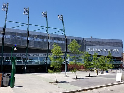
Yulman Stadium Address: Ben Weiner Drive street in New Orleans
Attractions near Yulman Stadium
Green Wave Grille,Tulane Stadium,Pt Solutions of New Orleans Uptown,202 Janet Yulman Way,Benson Field at Yulman Stadium,Barney Mintz Field - Tulane University,James W. Wilson, Jr. Intercollegiate Athletics Center - Tulane University,Tulane Campus Recreation,Tulane University Stadium,Greer Field at Turchin Stadium,Diboll Complex (Parking Garage),Clandestine,Aron Residences - Tulane University,Amazon Locker-Diboll,Rosen Parking Lot - Tulane University,P J's 72a,Ontime Locksmith,Willow St,smart Parent Media,A-Pro Home Inspection New OrleansHow to get to popular attractions in New Orleans with public transit
Empress Hotel, New Orleans,Audubon Tavern II, New Orleans,Greta, New Orleans,Harriet Tubman Charter School, New Orleans,3324 Sugar Mill, Kenner,Capdau Charter School, New Orleans,Eric 'Big E' Airport Transportation Service, New Orleans,Arabi, Arabi,Bullard Exit, New Orleans,Joey K's, New Orleans,Lucky Title Auto Transfer & Notary Service, Gretna,RTA Streetcar City Park, New Orleans,Professional Construction Services, New Orleans,Nunemaker Auditorium - Loyola University New Orleans, New Orleans,Garden District, New Orleans,Frenchmen Street, New Orleans,RTA 91 stop ID N8398, New Orleans,6th & Baronne, New Orleans,City Park Map, New Orleans,Tipitina’S French Quarter, New OrleansGet around New Orleans by public transit!
Traveling around New Orleans has never been so easy. See step by step directions as you travel to any attraction, street or major public transit station. View bus and train schedules, arrival times, service alerts and detailed routes on a map, so you know exactly how to get to anywhere in New Orleans.
When traveling to any destination around New Orleans use Moovit's Live Directions with Get Off Notifications to know exactly where and how far to walk, how long to wait for your line, and how many stops are left. Moovit will alert you when it's time to get off — no need to constantly re-check whether yours is the next stop.
Wondering how to use public transit in New Orleans or how to pay for public transit in New Orleans? Moovit public transit app can help you navigate your way with public transit easily, and at minimum cost. It includes public transit fees, ticket prices, and costs. Looking for a map of New Orleans public transit lines? Moovit public transit app shows all public transit maps in New Orleans with all bus routes and stops on an interactive map.
New Orleans has 1 transit type(s), including: bus, operated by several transit agencies, including New Orleans RTA , New Orleans RTA , New Orleans RTA , JP Transit , Megabus, FlixBus-us and Greyhound-us