See Zamek Ujazdowski, Warsaw, on the map
Directions to Zamek Ujazdowski (Warsaw) with public transportation
The following transit lines have routes that pass near Zamek Ujazdowski
 Bus:
Bus: - Train:
- Metro:
- Light Rail:
How to get to Zamek Ujazdowski by bus?
Click on the bus route to see step by step directions with maps, line arrival times and updated time schedules.
How to get to Zamek Ujazdowski by train?
Click on the train route to see step by step directions with maps, line arrival times and updated time schedules.
How to get to Zamek Ujazdowski by metro?
Click on the metro route to see step by step directions with maps, line arrival times and updated time schedules.
Bus stations near Zamek Ujazdowski in Warsaw
- Agrykola 01,5 min walk,
- Rozbrat 02,6 min walk,
- Pl. Na Rozdrożu 02,6 min walk,
- Rozbrat 06,6 min walk,
- Rozbrat 04,6 min walk,
- Pl. Na Rozdrożu 01,8 min walk,
Light Rail stations near Zamek Ujazdowski in Warsaw
- Trasa Łazienkowska 01,12 min walk,
- Pl. Zbawiciela 03,15 min walk,
Bus lines to Zamek Ujazdowski in Warsaw
- 108,Pl. Trzech Krzyży,
- 162,EC Siekierki,
- 138,Utrata — Bokserska,
- 143,Rembertów - Kolonia — Pomnik Lotnika,
- 151,Rechniewskiego — Pl. Konstytucji,
- 182,Witolin — Dw. Zachodni,
- 187,Ursus - Niedźwiadek — Św. Bonifacego,
- 188,Lotnisko Chopina — Gocławek Wschodni,
- 411,Metro Politechnika — Gocław,
- 502,Stara Miłosna (Graniczna) — Metro Politechnika,
- 514,Metro Politechnika — Wola Grzybowska,
- 520,Emilii Plater — Marysin,
- 523,PKP Olszynka Grochowska — Stare Bemowo,
- 525,Międzylesie — Dw. Centralny,
- N25,Międzylesie — Dw. Centralny,
- 116,Chomiczówka,
- 166,Pl. Hallera,
- 180,Chomiczówka,
- 503,Natolin Płn.,
- E-2,Metro Ratusz - Arsenał,
What are the closest stations to Zamek Ujazdowski?
The closest stations to Zamek Ujazdowski are:
- Agrykola 01 is 374 meters away, 5 min walk.
- Rozbrat 02 is 398 meters away, 6 min walk.
- Pl. Na Rozdrożu 02 is 416 meters away, 6 min walk.
- Rozbrat 06 is 419 meters away, 6 min walk.
- Rozbrat 04 is 424 meters away, 6 min walk.
- Pl. Na Rozdrożu 01 is 523 meters away, 8 min walk.
- Trasa Łazienkowska 01 is 885 meters away, 12 min walk.
- Pl. Zbawiciela 03 is 1064 meters away, 15 min walk.
Which bus lines stop near Zamek Ujazdowski?
These bus lines stop near Zamek Ujazdowski: 116, 138, 143, 166, 187, 188, 523, 525.
Which train lines stop near Zamek Ujazdowski?
These train lines stop near Zamek Ujazdowski: S1, S2.
Which metro line stops near Zamek Ujazdowski?
M1
Which light rail line stops near Zamek Ujazdowski?
4
What’s the nearest light rail station to Zamek Ujazdowski in Warsaw?
The nearest light rail station to Zamek Ujazdowski in Warsaw is Trasa Łazienkowska 01. It’s a 12 min walk away.
What’s the nearest bus stop to Zamek Ujazdowski in Warsaw?
The nearest bus stop to Zamek Ujazdowski in Warsaw is Agrykola 01. It’s a 5 min walk away.
What time is the first light rail to Zamek Ujazdowski in Warsaw?
The 15 is the first light rail that goes to Zamek Ujazdowski in Warsaw. It stops nearby at 4:21 AM.
What time is the last light rail to Zamek Ujazdowski in Warsaw?
The 35 is the last light rail that goes to Zamek Ujazdowski in Warsaw. It stops nearby at 12:07 AM.
What time is the first bus to Zamek Ujazdowski in Warsaw?
The N33 is the first bus that goes to Zamek Ujazdowski in Warsaw. It stops nearby at 3:23 AM.
What time is the last bus to Zamek Ujazdowski in Warsaw?
The N25 is the last bus that goes to Zamek Ujazdowski in Warsaw. It stops nearby at 3:25 AM.
How much is the bus fare to Zamek Ujazdowski?
The bus fare to Zamek Ujazdowski costs about zł3.40.
How much is the light rail fare to Zamek Ujazdowski?
The light rail fare to Zamek Ujazdowski costs about zł3.40.
See Zamek Ujazdowski, Warsaw, on the map
Public Transit to Zamek Ujazdowski in Warsaw
Wondering how to get to Zamek Ujazdowski in Warsaw, Poland? Moovit helps you find the best way to get to Zamek Ujazdowski with step-by-step directions from the nearest public transit station.
Moovit provides free maps and live directions to help you navigate through your city. View schedules, routes, timetables, and find out how long does it take to get to Zamek Ujazdowski in real time.
Looking for the nearest stop or station to Zamek Ujazdowski? Check out this list of stops closest to your destination: Agrykola 01; Rozbrat 02; Pl. Na Rozdrożu 02; Rozbrat 06; Rozbrat 04; Pl. Na Rozdrożu 01; Trasa Łazienkowska 01; Pl. Zbawiciela 03.
Bus:Train:Metro:Light Rail:
Want to see if there’s another route that gets you there at an earlier time? Moovit helps you find alternative routes or times. Get directions from and directions to Zamek Ujazdowski easily from the Moovit App or Website.
We make riding to Zamek Ujazdowski easy, which is why over 1.5 million users, including users in Warsaw, trust Moovit as the best app for public transit. You don’t need to download an individual bus app or train app, Moovit is your all-in-one transit app that helps you find the best bus time or train time available.
For information on prices of bus, train, light rail and metro, costs and ride fares to Zamek Ujazdowski, please check the Moovit app.
Use the app to navigate to popular places including to the airport, hospital, stadium, grocery store, mall, coffee shop, school, college, and university.
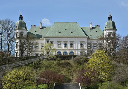
Zamek Ujazdowski Address: Jazdów street in Warsaw
Attractions near Zamek Ujazdowski
Park Agrykola,Park Jazdów,Przystanek Plac Na Rozdrożu,Agrykola,Skwer Płk. Dr Strehla,Skwer Dialogu Społecznego - Otwarty Jazdów,Zaczarowany Ogród,Stara Pomarańczarnia,Ogród Botaniczny Uniwersytetu Warszawskiego,Barbara Drewnowska \Parking Strzeżony\,Warszawskie Centrum Sportu Młodzieżowego Agrykola,Agrykola,Rdc Radio dla Ciebie 101,00,Polskie Radio Trójka,Studio Im. Agnieszki Osieckiej,Myśliwiecka 3/5/7,Veturilo 9545,Polskie Radio Rdc,Trajan,Myśliwiecka - RozbratHow to get to popular attractions in Warsaw with public transit
tor stegny, Warsaw,Galeria Północna, Warsaw,Blue City, Warsaw,Chyliczki, Warsaw,Myśliborska, Warsaw,Przystanek Reduta Wolska, Warsaw,Gimnazjum nr 164 z oddziałami integracyjnymi i oddzialami dwujęzycznymi im. Polskich Olimpijczyków, Warsaw,START hotel Aramis, Warsaw,Fort Piontek Hotel Warsaw, Legionowo,Muzeum Kolejnictwa, Warsaw,Apartamenty Przy Królikarni, Warsaw,Bobrowiecka 4/4a, Warsaw,SHUK mezze & bar, Warsaw,Hotel Partner, Warsaw,Sochaczew, Sochaczew,CDXX Liceum Filmowe z Oddziałami Dwujęzycznymi przy Warszawskiej Szkole Filmowej, Warsaw,Hotel DeSilva Piaseczno, Piaseczno,Skrzyżowanie Prymasa Tysiąclecia I Kasprzaka, Warsaw,Autobus 509, Warsaw,MoneyGram Polska, WarsawGet around Warsaw by public transit!
Traveling around Warsaw has never been so easy. See step by step directions as you travel to any attraction, street or major public transit station. View bus and train schedules, arrival times, service alerts and detailed routes on a map, so you know exactly how to get to anywhere in Warsaw.
When traveling to any destination around Warsaw use Moovit's Live Directions with Get Off Notifications to know exactly where and how far to walk, how long to wait for your line, and how many stops are left. Moovit will alert you when it's time to get off — no need to constantly re-check whether yours is the next stop.
Wondering how to use public transit in Warsaw or how to pay for public transit in Warsaw? Moovit public transit app can help you navigate your way with public transit easily, and at minimum cost. It includes public transit fees, ticket prices, and costs. Looking for a map of Warsaw public transit lines? Moovit public transit app shows all public transit maps in Warsaw with all bus, train, light rail or metro routes and stops on an interactive map.
Warsaw has 4 transit type(s), including: bus, train, light rail or metro, operated by several transit agencies, including Warszawski Transport Publiczny, Warszawski Transport Publiczny, Warszawski Transport Publiczny, Warszawska Kolej Dojazdowa, Warszawska Kolej Dojazdowa, Koleje Mazowieckie, Koleje Mazowieckie, Warszawski Transport Publiczny, ZTP Kraków, Miasto Piastów, ZTP Kraków, Miasto Ząbki, Koleje Małopolskie, Komunikacja Miejska Łomianki and Koleje Małopolskie